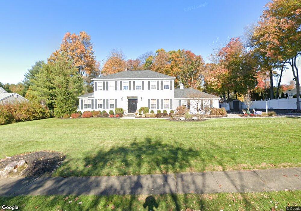
2 Sparrow Rd Randolph, NJ 07869
Estimated Value: $751,312 - $1,033,000
Studio
--
Bath
2,445
Sq Ft
$366/Sq Ft
Est. Value
About This Home
This home is located at 2 Sparrow Rd, Randolph, NJ 07869 and is currently estimated at $895,578, approximately $366 per square foot. 2 Sparrow Rd is a home located in Morris County with nearby schools including Randolph High School, Randolph Middle School, and Apple Montessori Schools and Camps - Randolph.
Ownership History
Date
Name
Owned For
Owner Type
Purchase Details
Closed on
Jan 11, 2008
Sold by
Serleto Gloria and Serleto John
Bought by
Dougherty Brian Joseph and Dougherty Tracey Lynn
Current Estimated Value
Purchase Details
Closed on
Feb 9, 1999
Sold by
Daniels Gloria and Serleto John
Bought by
Daniels Gloria
Purchase Details
Closed on
Feb 15, 1997
Sold by
Gary Theodore A and Gary Glenda M
Bought by
Daniels Gloria and Serleto John
Create a Home Valuation Report for This Property
The Home Valuation Report is an in-depth analysis detailing your home's value as well as a comparison with similar homes in the area
Home Values in the Area
Average Home Value in this Area
Purchase History
| Date | Buyer | Sale Price | Title Company |
|---|---|---|---|
| Dougherty Brian Joseph | $660,000 | None Available | |
| Daniels Gloria | -- | -- | |
| Daniels Gloria | $333,000 | -- |
Source: Public Records
Tax History
| Year | Tax Paid | Tax Assessment Tax Assessment Total Assessment is a certain percentage of the fair market value that is determined by local assessors to be the total taxable value of land and additions on the property. | Land | Improvement |
|---|---|---|---|---|
| 2025 | $15,004 | $530,000 | $205,600 | $324,400 |
| 2024 | $14,628 | $530,000 | $205,600 | $324,400 |
| 2023 | $14,628 | $530,000 | $205,600 | $324,400 |
| 2022 | $14,056 | $530,000 | $205,600 | $324,400 |
| 2021 | $14,056 | $527,000 | $205,600 | $321,400 |
| 2020 | $13,834 | $527,000 | $205,600 | $321,400 |
| 2019 | $13,676 | $527,000 | $205,600 | $321,400 |
| 2018 | $13,502 | $527,000 | $205,600 | $321,400 |
| 2017 | $13,333 | $527,000 | $205,600 | $321,400 |
| 2016 | $14,234 | $388,900 | $138,900 | $250,000 |
| 2015 | $14,063 | $376,800 | $138,900 | $237,900 |
| 2014 | $13,414 | $376,800 | $138,900 | $237,900 |
Source: Public Records
Map
Nearby Homes
- 64 Fords Rd
- 384 Millbrook Ave
- 181 Center Grove Rd
- 5 Jessica Place
- 10 Dalrymple St
- 221 Old Center Grove Rd
- 12 Skyline Dr
- 3 Marble Ln
- 343 & 339 Quaker Church Rd
- 37 Kearney St
- 42 Everdale Rd
- 10 Toye St
- 400 Quaker Church Rd
- 19 South St
- 42 1st St Ab
- 43 Wilkeshire Blvd
- 413 Boulder Ridge Dr Unit 413
- 71 Washington Ave Unit 73
- 38 E Dickerson St
- 10 Bayberry Ln
Your Personal Tour Guide
Ask me questions while you tour the home.