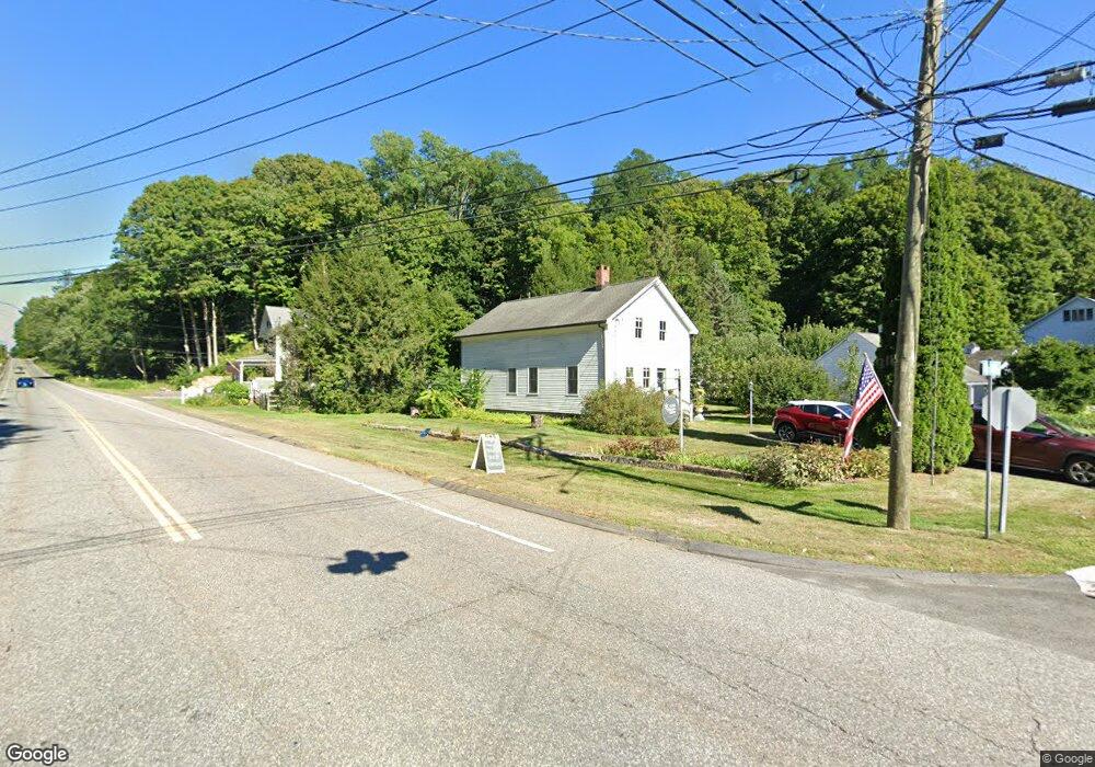
2 Wheaton Rd New Preston Marble Dale, CT 06777
Estimated Value: $659,644
Studio
--
Bath
--
Sq Ft
19,602
Sq Ft Lot
About This Home
This home is located at 2 Wheaton Rd, New Preston Marble Dale, CT 06777 and is currently estimated at $659,644. 2 Wheaton Rd is a home located in Litchfield County with nearby schools including Shepaug Valley School, Washington Montessori School, and Rumsey Hall School.
Ownership History
Date
Name
Owned For
Owner Type
Purchase Details
Closed on
Aug 30, 2018
Sold by
City & Field Llc
Bought by
Clark Lisa H and Clark Andrew R
Current Estimated Value
Purchase Details
Closed on
Oct 2, 2012
Sold by
2 Wheaton Llc
Bought by
Comer Kevin and Distel Richard
Purchase Details
Closed on
Jul 6, 2006
Sold by
Potter Ronald and Slack Earl
Bought by
2 Wheaton Llc
Create a Home Valuation Report for This Property
The Home Valuation Report is an in-depth analysis detailing your home's value as well as a comparison with similar homes in the area
Home Values in the Area
Average Home Value in this Area
Purchase History
| Date | Buyer | Sale Price | Title Company |
|---|---|---|---|
| Clark Lisa H | $375,000 | -- | |
| Clark Lisa H | $375,000 | -- | |
| Comer Kevin | -- | -- | |
| Comer Kevin | -- | -- | |
| 2 Wheaton Llc | $300,000 | -- | |
| 2 Wheaton Llc | $300,000 | -- |
Source: Public Records
Tax History
| Year | Tax Paid | Tax Assessment Tax Assessment Total Assessment is a certain percentage of the fair market value that is determined by local assessors to be the total taxable value of land and additions on the property. | Land | Improvement |
|---|---|---|---|---|
| 2025 | $2,869 | $264,390 | $61,880 | $202,510 |
| 2024 | $2,869 | $264,390 | $61,880 | $202,510 |
| 2023 | $3,598 | $252,520 | $61,840 | $190,680 |
| 2022 | $3,598 | $252,520 | $61,840 | $190,680 |
| 2021 | $3,598 | $252,520 | $61,840 | $190,680 |
| 2020 | $3,598 | $252,520 | $61,840 | $190,680 |
| 2019 | $3,598 | $252,520 | $61,840 | $190,680 |
| 2018 | $3,018 | $211,780 | $66,500 | $145,280 |
| 2017 | $3,018 | $211,780 | $66,500 | $145,280 |
| 2016 | $3,018 | $211,780 | $66,500 | $145,280 |
| 2015 | $2,912 | $211,780 | $66,500 | $145,280 |
| 2014 | $2,859 | $211,780 | $66,500 | $145,280 |
Source: Public Records
Map
Nearby Homes
- 29 Quarry Ridge Rd
- 45 Quarry Ridge Rd
- 35 Hillendale Dr
- 196 Baldwin Hill Rd
- 36 Sunset Ln
- 25 E Shore Rd
- Lot 2 060804A Popple Swamp Rd
- LOT 1 060804 Popple Swamp Rd
- 77 New Milford Turnpike
- 1 N Shore Rd
- 197 Tinker Hill Rd
- 106 Washington Ridge Rd
- 92 E Shore Rd
- 217 Sawyer Hill Rd
- 55 Washington Ridge Rd
- 62 Big Bear Hill Rd
- 10 Harmony Trail
- 37 Church Hill Rd
- 4 Blossom Ct
- 109 Church Hill Rd
- 2 Wheaton Rd Unit A
- 2 Wheaton Rd Unit B
- 2 Wheaton Rd Unit C
- 4 Wheaton Rd
- 239 New Milford Turnpike
- 246 New Milford Turnpike
- 249 -251 New Milford Turnpike
- 3 Findlay Rd
- 251 New Milford Turnpike
- 249 New Milford Turnpike
- 249 New Milford Turnpike Unit A
- 249A New Milford Turnpike
- 250 New Milford Turnpike
- 6 Findlay Rd
- 11 Wheaton Rd
- 12 Wheaton Rd
- 5 Pleasant View Dr
- 255 New Milford Turnpike
- 9 Findlay Rd
- 7 Pleasant View Dr
Your Personal Tour Guide
Ask me questions while you tour the home.