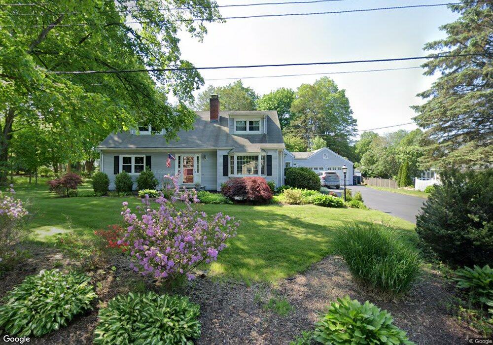
2 Willowbrook Rd Trumbull, CT 06611
Nichols NeighborhoodEstimated Value: $675,862 - $729,000
About This Home
This home is located at 2 Willowbrook Rd, Trumbull, CT 06611 and is currently estimated at $692,466, approximately $292 per square foot. 2 Willowbrook Rd is a home located in Fairfield County with nearby schools including Booth Hill School, Hillcrest Middle School, and Trumbull High School.
Ownership History
We collect this data history from publicly available records. To have your information removed, we recommend requesting removal directly through your county’s website.
Purchase Details
Home Values in the Area
Average Home Value in this Area
Purchase History
We collect this data history from publicly available records. To have your information removed, we recommend requesting removal directly through your county’s website.
| Date | Buyer | Sale Price | Title Company |
|---|---|---|---|
| -- | -- |
Mortgage History
We collect this data history from publicly available records. To have your information removed, we recommend requesting removal directly through your county’s website.
| Date | Status | Borrower | Loan Amount |
|---|---|---|---|
| Open | $192,000 | ||
| Closed | $70,000 | ||
| Closed | $74,879 | ||
| Closed | $200,000 | ||
| Closed | $200,000 | ||
| Closed | $30,000 | ||
| Closed | $120,000 |
Tax History
We collect this data history from publicly available records. To have your information removed, we recommend requesting removal directly through your county’s website.
| Year | Tax Paid | Tax Assessment Tax Assessment Total Assessment is a certain percentage of the fair market value that is determined by local assessors to be the total taxable value of land and additions on the property. | Land | Improvement |
|---|---|---|---|---|
| 2025 | $10,931 | $295,750 | $152,250 | $143,500 |
| 2024 | $10,617 | $295,750 | $152,250 | $143,500 |
| 2023 | $10,455 | $295,750 | $152,250 | $143,500 |
| 2022 | $10,294 | $295,750 | $152,250 | $143,500 |
| 2021 | $4,971 | $253,190 | $138,460 | $114,730 |
| 2020 | $9,104 | $253,190 | $138,460 | $114,730 |
| 2018 | $8,905 | $253,190 | $138,460 | $114,730 |
| 2017 | $8,735 | $253,190 | $138,460 | $114,730 |
| 2016 | $8,571 | $253,190 | $138,460 | $114,730 |
| 2015 | $8,536 | $253,300 | $138,500 | $114,800 |
| 2014 | $8,354 | $253,300 | $138,500 | $114,800 |
Map
- 52 Mischa Hill Rd
- 36 North St
- 315 Booth Hill Rd
- 42 Turkey Meadow Rd
- 421 Shelton Rd
- Lot #4 W Mischa Rd
- 12 Briarwoods Terrace
- 33 Jerusalem Hill
- 91 Jerusalem Hill
- 21 Twin Circle Dr
- 68 Old Dike Rd
- 0 Pinewood Trail
- 100 Old Dike Rd
- 22 Larkspur Dr
- 190 Beaver Dam Access Rd
- 29 Foxwood Rd
- 34 Hawley Glen Unit 34
- 25 Wildrose Ln
- 995 Beaver Dam Rd
- 41 Hemlock Trail
- 9 Stowe Place
- 1988 Huntington Turnpike
- 1 Willowbrook Rd
- 3 Willowbrook Rd
- 18 Stowe Place
- 7 Stowe Place
- 1998 Huntington Turnpike
- 1970 Huntington Turnpike
- 22 Stowe Place
- 232 North St
- 2010 Huntington Turnpike
- 220 North St
- 214 North St
- 1958 Huntington Turnpike
- 204 North St
- 2009 Huntington Turnpike
- 2020 Huntington Turnpike
- 1975 Huntington Turnpike
- 231 North St
- 1967 Huntington Turnpike
Ask me questions while you tour the home.