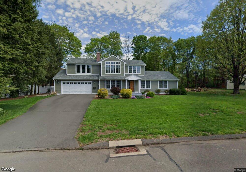
20 Brook Ln Cheshire, CT 06410
Estimated Value: $665,929 - $776,000
3
Beds
3
Baths
3,082
Sq Ft
$237/Sq Ft
Est. Value
About This Home
This home is located at 20 Brook Ln, Cheshire, CT 06410 and is currently estimated at $730,982, approximately $237 per square foot. 20 Brook Ln is a home located in New Haven County with nearby schools including Darcey School, Highland School, and Dodd Middle School.
Ownership History
Date
Name
Owned For
Owner Type
Purchase Details
Closed on
Jul 30, 1995
Sold by
Crockett Neil M and Crockett Megan C
Bought by
Rutkiewicz Victoria L
Current Estimated Value
Home Financials for this Owner
Home Financials are based on the most recent Mortgage that was taken out on this home.
Original Mortgage
$133,200
Interest Rate
7.56%
Mortgage Type
Unknown
Create a Home Valuation Report for This Property
The Home Valuation Report is an in-depth analysis detailing your home's value as well as a comparison with similar homes in the area
Home Values in the Area
Average Home Value in this Area
Purchase History
We collect this data history from publicly available records. To have your information removed, we recommend requesting removal directly through your county’s website.
| Date | Buyer | Sale Price | Title Company |
|---|---|---|---|
| Rutkiewicz Victoria L | $148,000 | -- | |
| Rutkiewicz Victoria L | $148,000 | -- |
Source: Public Records
Mortgage History
We collect this data history from publicly available records. To have your information removed, we recommend requesting removal directly through your county’s website.
| Date | Status | Borrower | Loan Amount |
|---|---|---|---|
| Open | Rutkiewicz Victoria L | $100,000 | |
| Open | Rutkiewicz Victoria L | $300,000 | |
| Closed | Rutkiewicz Victoria L | $280,000 | |
| Closed | Rutkiewicz Victoria L | $133,200 |
Source: Public Records
Tax History
| Year | Tax Paid | Tax Assessment Tax Assessment Total Assessment is a certain percentage of the fair market value that is determined by local assessors to be the total taxable value of land and additions on the property. | Land | Improvement |
|---|---|---|---|---|
| 2025 | $11,589 | $389,690 | $78,120 | $311,570 |
| 2024 | $10,701 | $389,690 | $78,120 | $311,570 |
| 2023 | $9,271 | $264,210 | $78,090 | $186,120 |
| 2022 | $9,068 | $264,210 | $78,090 | $186,120 |
| 2021 | $7,764 | $264,210 | $78,090 | $186,120 |
| 2020 | $8,777 | $264,210 | $78,090 | $186,120 |
| 2019 | $12,381 | $264,210 | $78,090 | $186,120 |
| 2018 | $7,666 | $225,980 | $83,520 | $142,460 |
| 2017 | $7,337 | $225,980 | $83,520 | $142,460 |
| 2016 | $6,935 | $225,980 | $83,520 | $142,460 |
| 2015 | $6,935 | $225,980 | $83,520 | $142,460 |
| 2014 | $6,198 | $204,890 | $83,520 | $121,370 |
Source: Public Records
Map
Nearby Homes
- 649 Maple Ave
- 643 Maple Ave
- 435 Maple Ave
- 456 Castle Glenn
- 365 Maple Ave
- 76 Glenbrook Dr
- 383 Lincoln Dr
- 568 Wiese Rd
- 375 Sycamore Ln
- 15 Melrose Dr
- 17 Melrose Dr Unit Lot 3
- 21 Melrose Dr Unit Lot 2
- 1062 Amherst Place
- 393 E Mitchell Ave Unit 393
- 443 E Mitchell Ave
- 305 Richmond Glen Dr
- 960 Peck Ln
- 3 Melrose Dr Unit Lot 9
- 88 Nob Hill Rd
- 611 Ives Row
- 30 Brook Ln
- 3 Country Club Rd
- 19 Brook Ln
- 40 Brook Ln
- 688 Highland Ave
- 11 Broad Brook
- 39 Brook Ln
- 707 Highland Ave
- 50 Brook Ln
- 38 Pleasant Dr
- 48 Pleasant Dr
- 28 Pleasant Dr
- 11 Country Club Rd
- 49 Brook Ln
- 18 Pleasant Dr
- 58 Pleasant Dr
- 691 Highland Ave
- 17 Country Club Rd
- 68 Pleasant Dr
- 670 Highland Ave
Your Personal Tour Guide
Ask me questions while you tour the home.