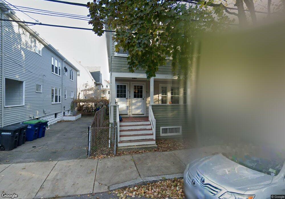
20 Corinthian Rd Somerville, MA 02144
Davis Square NeighborhoodEstimated Value: $1,034,000 - $1,310,077
4
Beds
2
Baths
2,024
Sq Ft
$598/Sq Ft
Est. Value
About This Home
This home is located at 20 Corinthian Rd, Somerville, MA 02144 and is currently estimated at $1,209,519, approximately $597 per square foot. 20 Corinthian Rd is a home located in Middlesex County with nearby schools including Somerville High School, St. Clement Elementary School, and International School of Boston.
Ownership History
Date
Name
Owned For
Owner Type
Purchase Details
Closed on
Jun 10, 2014
Sold by
Vozella Marjorie M
Bought by
Vozella Marjorie M and Turner Valerie
Current Estimated Value
Purchase Details
Closed on
Jan 19, 1962
Bought by
Vozella Marjorie M and Turner Valerie
Create a Home Valuation Report for This Property
The Home Valuation Report is an in-depth analysis detailing your home's value as well as a comparison with similar homes in the area
Home Values in the Area
Average Home Value in this Area
Purchase History
We collect this data history from publicly available records. To have your information removed, we recommend requesting removal directly through your county’s website.
| Date | Buyer | Sale Price | Title Company |
|---|---|---|---|
| Vozella Marjorie M | -- | -- | |
| Vozella Marjorie M | -- | -- |
Source: Public Records
Tax History
| Year | Tax Paid | Tax Assessment Tax Assessment Total Assessment is a certain percentage of the fair market value that is determined by local assessors to be the total taxable value of land and additions on the property. | Land | Improvement |
|---|---|---|---|---|
| 2025 | $11,350 | $1,040,300 | $753,100 | $287,200 |
| 2024 | $10,785 | $1,025,200 | $753,100 | $272,100 |
| 2023 | $10,553 | $1,020,600 | $753,100 | $267,500 |
| 2022 | $9,794 | $962,100 | $717,200 | $244,900 |
| 2021 | $9,612 | $943,300 | $712,000 | $231,300 |
| 2020 | $8,997 | $891,700 | $665,000 | $226,700 |
| 2019 | $9,012 | $837,500 | $648,600 | $188,900 |
| 2018 | $8,739 | $772,700 | $589,600 | $183,100 |
| 2017 | $8,446 | $723,700 | $556,200 | $167,500 |
| 2016 | $8,440 | $673,600 | $496,700 | $176,900 |
| 2015 | $7,975 | $632,400 | $458,700 | $173,700 |
Source: Public Records
Map
Nearby Homes
- 1004 Broadway Unit 3
- 5-7 Whitman St
- 5-7 Whitman St Unit 1
- 39 Whitman St
- 18 Paulina St Unit 1
- 160 Holland St Unit 1
- 16 Claremon St
- 15 Park Ave
- 9 Kidder Ave Unit 2
- 26 Newbury St Unit 2
- 58 Elmwood St Unit 58
- 33 Newbury St Unit 1
- 30 Clarendon Ave
- 1 Tannery Brook Row Unit 1F
- 11 Tannery Brook Row Unit 3
- 14 Farragut Ave Unit 1
- 202 Powder House Blvd Unit 2
- 1246 Broadway Unit 3
- 32 Farragut Ave Unit 3
- 7 Farragut Ave Unit 1
- 1006 Broadway
- 1002 Broadway
- 1002 Broadway Unit 3
- 1002 Broadway Unit 2
- 74 Simpson Ave
- 72 Simpson Ave
- 68 Simpson Ave
- 14 Corinthian Rd
- 14 Corinthian Rd Unit A
- 14 Corinthian Rd Unit B
- 998 Broadway
- 998 Broadway Unit 1
- 998 Broadway Unit 3
- 1000 Broadway
- 66 Simpson Ave
- 66 Simpson Ave Unit 2
- 66 Simpson Ave
- 66 Simpson Ave Unit 1
- 16 Corinthian Rd
- 16 Corinthian Rd Unit 2
Your Personal Tour Guide
Ask me questions while you tour the home.