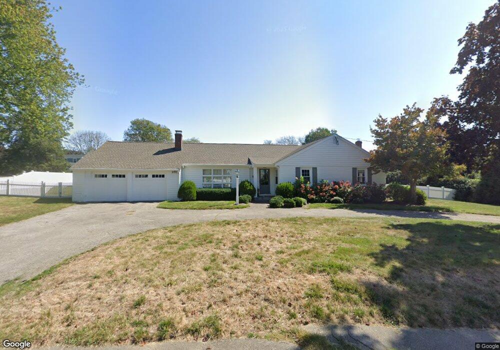
20 Cudworth Rd Scituate, MA 02066
Estimated Value: $838,000 - $974,000
3
Beds
2
Baths
1,520
Sq Ft
$592/Sq Ft
Est. Value
About This Home
This home is located at 20 Cudworth Rd, Scituate, MA 02066 and is currently estimated at $900,140, approximately $592 per square foot. 20 Cudworth Rd is a home located in Plymouth County with nearby schools including Cushing Elementary School, Lester J. Gates Middle School, and Scituate High School.
Ownership History
Date
Name
Owned For
Owner Type
Purchase Details
Closed on
May 19, 2020
Sold by
Anne P Caffrey Nt
Bought by
Caffrey Molly M
Current Estimated Value
Home Financials for this Owner
Home Financials are based on the most recent Mortgage that was taken out on this home.
Original Mortgage
$451,250
Outstanding Balance
$399,870
Interest Rate
3.3%
Mortgage Type
New Conventional
Estimated Equity
$500,270
Create a Home Valuation Report for This Property
The Home Valuation Report is an in-depth analysis detailing your home's value as well as a comparison with similar homes in the area
Home Values in the Area
Average Home Value in this Area
Purchase History
| Date | Buyer | Sale Price | Title Company |
|---|---|---|---|
| Caffrey Molly M | $475,000 | None Available |
Source: Public Records
Mortgage History
| Date | Status | Borrower | Loan Amount |
|---|---|---|---|
| Open | Caffrey Molly M | $451,250 |
Source: Public Records
Tax History
| Year | Tax Paid | Tax Assessment Tax Assessment Total Assessment is a certain percentage of the fair market value that is determined by local assessors to be the total taxable value of land and additions on the property. | Land | Improvement |
|---|---|---|---|---|
| 2025 | $7,119 | $712,600 | $372,800 | $339,800 |
| 2024 | $6,963 | $672,100 | $338,900 | $333,200 |
| 2023 | $7,017 | $621,500 | $325,200 | $296,300 |
| 2022 | $7,017 | $556,000 | $293,600 | $262,400 |
| 2021 | $6,720 | $504,100 | $279,600 | $224,500 |
| 2020 | $6,411 | $474,900 | $268,800 | $206,100 |
| 2019 | $6,331 | $460,800 | $263,600 | $197,200 |
| 2018 | $5,968 | $427,800 | $264,000 | $163,800 |
| 2017 | $5,873 | $416,800 | $253,000 | $163,800 |
| 2016 | $5,582 | $394,800 | $231,000 | $163,800 |
| 2015 | $5,028 | $383,800 | $220,000 | $163,800 |
Source: Public Records
Map
Nearby Homes
- 20 Grace Way Unit 20
- 6 Grace Way Unit 6
- 1 Grace Way Unit 1
- 27 Grace Way
- 25 Grace Way
- 115 Elm St
- 111 Elm St
- 20 Lawson Rd
- 1 Washington Ln
- 386 Country Way
- 74 Branch St Unit 15
- 49 Jackson Rd
- 37 Utility Rd
- 44 Kane Dr
- 334 Chief Justice Cushing Hwy
- 27 Curtis St
- 14 Old Country Way Unit C
- 18 Hillside Rd
- 76 A Brook St
- 76 A Brook St Unit 1
- 10 Daedalus Cir
- 26 Cudworth Rd
- 14 Cudworth Rd
- 19 Cudworth Rd
- 15 Cudworth Rd
- 14 Daedalus Cir
- 4 Daedalus Cir
- 296 Country Way
- 296 Country Way
- 284 Country Way
- 284 Country Way
- 9 Daedalus Cir
- 29 Cudworth Rd
- 284 Central Ave
- 284 Central Ave Unit 284
- 290 Central Ave Unit 1
- 3 Daedalus Cir
- 9 Hilltop Rd
- 288 Central Ave Unit 288
- 19 Daedalus Cir
Your Personal Tour Guide
Ask me questions while you tour the home.