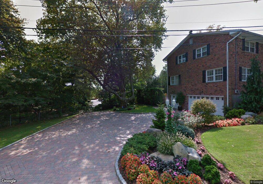
20 Eastentry Rd Staten Island, NY 10304
Todt Hill NeighborhoodEstimated Value: $3,598,907 - $4,422,000
Studio
4
Baths
7,948
Sq Ft
$503/Sq Ft
Est. Value
About This Home
This home is located at 20 Eastentry Rd, Staten Island, NY 10304 and is currently estimated at $3,999,302, approximately $503 per square foot. 20 Eastentry Rd is a home located in Richmond County with nearby schools including P.S. 11 Thomas Dongan School, Is 2 George L Egbert, and New Dorp High School.
Ownership History
Date
Name
Owned For
Owner Type
Purchase Details
Closed on
Mar 7, 2011
Sold by
Petrone Thomas J and Petrone Maria G
Bought by
Petrone Thomas J and Petrone Maria G
Current Estimated Value
Purchase Details
Closed on
Nov 10, 2005
Sold by
Vona Carmine and Vona Carmela
Bought by
Petrone Thomas J and Petrone Maria G
Home Financials for this Owner
Home Financials are based on the most recent Mortgage that was taken out on this home.
Original Mortgage
$1,500,000
Outstanding Balance
$825,890
Interest Rate
6.12%
Mortgage Type
Fannie Mae Freddie Mac
Estimated Equity
$3,173,412
Purchase Details
Closed on
Apr 10, 1999
Sold by
Vona Joseph and Vona Salvatore
Bought by
Vona Joseph
Create a Home Valuation Report for This Property
The Home Valuation Report is an in-depth analysis detailing your home's value as well as a comparison with similar homes in the area
Home Values in the Area
Average Home Value in this Area
Purchase History
| Date | Buyer | Sale Price | Title Company |
|---|---|---|---|
| Petrone Thomas J | -- | None Available | |
| Petrone Thomas J | $3,800,000 | Fidelity National Title Insu | |
| Vona Joseph | -- | -- |
Source: Public Records
Mortgage History
| Date | Status | Borrower | Loan Amount |
|---|---|---|---|
| Open | Petrone Thomas J | $1,500,000 | |
| Closed | Petrone Thomas J | $1,300,000 |
Source: Public Records
Tax History
| Year | Tax Paid | Tax Assessment Tax Assessment Total Assessment is a certain percentage of the fair market value that is determined by local assessors to be the total taxable value of land and additions on the property. | Land | Improvement |
|---|---|---|---|---|
| 2025 | $24,584 | $202,800 | $21,649 | $181,151 |
| 2024 | $24,584 | $165,720 | $24,994 | $140,726 |
| 2023 | $23,451 | $115,471 | $20,002 | $95,469 |
| 2022 | $21,747 | $197,100 | $33,840 | $163,260 |
| 2021 | $22,926 | $163,200 | $33,840 | $129,360 |
| 2020 | $22,886 | $154,500 | $33,840 | $120,660 |
| 2019 | $21,337 | $154,500 | $33,840 | $120,660 |
| 2018 | $19,616 | $96,226 | $26,193 | $70,033 |
| 2017 | $18,505 | $90,780 | $33,840 | $56,940 |
| 2016 | $20,067 | $100,380 | $33,840 | $66,540 |
| 2015 | $18,721 | $101,880 | $37,560 | $64,320 |
| 2014 | $18,721 | $97,550 | $31,061 | $66,489 |
Source: Public Records
Map
Nearby Homes
- 90 Flagg Place
- 20 Buel Ave Unit A
- 186 Flagg Place
- 00 Flagg Place
- 0 Flagg Place
- 131 Jefferson St
- 40 Jenna Ln
- 130 Jefferson St
- 107 Jefferson St
- 70 Jenna Ln
- 59 Seaview Ave
- 51 Cromwell Cir
- 59 & 51 Garretson Ave
- 175 Zoe St Unit 2R
- 175 Zoe St Unit 5S
- 175 Zoe St Unit 1P
- 175 Zoe St Unit 6C
- 105 Seaview Ave
- 172 Coventry Rd
- 107 Liberty Ave
- 20 E Entry Rd
- 101 Flagg Place
- 40 Eastentry Rd
- 56 Eastentry Rd
- 56 E Entry Rd
- 16 Eastentry Rd
- 6 Eastentry Rd
- 6 E Entry Rd
- 114 Flagg Place
- 100 Flagg Place
- 35 E Entry Rd
- 35 Eastentry Rd
- 135 Flagg Place
- 25 Eastentry Rd
- 126 Flagg Place
- 1725 Richmond Rd
- 50 Eastentry Rd
- 50 E Entry Rd
- 1727 Richmond Rd
- 1727 Richmond Rd Unit 1729
Your Personal Tour Guide
Ask me questions while you tour the home.