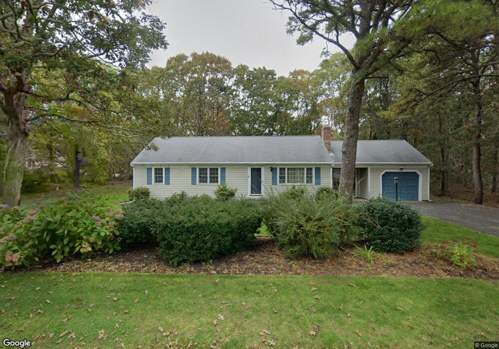
20 Gates Path Dennis, MA 02638
Dennis Village NeighborhoodEstimated Value: $662,429 - $788,000
3
Beds
2
Baths
1,201
Sq Ft
$613/Sq Ft
Est. Value
About This Home
This home is located at 20 Gates Path, Dennis, MA 02638 and is currently estimated at $736,107, approximately $612 per square foot. 20 Gates Path is a home located in Barnstable County with nearby schools including Dennis-Yarmouth Regional High School.
Ownership History
Date
Name
Owned For
Owner Type
Purchase Details
Closed on
Nov 4, 2020
Sold by
Denisco John A and Denisco Phyllis
Bought by
John A Denisco Ret
Current Estimated Value
Purchase Details
Closed on
May 9, 2003
Sold by
Costello Clifford L and Costello Tamara
Bought by
Denisco John A and Denisco Phyllis
Create a Home Valuation Report for This Property
The Home Valuation Report is an in-depth analysis detailing your home's value as well as a comparison with similar homes in the area
Home Values in the Area
Average Home Value in this Area
Purchase History
| Date | Buyer | Sale Price | Title Company |
|---|---|---|---|
| John A Denisco Ret | -- | None Available | |
| Denisco John A | $349,900 | -- |
Source: Public Records
Mortgage History
| Date | Status | Borrower | Loan Amount |
|---|---|---|---|
| Previous Owner | Denisco John A | $96,500 |
Source: Public Records
Tax History
| Year | Tax Paid | Tax Assessment Tax Assessment Total Assessment is a certain percentage of the fair market value that is determined by local assessors to be the total taxable value of land and additions on the property. | Land | Improvement |
|---|---|---|---|---|
| 2025 | $2,818 | $650,900 | $176,400 | $474,500 |
| 2024 | $2,738 | $623,700 | $177,700 | $446,000 |
| 2023 | $2,648 | $567,000 | $161,600 | $405,400 |
| 2022 | $2,419 | $432,000 | $132,300 | $299,700 |
| 2021 | $2,297 | $381,000 | $129,700 | $251,300 |
| 2020 | $2,483 | $407,100 | $129,700 | $277,400 |
| 2019 | $2,388 | $387,000 | $139,900 | $247,100 |
| 2018 | $2,266 | $357,400 | $121,100 | $236,300 |
| 2017 | $2,153 | $350,000 | $121,100 | $228,900 |
| 2016 | $2,248 | $344,300 | $151,300 | $193,000 |
| 2015 | $2,204 | $344,300 | $151,300 | $193,000 |
| 2014 | $1,897 | $298,700 | $121,100 | $177,600 |
Source: Public Records
Map
Nearby Homes
- 32 Captain Walsh Dr
- 61 Terrace Hill Dr
- 58 Terrace Hill Dr
- 39 Whittier Dr
- 26 S West Dr
- 16 Hazelwood Rd
- 71 Grassy Pond Dr
- 35 Crown Grant Dr
- 68 Sea Meadow Dr
- 31 High Head Rd
- 6 Thomas Ct
- 15 Signal Hill Dr
- 52 Uncle Bobs Way
- 268 Main St
- 10 Uncle Bills Way
- 14 S Yarmouth Rd
- 59 Main St Unit 7-3
- 59 Main St Unit 19-2
- 59 Route 6a Unit 9-2
- 59 Route 6a Unit 7-3
- 20 Gates Path
- 80 Long Hill Rd
- 14 Gates Path
- 21 Gates Path
- 15 Gates Path
- 74 Long Hill Rd
- 83 Long Hill Rd
- 87 Long Hill Rd
- 8 Gates Path
- 89 Long Hill Rd
- 9 Gates Path
- 77 Long Hill Rd
- 98 Long Hill Rd
- 91 Long Hill Rd
- 697 Old Bass River Rd
- 68 Long Hill Rd
- 685 Old Bass River Rd
- 691 Old Bass River Rd
- 71 Long Hill Rd
- 5 Gates Point
Your Personal Tour Guide
Ask me questions while you tour the home.