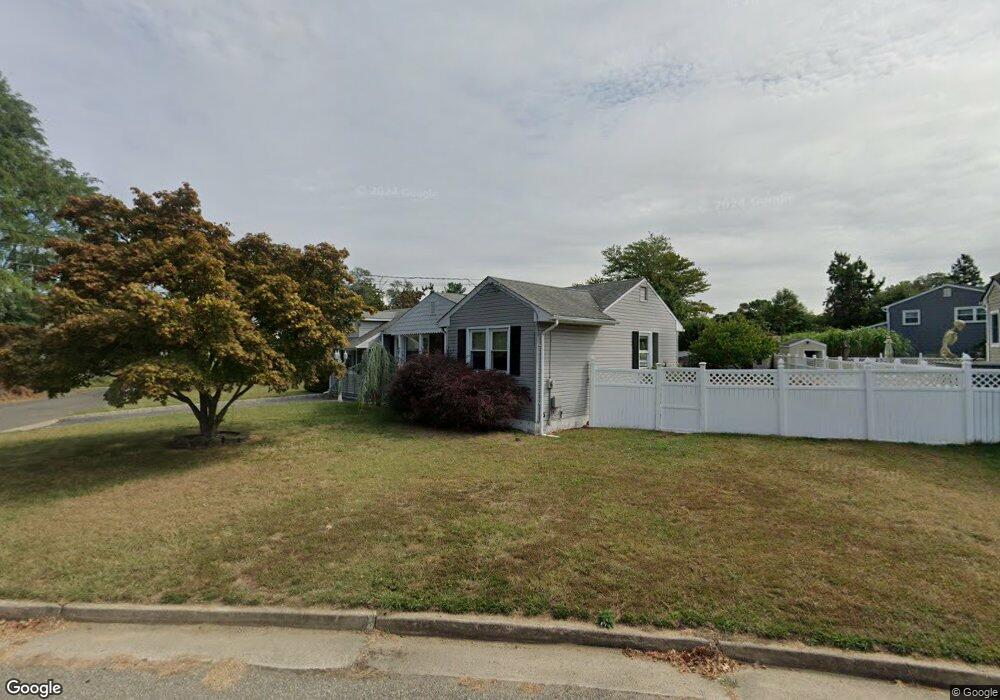
20 Harkins Dr Middletown, NJ 07748
New Monmouth NeighborhoodEstimated Value: $385,000 - $506,000
About This Home
This home is located at 20 Harkins Dr, Middletown, NJ 07748 and is currently estimated at $452,946, approximately $467 per square foot. 20 Harkins Dr is a home located in Monmouth County with nearby schools including Harmony Elementary School, Thorne Middle School, and Middletown High School North.
Ownership History
We collect this data history from publicly available records. To have your information removed, we recommend requesting removal directly through your county’s website.
Purchase Details
Home Financials for this Owner
Home Financials are based on the most recent Mortgage that was taken out on this home.Purchase Details
Home Financials for this Owner
Home Financials are based on the most recent Mortgage that was taken out on this home.Purchase Details
Purchase Details
Purchase Details
Home Values in the Area
Average Home Value in this Area
Purchase History
We collect this data history from publicly available records. To have your information removed, we recommend requesting removal directly through your county’s website.
| Date | Buyer | Sale Price | Title Company |
|---|---|---|---|
| $260,000 | Westcor Land Title Ins Co | ||
| $217,000 | Multiple | ||
| $212,000 | -- | ||
| $127,000 | -- | ||
| $55,000 | -- |
Mortgage History
We collect this data history from publicly available records. To have your information removed, we recommend requesting removal directly through your county’s website.
| Date | Status | Borrower | Loan Amount |
|---|---|---|---|
| Open | $130,000 | ||
| Previous Owner | $173,600 |
Tax History
We collect this data history from publicly available records. To have your information removed, we recommend requesting removal directly through your county’s website.
| Year | Tax Paid | Tax Assessment Tax Assessment Total Assessment is a certain percentage of the fair market value that is determined by local assessors to be the total taxable value of land and additions on the property. | Land | Improvement |
|---|---|---|---|---|
| 2026 | $7,019 | $484,900 | $366,000 | $118,900 |
| 2025 | $7,019 | $434,900 | $316,200 | $118,700 |
| 2024 | $6,276 | $412,800 | $296,300 | $116,500 |
| 2023 | $6,276 | $361,100 | $247,300 | $113,800 |
| 2022 | $5,862 | $318,600 | $210,200 | $108,400 |
| 2021 | $5,862 | $294,200 | $180,500 | $113,700 |
| 2020 | $5,738 | $268,400 | $157,300 | $111,100 |
| 2019 | $5,656 | $267,800 | $157,300 | $110,500 |
| 2018 | $5,691 | $262,600 | $157,300 | $105,300 |
| 2017 | $5,661 | $258,600 | $147,300 | $111,300 |
| 2016 | $4,976 | $233,500 | $147,300 | $86,200 |
| 2015 | $5,142 | $233,000 | $147,300 | $85,700 |
| 2014 | $4,879 | $215,600 | $137,300 | $78,300 |
Map
- 831 Palmer Ave
- 8 Bonnie Dr Unit R
- 10 Maurice Ave
- 18 Maurice Ave
- 49 Maurice Ave
- 18 Avenue A Unit 98
- 3 John St Unit 118
- 64 Agostina Dr Unit 64
- 15 Avenue B
- 22 Avenue C Unit 48
- 22 Avenue C
- 14 Avenue A Unit 102
- 8 John St Unit 123
- 22 John St Unit 137
- 8 John St
- 38 Azimuth Ct Unit 128
- 3 Avenue B Unit 72
- 11 Avenue B Unit 80
- 89 Harmony Ave
- 9 Avenue C Unit 61
- 31 Baytree Cir
- 33 Baytree Cir
- 23 Palmer Ct
- 37 Baytree Cir Unit 1
- 22 Palmer Ct
- 35 Baytree Cir
- 27 Baytree Cir
- 27 Baytree Cir Unit 2
- 29 Baytree Cir
- 24 Palmer Ct
- 18 Harkins Dr
- 41 Baytree Cir
- 16 Harkins Dr
- 17 Harkins Dr
- 39 Baytree Cir
- 97 Palmer Ct
- 16 Baytree Cir
- 4 Old Colonial Rd
- 23 Baytree Cir
- 15 Harkins Dr
Ask me questions while you tour the home.