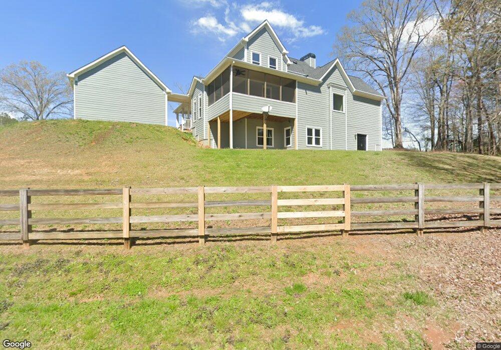
20 Maxwell Rd Rydal, GA 30171
White AreaEstimated Value: $430,000 - $490,000
About This Home
This home is located at 20 Maxwell Rd, Rydal, GA 30171 and is currently estimated at $462,207, approximately $149 per square foot. 20 Maxwell Rd is a home located in Bartow County with nearby schools including Pine Log Elementary School, Adairsville Middle School, and Adairsville High School.
Ownership History
We collect this data history from publicly available records. To have your information removed, we recommend requesting removal directly through your county’s website.
Purchase Details
Home Financials for this Owner
Home Financials are based on the most recent Mortgage that was taken out on this home.Home Values in the Area
Average Home Value in this Area
Purchase History
We collect this data history from publicly available records. To have your information removed, we recommend requesting removal directly through your county’s website.
| Date | Buyer | Sale Price | Title Company |
|---|---|---|---|
| $300,000 | -- | ||
| $300,000 | -- |
Mortgage History
We collect this data history from publicly available records. To have your information removed, we recommend requesting removal directly through your county’s website.
| Date | Status | Borrower | Loan Amount |
|---|---|---|---|
| Open | $317,360 | ||
| Closed | $236,000 | ||
| Closed | $244,775 | ||
| Closed | $240,000 |
Tax History
We collect this data history from publicly available records. To have your information removed, we recommend requesting removal directly through your county’s website.
| Year | Tax Paid | Tax Assessment Tax Assessment Total Assessment is a certain percentage of the fair market value that is determined by local assessors to be the total taxable value of land and additions on the property. | Land | Improvement |
|---|---|---|---|---|
| 2025 | $3,786 | $172,410 | $14,000 | $158,410 |
| 2024 | $3,786 | $172,410 | $14,000 | $158,410 |
| 2023 | $4,034 | $172,776 | $14,000 | $158,776 |
| 2022 | $4,220 | $172,776 | $14,000 | $158,776 |
| 2021 | $3,389 | $133,664 | $14,000 | $119,664 |
| 2020 | $3,534 | $133,664 | $14,000 | $119,664 |
| 2019 | $3,387 | $127,016 | $14,000 | $113,016 |
| 2018 | $3,294 | $123,240 | $5,960 | $117,280 |
| 2017 | $3,311 | $123,240 | $5,960 | $117,280 |
| 2016 | $3,336 | $123,240 | $5,960 | $117,280 |
| 2015 | $3,078 | $113,920 | $5,960 | $107,960 |
| 2014 | $2,995 | $107,640 | $6,800 | $100,840 |
| 2013 | -- | $88,560 | $6,800 | $81,760 |
Map
- 000 Us-411
- 13 Four Feathers Ln NE
- 49 Indian Hills Dr
- 17 Four Feathers Ln NE
- 61 N Village Cir
- 18 Thunderhawk Ln
- 36 Thunderhawk Ln NE
- 51 Jennifer Ln
- 0 Cherokee Hills Dr Unit 7323862
- 0 Cherokee Hills Dr Unit 129186
- 25 Cherokee Hills Dr
- 151 Sugar Hill Rd NE
- 112 Palisade Dr
- 111 Palisade Dr
- 114 Palisade Dr
- 20 Stampede Pass
- 118 Palisade Dr
- 120 Palisade Dr
- 121 Palisade Dr
- 122 Palisade Dr
- 19 Broken Arrow Ct NE
- 17 Broken Arrow Ct NE
- 15 Broken Arrow Ct NE
- 19 Indian Woods Dr NE
- 19 Indian Wds
- 13 Broken Arrow Ct NE
- 18 Broken Arrow Ct NE
- 11 Indian Springs Dr NE
- 0 Highway 411 NE Unit 9.66 8457772
- 0 Highway 411 NE Unit 2 8155975
- 0 Highway 411 NE
- 00 Highway 411 NE
- 0 Highway 411 NE Unit 10572868
- 0 Highway 411 NE Unit 7622657
- 000000 Highway 411 NE
- 0 Highway 411 NE Unit 10405715
- 0 Highway 411 NE Unit 7554504
- 0 Highway 411 NE Unit 7531263
- 0 Highway 411 NE Unit 7424594
- 0 Highway 411 NE Unit 8090596
Ask me questions while you tour the home.