Estimated Value: $559,622 - $675,000
About This Home
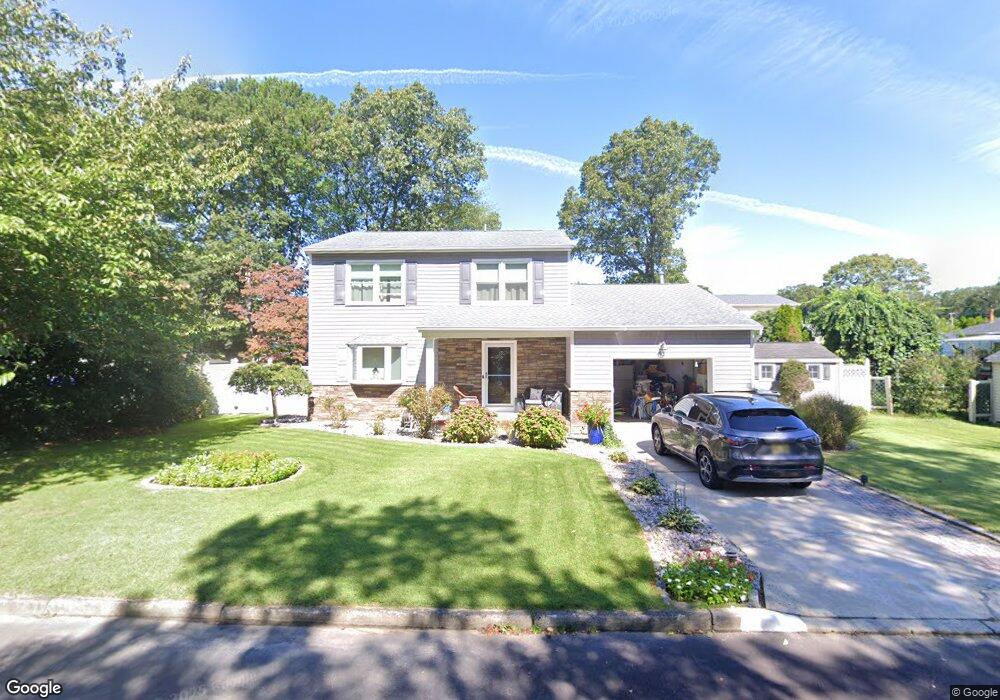
This home is located at 20 McLagan Ave, Brick, NJ 08724 and is currently estimated at $624,906, approximately $320 per square foot. 20 McLagan Ave is a home located in Ocean County with nearby schools including Lanes Mill Elementary School, Veterans Memorial Middle School, and Brick Township Memorial High School.
Ownership History
We collect this data history from publicly available records. To have your information removed, we recommend requesting removal directly through your county’s website.
Purchase Details
Home Financials for this Owner
Home Financials are based on the most recent Mortgage that was taken out on this home.Home Values in the Area
Average Home Value in this Area
Purchase History
We collect this data history from publicly available records. To have your information removed, we recommend requesting removal directly through your county’s website.
| Date | Buyer | Sale Price | Title Company |
|---|---|---|---|
| $169,900 | -- |
Mortgage History
We collect this data history from publicly available records. To have your information removed, we recommend requesting removal directly through your county’s website.
| Date | Status | Borrower | Loan Amount |
|---|---|---|---|
| Open | $152,900 |
Tax History
We collect this data history from publicly available records. To have your information removed, we recommend requesting removal directly through your county’s website.
| Year | Tax Paid | Tax Assessment Tax Assessment Total Assessment is a certain percentage of the fair market value that is determined by local assessors to be the total taxable value of land and additions on the property. | Land | Improvement |
|---|---|---|---|---|
| 2025 | $8,242 | $300,600 | $132,500 | $168,100 |
| 2024 | $7,446 | $300,600 | $132,500 | $168,100 |
| 2023 | $7,338 | $300,600 | $132,500 | $168,100 |
| 2022 | $7,338 | $300,600 | $132,500 | $168,100 |
| 2021 | $7,184 | $300,600 | $132,500 | $168,100 |
| 2020 | $7,091 | $300,600 | $132,500 | $168,100 |
| 2019 | $6,965 | $300,600 | $132,500 | $168,100 |
| 2018 | $6,806 | $300,600 | $132,500 | $168,100 |
| 2017 | $6,622 | $300,600 | $132,500 | $168,100 |
| 2016 | $6,586 | $300,600 | $132,500 | $168,100 |
| 2015 | $6,415 | $300,600 | $132,500 | $168,100 |
| 2014 | $6,361 | $300,600 | $132,500 | $168,100 |
Map
- 1490 Davidson Ave
- 6 Lisa Dr
- 12 D Trail
- 1635 Burrsville Rd
- 18 Regina Dr
- 1450 Davidson Ave
- 58 Central Blvd
- 510 Laurel Brook Dr Unit A
- 489C Jason Place Unit 2703
- 416 Laurel Brook Dr Unit 1401
- 420 Laurel Brook Dr Unit C
- 62 Garden Ave
- 1555 Forge Pond Rd
- 494A Laurel Brook Dr Unit A
- 64 Tony Ct
- 1591 W Princeton Ave
- 1563 Forge Pond Rd
- 40 Sidney Ct
- 1611 Patriot Ave
- 470A Laurel Brook Dr Unit 4401
Ask me questions while you tour the home.