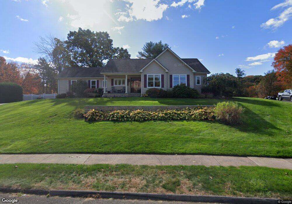
20 Michael Dr Southington, CT 06489
East Southington NeighborhoodEstimated Value: $508,703 - $550,000
3
Beds
3
Baths
1,668
Sq Ft
$314/Sq Ft
Est. Value
About This Home
This home is located at 20 Michael Dr, Southington, CT 06489 and is currently estimated at $522,926, approximately $313 per square foot. 20 Michael Dr is a home located in Hartford County with nearby schools including Hatton Elementary School, Joseph A. Depaolo Middle School, and Southington High School.
Ownership History
Date
Name
Owned For
Owner Type
Purchase Details
Closed on
Jul 9, 2014
Sold by
Lovley Development Inc
Bought by
Lee Leandra and Lee Christopher M
Current Estimated Value
Purchase Details
Closed on
Mar 24, 2014
Sold by
Egidio Richard L and Egidio Patricia R
Bought by
Egidio Patricia R and Egidio Richard L
Purchase Details
Closed on
Sep 4, 2008
Sold by
Loviey Farms Llc
Bought by
Egidio Richard and Egidio Patricia R
Home Financials for this Owner
Home Financials are based on the most recent Mortgage that was taken out on this home.
Original Mortgage
$200,000
Interest Rate
6.69%
Mortgage Type
Purchase Money Mortgage
Purchase Details
Closed on
Aug 19, 2008
Sold by
Mckay Donald E
Bought by
Lovley Farms Llc
Home Financials for this Owner
Home Financials are based on the most recent Mortgage that was taken out on this home.
Original Mortgage
$200,000
Interest Rate
6.69%
Mortgage Type
Purchase Money Mortgage
Create a Home Valuation Report for This Property
The Home Valuation Report is an in-depth analysis detailing your home's value as well as a comparison with similar homes in the area
Home Values in the Area
Average Home Value in this Area
Purchase History
We collect this data history from publicly available records. To have your information removed, we recommend requesting removal directly through your county’s website.
| Date | Buyer | Sale Price | Title Company |
|---|---|---|---|
| Lee Leandra | -- | -- | |
| Egidio Patricia R | -- | -- | |
| Egidio Richard | $140,000 | -- | |
| Lovley Farms Llc | $170,000 | -- |
Source: Public Records
Mortgage History
We collect this data history from publicly available records. To have your information removed, we recommend requesting removal directly through your county’s website.
| Date | Status | Borrower | Loan Amount |
|---|---|---|---|
| Previous Owner | Lovley Farms Llc | $200,000 |
Source: Public Records
Tax History
| Year | Tax Paid | Tax Assessment Tax Assessment Total Assessment is a certain percentage of the fair market value that is determined by local assessors to be the total taxable value of land and additions on the property. | Land | Improvement |
|---|---|---|---|---|
| 2025 | $7,683 | $231,340 | $66,090 | $165,250 |
| 2024 | $7,273 | $231,340 | $66,090 | $165,250 |
| 2023 | $7,023 | $231,340 | $66,090 | $165,250 |
| 2022 | $6,739 | $231,340 | $66,090 | $165,250 |
| 2021 | $6,716 | $231,340 | $66,090 | $165,250 |
| 2020 | $6,759 | $220,650 | $67,440 | $153,210 |
| 2019 | $6,761 | $220,650 | $67,440 | $153,210 |
| 2018 | $6,725 | $220,650 | $67,440 | $153,210 |
| 2017 | $6,725 | $220,650 | $67,440 | $153,210 |
| 2016 | $6,540 | $220,650 | $67,440 | $153,210 |
| 2015 | $6,788 | $232,950 | $64,230 | $168,720 |
| 2014 | $6,251 | $220,410 | $64,230 | $156,180 |
Source: Public Records
Map
Nearby Homes
- 15 Woodruff St
- 278 Hobart St
- 30 Prosperity Ct Unit 12
- 42 Reussner Rd
- 621 Overlook Path
- 6 Lakeview Dr
- 123 Oakland Rd
- 142 Liberty St
- 152 Liberty St
- 1 Coach Dr Unit 1
- 37 Homesdale Ave
- 86 Bristol St
- 500 Darling St Unit 11Q
- 77 Howard Ave
- 600 N Main St Unit 5
- 600 N Main St Unit 7
- 43 Raynor St
- 550 Darling St Unit 42B
- 550 Darling St Unit 41C
- 46 Garden Gate Rd
Your Personal Tour Guide
Ask me questions while you tour the home.