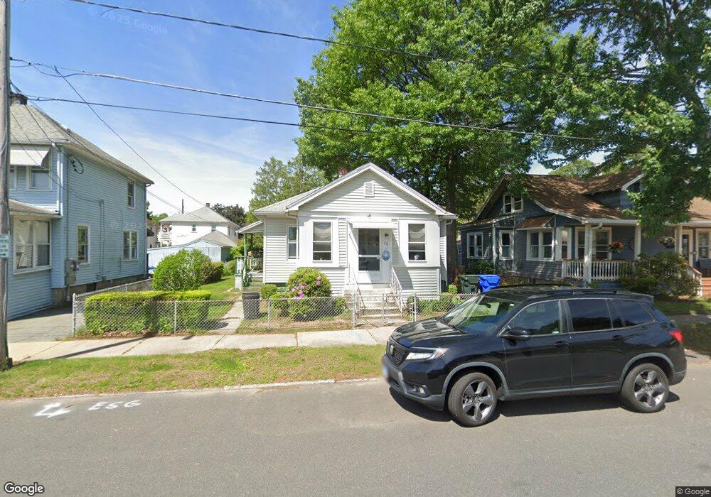
20 Monrovia St Springfield, MA 01104
East Springfield NeighborhoodEstimated Value: $204,000 - $263,000
3
Beds
1
Bath
1,000
Sq Ft
$234/Sq Ft
Est. Value
About This Home
This home is located at 20 Monrovia St, Springfield, MA 01104 and is currently estimated at $233,790, approximately $233 per square foot. 20 Monrovia St is a home located in Hampden County with nearby schools including Van Sickle Academy, Springfield Central High School, and Roger L. Putnam Vocational Technical Academy.
Ownership History
Date
Name
Owned For
Owner Type
Purchase Details
Closed on
Aug 4, 2017
Sold by
Allis Judith A and Hutchinson Nancy A
Bought by
Allis Ft
Current Estimated Value
Purchase Details
Closed on
May 29, 2014
Sold by
Allis Judith A and Smith Mary J
Bought by
Allis Judith A and Hutchinson Nancy A
Purchase Details
Closed on
Dec 20, 1978
Bought by
Allis Judith A and Hutchinson Nancy A
Create a Home Valuation Report for This Property
The Home Valuation Report is an in-depth analysis detailing your home's value as well as a comparison with similar homes in the area
Home Values in the Area
Average Home Value in this Area
Purchase History
| Date | Buyer | Sale Price | Title Company |
|---|---|---|---|
| Allis Ft | -- | -- | |
| Allis Judith A | -- | -- | |
| Allis Judith A | -- | -- |
Source: Public Records
Mortgage History
| Date | Status | Borrower | Loan Amount |
|---|---|---|---|
| Previous Owner | Allis Judith A | $8,000 | |
| Previous Owner | Allis Judith A | $45,000 | |
| Previous Owner | Allis Judith A | $47,000 |
Source: Public Records
Tax History
| Year | Tax Paid | Tax Assessment Tax Assessment Total Assessment is a certain percentage of the fair market value that is determined by local assessors to be the total taxable value of land and additions on the property. | Land | Improvement |
|---|---|---|---|---|
| 2025 | $2,554 | $162,900 | $37,200 | $125,700 |
| 2024 | $2,451 | $152,600 | $37,200 | $115,400 |
| 2023 | $2,511 | $147,300 | $34,700 | $112,600 |
| 2022 | $2,379 | $126,400 | $32,400 | $94,000 |
| 2021 | $2,064 | $109,200 | $29,500 | $79,700 |
| 2020 | $2,160 | $110,600 | $29,500 | $81,100 |
| 2019 | $1,998 | $101,500 | $30,500 | $71,000 |
| 2018 | $1,822 | $92,600 | $30,500 | $62,100 |
| 2017 | $1,767 | $89,900 | $27,600 | $62,300 |
| 2016 | $1,693 | $86,100 | $27,600 | $58,500 |
| 2015 | $1,721 | $87,500 | $27,600 | $59,900 |
Source: Public Records
Map
Nearby Homes
- 21-23 Santa Barbara St
- 25-27 Santa Barbara St
- 126 Windemere St
- 114 Monrovia St
- 456-458 Page Blvd
- 58 Eureka St
- 158 Monrovia St
- 66 Thornton St
- 245 El Paso St
- 191 Monrovia St
- 147 Bowles Park
- 3 Fordham St
- 47 Holy Cross St
- 51 E Canton Cir
- 2408 Roosevelt Ave
- 73 Oklahoma St
- 112 W Canton Cir
- 890-892 Saint James Ave
- 884-886 Saint James Ave
- 878-880 Saint James Ave
- 26 Monrovia St
- 16 Monrovia St
- 32 Monrovia St
- 10 Monrovia St Unit Street
- 10 Monrovia St
- 21 Santa Barbara St Unit 23
- 21 Santa Barbara St
- 21 Santa Barbara St Unit 2
- 15 Santa Barbara St Unit 17
- 15-17 Santa Barbara St
- 25-27 Santa Barbara St Unit 27
- 25 Santa Barbara St Unit 27
- 27 Santa Barbara St Unit 1
- 25 Santa Barbara St Unit 25
- 27 Santa Barbara St
- 25 Santa Barbara St Unit 2
- 25 Santa Barbara St Unit 1
- 11 Santa Barbara St Unit 13
- 31 Santa Barbara St Unit 33
- 31-33 Santa Barbara St
Your Personal Tour Guide
Ask me questions while you tour the home.