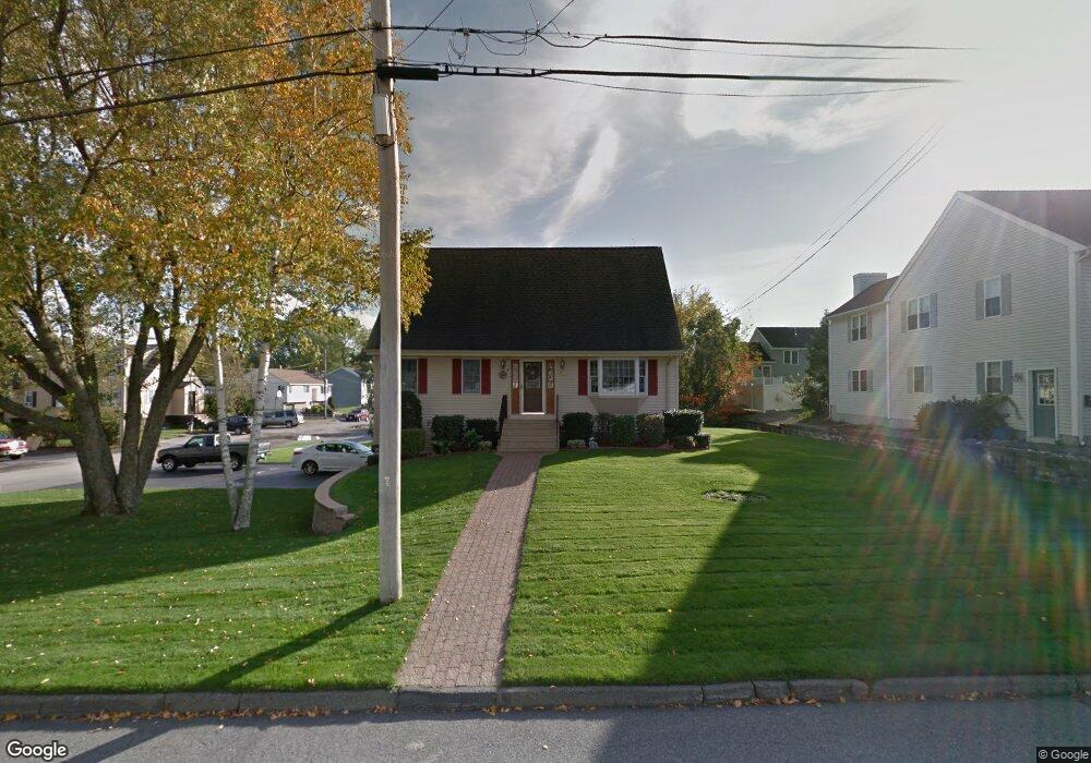
20 Montgomery Ave Worcester, MA 01604
Hamilton NeighborhoodEstimated Value: $457,000 - $523,000
3
Beds
2
Baths
1,547
Sq Ft
$318/Sq Ft
Est. Value
About This Home
This home is located at 20 Montgomery Ave, Worcester, MA 01604 and is currently estimated at $491,180, approximately $317 per square foot. 20 Montgomery Ave is a home located in Worcester County with nearby schools including Jacob Hiatt Magnet School, Chandler Magnet, and Rice Square Elementary School.
Ownership History
Date
Name
Owned For
Owner Type
Purchase Details
Closed on
Aug 27, 1999
Sold by
Perrone Vincent J and Perrone Joseph
Bought by
Pike Robert K
Current Estimated Value
Purchase Details
Closed on
Aug 4, 1992
Sold by
Garcia Diane M
Bought by
Genese Francis C
Home Financials for this Owner
Home Financials are based on the most recent Mortgage that was taken out on this home.
Original Mortgage
$82,000
Interest Rate
8.46%
Mortgage Type
Purchase Money Mortgage
Create a Home Valuation Report for This Property
The Home Valuation Report is an in-depth analysis detailing your home's value as well as a comparison with similar homes in the area
Home Values in the Area
Average Home Value in this Area
Purchase History
We collect this data history from publicly available records. To have your information removed, we recommend requesting removal directly through your county’s website.
| Date | Buyer | Sale Price | Title Company |
|---|---|---|---|
| Pike Robert K | $57,000 | -- | |
| Genese Francis C | $65,000 | -- |
Source: Public Records
Mortgage History
We collect this data history from publicly available records. To have your information removed, we recommend requesting removal directly through your county’s website.
| Date | Status | Borrower | Loan Amount |
|---|---|---|---|
| Open | Genese Francis C | $36,000 | |
| Previous Owner | Genese Francis C | $82,000 |
Source: Public Records
Tax History
| Year | Tax Paid | Tax Assessment Tax Assessment Total Assessment is a certain percentage of the fair market value that is determined by local assessors to be the total taxable value of land and additions on the property. | Land | Improvement |
|---|---|---|---|---|
| 2025 | $5,982 | $453,500 | $118,700 | $334,800 |
| 2024 | $5,841 | $424,800 | $118,700 | $306,100 |
| 2023 | $5,627 | $392,400 | $103,200 | $289,200 |
| 2022 | $5,193 | $341,400 | $82,600 | $258,800 |
| 2021 | $5,055 | $310,500 | $66,100 | $244,400 |
| 2020 | $4,910 | $288,800 | $66,100 | $222,700 |
| 2019 | $4,673 | $259,600 | $59,500 | $200,100 |
| 2018 | $4,667 | $246,800 | $59,500 | $187,300 |
| 2017 | $4,453 | $231,700 | $59,500 | $172,200 |
| 2016 | $4,336 | $210,400 | $43,600 | $166,800 |
| 2015 | $4,223 | $210,400 | $43,600 | $166,800 |
| 2014 | $4,111 | $210,400 | $43,600 | $166,800 |
Source: Public Records
Map
Nearby Homes
- 43 Robin Rd
- 24 Ingleside Ave
- 34 Dartmouth St
- 81 Pilgrim Ave
- 6 Harrington Way
- 29 Chilmark St
- 25 Almont Ave
- 1 Verdi Rd
- 812 Franklin St Unit A
- 327 Plantation St Unit 312
- 109 Hamilton St
- 80 Delmont Ave
- 13 Prentice St
- 16 Caprera Rd
- 360 Hamilton St
- 25 Johnson St
- 23 Suffolk St
- 56 Cohasset St
- 22 Frank St
- 143 Dorcester
- 13 Montgomery Ave
- 10 Ancona Rd
- 7 Montgomery Ave
- 15 Montgomery Ave
- 14 Ancona Rd
- 6 Ancona Rd
- 1 Rosemary St
- 12 Montgomery Ave
- 18 Ancona Rd
- 21 Montgomery Ave
- 220 Plantation St
- 216 Plantation St
- 6 Montgomery Ave
- 6 Montgomery Ave Unit 6
- 6 Montgomery Ave Unit 1
- 230 Plantation St
- 28 Ancona Rd
- 7 Arrow St
- 23 Montgomery Ave
- 15 Ancona Rd
Your Personal Tour Guide
Ask me questions while you tour the home.