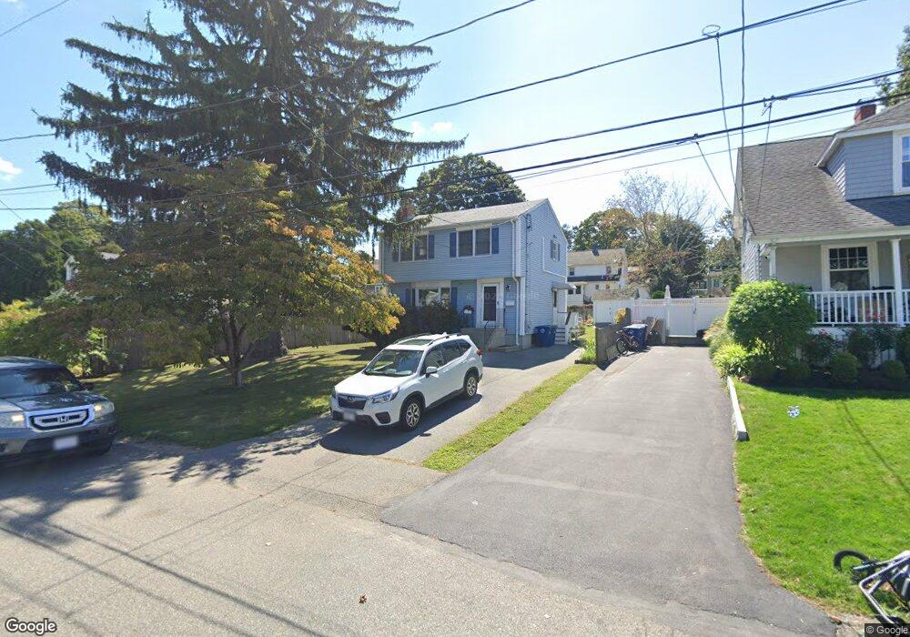
20 Wampatuck Rd Braintree, MA 02184
Braintree Highlands NeighborhoodEstimated Value: $647,763 - $724,000
3
Beds
2
Baths
1,300
Sq Ft
$528/Sq Ft
Est. Value
About This Home
This home is located at 20 Wampatuck Rd, Braintree, MA 02184 and is currently estimated at $685,941, approximately $527 per square foot. 20 Wampatuck Rd is a home located in Norfolk County with nearby schools including Braintree High School, Boston Higashi School, and Lighthouse Baptist Christian Academy.
Ownership History
Date
Name
Owned For
Owner Type
Purchase Details
Closed on
Nov 18, 1994
Sold by
Fnma
Bought by
Olsen Robert L and Olsen Ruth M
Current Estimated Value
Home Financials for this Owner
Home Financials are based on the most recent Mortgage that was taken out on this home.
Original Mortgage
$141,750
Interest Rate
8.9%
Mortgage Type
Purchase Money Mortgage
Purchase Details
Closed on
Aug 11, 1994
Sold by
Est Tocci Kenneth A
Bought by
Quincy Sb
Create a Home Valuation Report for This Property
The Home Valuation Report is an in-depth analysis detailing your home's value as well as a comparison with similar homes in the area
Home Values in the Area
Average Home Value in this Area
Purchase History
We collect this data history from publicly available records. To have your information removed, we recommend requesting removal directly through your county’s website.
| Date | Buyer | Sale Price | Title Company |
|---|---|---|---|
| Olsen Robert L | $157,500 | -- | |
| Quincy Sb | $159,000 | -- | |
| Quincy Sb | $159,000 | -- |
Source: Public Records
Mortgage History
We collect this data history from publicly available records. To have your information removed, we recommend requesting removal directly through your county’s website.
| Date | Status | Borrower | Loan Amount |
|---|---|---|---|
| Open | Quincy Sb | $139,000 | |
| Closed | Quincy Sb | $141,750 | |
| Previous Owner | Quincy Sb | $140,000 |
Source: Public Records
Tax History
| Year | Tax Paid | Tax Assessment Tax Assessment Total Assessment is a certain percentage of the fair market value that is determined by local assessors to be the total taxable value of land and additions on the property. | Land | Improvement |
|---|---|---|---|---|
| 2025 | $6,126 | $613,800 | $339,700 | $274,100 |
| 2024 | $5,476 | $577,600 | $308,400 | $269,200 |
| 2023 | $5,192 | $532,000 | $277,100 | $254,900 |
| 2022 | $5,027 | $505,200 | $250,300 | $254,900 |
| 2021 | $4,644 | $466,700 | $226,200 | $240,500 |
| 2020 | $4,399 | $446,100 | $205,600 | $240,500 |
| 2019 | $4,194 | $415,700 | $196,700 | $219,000 |
| 2018 | $4,099 | $388,900 | $178,800 | $210,100 |
| 2017 | $3,987 | $371,200 | $169,900 | $201,300 |
| 2016 | $3,847 | $350,400 | $160,900 | $189,500 |
| 2015 | $3,501 | $316,300 | $134,100 | $182,200 |
| 2014 | $3,431 | $300,400 | $128,700 | $171,700 |
Source: Public Records
Map
Nearby Homes
- 36 Woodside Ave
- 1579 Washington St
- 1 Brewster Rd
- 107 Meadow Ln Unit 107
- 81 Livoli Ave
- 14 Lewis Rd
- 26 Mcdevitt Rd
- 1696 Liberty St
- 111 Barstow Dr
- 614 Pond St Unit 2306
- 614 Pond St Unit 1303
- 11 Hingston Cir
- 181 Oak St
- 65 Lake St
- 156 Allen St
- 4 Lake St
- 5 Clarendon Cir Unit Lot 4
- 249 Mill St
- 9 Sunset Ave
- 33 Clark St Unit A
- 24 Wampatuck Rd
- 12 Wampatuck Rd
- 28 Wampatuck Rd
- 25 Hillview Rd
- 29 Hillview Rd
- 19 Hillview Rd
- 17 Wampatuck Rd
- 11 Wampatuck Rd
- 29 Wampatuck Rd
- 33 Hillview Rd
- 1791 Washington St
- 15 Hillview Rd
- 32 Wampatuck Rd
- 1795 Washington St
- 33 Wampatuck Rd
- 5 Wampatuck Rd
- 39 Hillview Rd
- 9 Hillview Rd
- 36 Wampatuck Rd
- 39 Wampatuck Rd
Your Personal Tour Guide
Ask me questions while you tour the home.