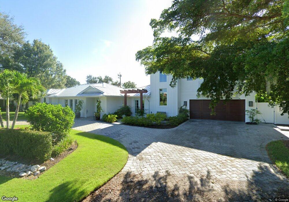
200 Burning Tree Dr Unit 20 Naples, FL 34105
Moorings Park-Hawks Ridge NeighborhoodEstimated Value: $2,777,000 - $2,969,000
Studio
3
Baths
2,212
Sq Ft
$1,305/Sq Ft
Est. Value
About This Home
This home is located at 200 Burning Tree Dr Unit 20, Naples, FL 34105 and is currently estimated at $2,886,484, approximately $1,304 per square foot. 200 Burning Tree Dr Unit 20 is a home located in Collier County with nearby schools including Sea Gate Elementary School, Pine Ridge Middle School, and Barron Collier High School.
Ownership History
Date
Name
Owned For
Owner Type
Purchase Details
Closed on
Oct 28, 2016
Sold by
Twohig Marjorie A and Twohig Paul James
Bought by
Peck Robert Edward and Peck Brynne Elise
Current Estimated Value
Home Financials for this Owner
Home Financials are based on the most recent Mortgage that was taken out on this home.
Original Mortgage
$520,000
Interest Rate
3.5%
Mortgage Type
Purchase Money Mortgage
Purchase Details
Closed on
Jun 1, 2016
Bought by
Twohig Marjorie A
Create a Home Valuation Report for This Property
The Home Valuation Report is an in-depth analysis detailing your home's value as well as a comparison with similar homes in the area
Home Values in the Area
Average Home Value in this Area
Purchase History
| Date | Buyer | Sale Price | Title Company |
|---|---|---|---|
| Peck Robert Edward | $520,000 | Licensed Title Agent | |
| Twohig Marjorie A | $100 | -- |
Source: Public Records
Mortgage History
| Date | Status | Borrower | Loan Amount |
|---|---|---|---|
| Closed | Peck Robert Edward | $520,000 |
Source: Public Records
Tax History
| Year | Tax Paid | Tax Assessment Tax Assessment Total Assessment is a certain percentage of the fair market value that is determined by local assessors to be the total taxable value of land and additions on the property. | Land | Improvement |
|---|---|---|---|---|
| 2025 | $5,980 | $655,408 | -- | -- |
| 2024 | $4,969 | $636,937 | -- | -- |
| 2023 | $4,969 | $520,075 | -- | -- |
| 2022 | $5,102 | $504,927 | $0 | $0 |
| 2021 | $5,155 | $490,220 | $0 | $0 |
| 2020 | $5,032 | $483,452 | $0 | $0 |
| 2019 | $4,947 | $472,583 | $0 | $0 |
| 2018 | $4,643 | $445,867 | $0 | $0 |
| 2017 | $4,574 | $436,696 | $258,300 | $178,396 |
| 2016 | $2,473 | $263,790 | $0 | $0 |
| 2015 | $2,683 | $261,956 | $0 | $0 |
| 2014 | $2,683 | $209,877 | $0 | $0 |
Source: Public Records
Map
Nearby Homes
- 200 Burning Tree Dr
- 237 Burning Tree Dr
- 1041 Forest Lakes Dr Unit 7-D
- 1037 Forest Lakes Dr Unit 8D
- 1094 Forest Lakes Dr Unit 20C
- 1086 Forest Lakes Dr Unit 9207
- 1086 Forest Lakes Dr Unit 9305
- 1084 Forest Lakes Dr Unit 7304
- 1083 Forest Lakes Dr Unit 6304/6305
- 318 Burning Tree Dr
- 335 Burning Tree Dr
- 1620 Forest Lakes Blvd
- 267 Quail Forest Blvd Unit 209
- 1057 Forest Lakes Dr Unit 209
- 1057 Forest Lakes Dr Unit 1208
- 1087 Forest Lakes Dr Unit 1-201
- 1087 Forest Lakes Dr Unit 1-303
- 1087 Forest Lakes Dr Unit 309
- 1087 Forest Lakes Dr Unit 1-104
- 1087 Forest Lakes Dr Unit 1-309
- 208 Burning Tree Dr
- 216 Burning Tree Dr
- 185 Burning Tree Dr
- 224 Burning Tree Dr
- 213 Burning Tree Dr
- 232 Burning Tree Dr
- 221 Burning Tree Dr
- 240 Burning Tree Dr
- 231 Burning Tree Dr
- 1505 Jimpson Ln
- 248 Burning Tree Dr
- 1427 Kelp Ln
- 1503 Jimpson Ln
- 245 Burning Tree Dr
- 1423 Kelp Ln
- 1507 Jimpson Ln
- 1417 Lyonia Ln
- 1513 Ivygate Ln
- 247 Burning Tree Dr
- 1415 Lyonia Ln
Your Personal Tour Guide
Ask me questions while you tour the home.