Estimated Value: $318,000 - $367,000
4
Beds
2
Baths
1,632
Sq Ft
$209/Sq Ft
Est. Value
About This Home
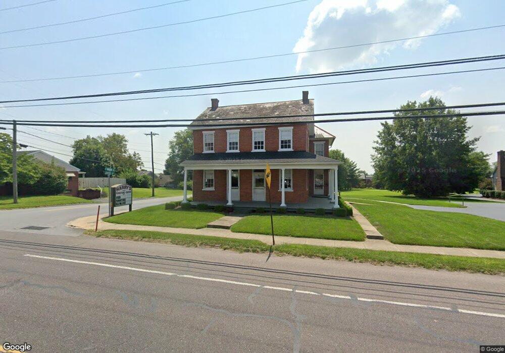
This home is located at 200 E Main St, Leola, PA 17540 and is currently estimated at $341,017, approximately $208 per square foot. 200 E Main St is a home located in Lancaster County with nearby schools including Leola Elementary School, Gerald G. Huesken Middle School, and Conestoga Valley High School.
Ownership History
Date
Name
Owned For
Owner Type
Purchase Details
Closed on
Oct 16, 2015
Sold by
Mattis Gerald A and Mattis Tina M
Bought by
Mattis Gerald A
Current Estimated Value
Home Financials for this Owner
Home Financials are based on the most recent Mortgage that was taken out on this home.
Original Mortgage
$127,050
Outstanding Balance
$76,162
Interest Rate
3.87%
Mortgage Type
New Conventional
Estimated Equity
$264,855
Purchase Details
Closed on
Jan 4, 2002
Sold by
Whitaker James and Whitaker Brenda
Bought by
Mattis Gerald A and Mattis Tina M
Home Financials for this Owner
Home Financials are based on the most recent Mortgage that was taken out on this home.
Original Mortgage
$111,008
Interest Rate
7.04%
Mortgage Type
FHA
Purchase Details
Closed on
Oct 10, 2001
Sold by
Stoltzfus Eldon R and Soltzfus Joseph Brent
Bought by
Whitaker James and Whitaker Brenda
Create a Home Valuation Report for This Property
The Home Valuation Report is an in-depth analysis detailing your home's value as well as a comparison with similar homes in the area
Home Values in the Area
Average Home Value in this Area
Purchase History
| Date | Buyer | Sale Price | Title Company |
|---|---|---|---|
| Mattis Gerald A | -- | Servicelink | |
| Mattis Gerald A | $112,000 | -- | |
| Whitaker James | $83,000 | -- |
Source: Public Records
Mortgage History
| Date | Status | Borrower | Loan Amount |
|---|---|---|---|
| Open | Mattis Gerald A | $127,050 | |
| Closed | Mattis Gerald A | $111,008 |
Source: Public Records
Tax History
| Year | Tax Paid | Tax Assessment Tax Assessment Total Assessment is a certain percentage of the fair market value that is determined by local assessors to be the total taxable value of land and additions on the property. | Land | Improvement |
|---|---|---|---|---|
| 2025 | $2,942 | $147,800 | $41,100 | $106,700 |
| 2024 | $2,942 | $147,800 | $41,100 | $106,700 |
| 2023 | $2,873 | $147,800 | $41,100 | $106,700 |
| 2022 | $2,757 | $147,800 | $41,100 | $106,700 |
| 2021 | $2,656 | $147,800 | $41,100 | $106,700 |
| 2020 | $2,656 | $147,800 | $41,100 | $106,700 |
| 2019 | $2,966 | $168,800 | $41,100 | $127,700 |
| 2018 | $4,522 | $168,800 | $41,100 | $127,700 |
| 2017 | $2,465 | $116,000 | $30,800 | $85,200 |
| 2016 | $2,465 | $116,000 | $30,800 | $85,200 |
| 2015 | $618 | $116,000 | $30,800 | $85,200 |
| 2014 | $1,625 | $116,000 | $30,800 | $85,200 |
Source: Public Records
Map
Nearby Homes
- 32 Battens Cir
- 344 E Main St
- 379 E Main St
- 466 E Main St
- 468 Brendon Dr
- 456 Brendon Dr
- 489 Brendon Dr
- 174 W Main St
- 15 Fairview Ave
- 299 Rolling Terrace
- 101 Chapel Ln
- 524 Westfield Dr
- 307 Cottonwood Ln
- 220 Sycamore Ln
- 314 W Conestoga St
- 315 W Broad St
- 59 Ashlea Village
- 2297
- 3133 Old Philadelphia Pike
- 2299 Sue Ann Drive (Lot #1)
Your Personal Tour Guide
Ask me questions while you tour the home.