Estimated Value: $170,800 - $201,000
3
Beds
2
Baths
1,121
Sq Ft
$167/Sq Ft
Est. Value
About This Home
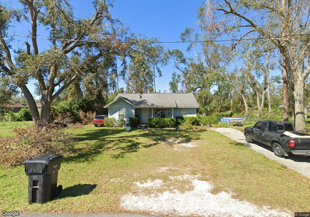
This home is located at 200 Kate Dr Unit 1, Perry, FL 32348 and is currently estimated at $187,450, approximately $167 per square foot. 200 Kate Dr Unit 1 is a home located in Taylor County with nearby schools including Perry Primary School, Taylor County Elementary School, and Taylor County Middle School.
Ownership History
Date
Name
Owned For
Owner Type
Purchase Details
Closed on
May 5, 2003
Sold by
Tuten Gail B and Tuten Harvey Benjye
Bought by
Mcgriff David P
Current Estimated Value
Home Financials for this Owner
Home Financials are based on the most recent Mortgage that was taken out on this home.
Original Mortgage
$55,000
Outstanding Balance
$19,086
Interest Rate
5.79%
Mortgage Type
Purchase Money Mortgage
Estimated Equity
$168,364
Create a Home Valuation Report for This Property
The Home Valuation Report is an in-depth analysis detailing your home's value as well as a comparison with similar homes in the area
Home Values in the Area
Average Home Value in this Area
Purchase History
| Date | Buyer | Sale Price | Title Company |
|---|---|---|---|
| Mcgriff David P | $65,000 | -- |
Source: Public Records
Mortgage History
| Date | Status | Borrower | Loan Amount |
|---|---|---|---|
| Open | Mcgriff David P | $55,000 |
Source: Public Records
Tax History
| Year | Tax Paid | Tax Assessment Tax Assessment Total Assessment is a certain percentage of the fair market value that is determined by local assessors to be the total taxable value of land and additions on the property. | Land | Improvement |
|---|---|---|---|---|
| 2025 | $2,414 | $128,840 | $29,900 | $98,940 |
| 2024 | $2,117 | $128,840 | $29,900 | $98,940 |
| 2023 | $2,117 | $104,430 | $0 | $0 |
| 2022 | $1,947 | $109,650 | $28,750 | $80,900 |
| 2021 | $1,792 | $93,770 | $28,750 | $65,020 |
| 2020 | $1,604 | $78,470 | $28,750 | $49,720 |
| 2019 | $1,635 | $79,540 | $28,750 | $50,790 |
| 2018 | $581 | $60,750 | $10,350 | $50,400 |
| 2017 | $594 | $60,130 | $10,350 | $49,780 |
| 2016 | $601 | $61,090 | $10,350 | $50,740 |
| 2015 | $618 | $62,050 | $10,350 | $51,700 |
| 2014 | -- | $64,283 | $0 | $0 |
Source: Public Records
Map
Nearby Homes
- 102 S Claire Dr
- 200 Davis Dr
- 202 Puckett Rd
- 415 Judson Dr
- 150 Houck Rd
- 95 Houck Rd
- 0 Airport Rd Unit 25458733
- 206 Pineland St
- 823 S Warner Ave
- 106 Crit Jones Dr
- 1302 S Center St
- 104 Crit Jones Dr
- 3756 Cash More St
- 1100 S Wilder St
- Lot 000 U S Highway 19
- 1012 S Orange St
- TBD Shady Oaks Ln
- 00 Shady Oaks Ln
- 831 U S 27
- 0 US Highway 27 Unit 796363
Your Personal Tour Guide
Ask me questions while you tour the home.