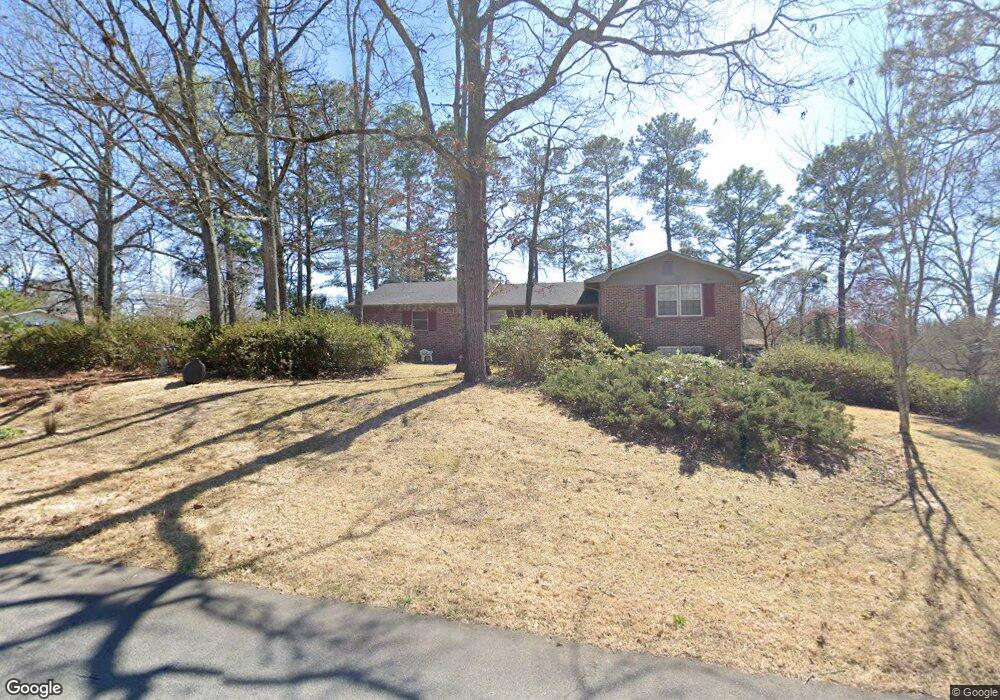
200 Lumpkin Dr Warner Robins, GA 31093
Estimated Value: $181,643 - $212,000
About This Home
This home is located at 200 Lumpkin Dr, Warner Robins, GA 31093 and is currently estimated at $194,161, approximately $109 per square foot. 200 Lumpkin Dr is a home located in Houston County with nearby schools including Westside Elementary School, Northside Middle School, and Northside High School.
Ownership History
We collect this data history from publicly available records. To have your information removed, we recommend requesting removal directly through your county’s website.
Purchase Details
Purchase Details
Purchase Details
Purchase Details
Purchase Details
Purchase Details
Purchase Details
Purchase Details
Purchase Details
Purchase Details
Purchase Details
Home Values in the Area
Average Home Value in this Area
Purchase History
We collect this data history from publicly available records. To have your information removed, we recommend requesting removal directly through your county’s website.
| Date | Buyer | Sale Price | Title Company |
|---|---|---|---|
| -- | None Available | ||
| -- | None Available | ||
| -- | -- | ||
| -- | -- | ||
| -- | -- | ||
| -- | -- | ||
| -- | -- | ||
| -- | -- | ||
| -- | -- | ||
| -- | -- | ||
| -- | -- | ||
| -- | -- |
Tax History
We collect this data history from publicly available records. To have your information removed, we recommend requesting removal directly through your county’s website.
| Year | Tax Paid | Tax Assessment Tax Assessment Total Assessment is a certain percentage of the fair market value that is determined by local assessors to be the total taxable value of land and additions on the property. | Land | Improvement |
|---|---|---|---|---|
| 2025 | $1,174 | $58,200 | $7,120 | $51,080 |
| 2024 | $1,217 | $52,880 | $7,120 | $45,760 |
| 2023 | $1,090 | $47,080 | $7,120 | $39,960 |
| 2022 | $983 | $42,680 | $5,720 | $36,960 |
| 2021 | $862 | $37,480 | $5,720 | $31,760 |
| 2020 | $846 | $36,640 | $5,720 | $30,920 |
| 2019 | $846 | $36,640 | $5,720 | $30,920 |
| 2018 | $846 | $36,640 | $5,720 | $30,920 |
| 2017 | $846 | $36,640 | $5,720 | $30,920 |
| 2016 | $848 | $36,640 | $5,720 | $30,920 |
| 2015 | $849 | $36,640 | $5,720 | $30,920 |
| 2014 | -- | $36,640 | $5,720 | $30,920 |
| 2013 | -- | $36,200 | $5,720 | $30,480 |
Map
- 416 Knodishall Dr
- 221 Gilchrist Dr
- 109 Delchamps Dr
- 115 Foxfire Dr
- 111 Laurel Oak Ln
- 108 Laurel Oak Ln
- 102 Hemlock St
- 103 Westcliff Cir Unit A
- 103 Westcliff Cir Unit A
- 106 Westcliff Cir Unit C
- 106 Westcliff Cir Unit C
- 217 Wray St
- 102 Williams St
- 138 Woodcrest Cir
- 121 Napier Ave
- 112 Emory Dr
- 131 Red Birch Ln
- 136 Red Birch Ln
- 159 Red Birch Ln
- 127 Red Birch Ln
- 303 Taylor St
- 202 Lumpkin Dr
- 201 Lumpkin Dr
- 306 Taylor St
- 308 Taylor St
- 304 Taylor St
- 203 Lumpkin Dr
- 400 Taylor St
- 200 Debbie Dr
- 205 Lumpkin Dr
- 201 Meadow Glen Ct
- 302 Taylor St
- 101 Meadow Glen Ct
- 203 Meadow Glen Ct
- 201 Stanford St
- 103 Meadow Glen Ct
- 110 Flournoy Dr
- 203 Stanford St
- 402 Taylor St
- 118 Taylor St
Ask me questions while you tour the home.