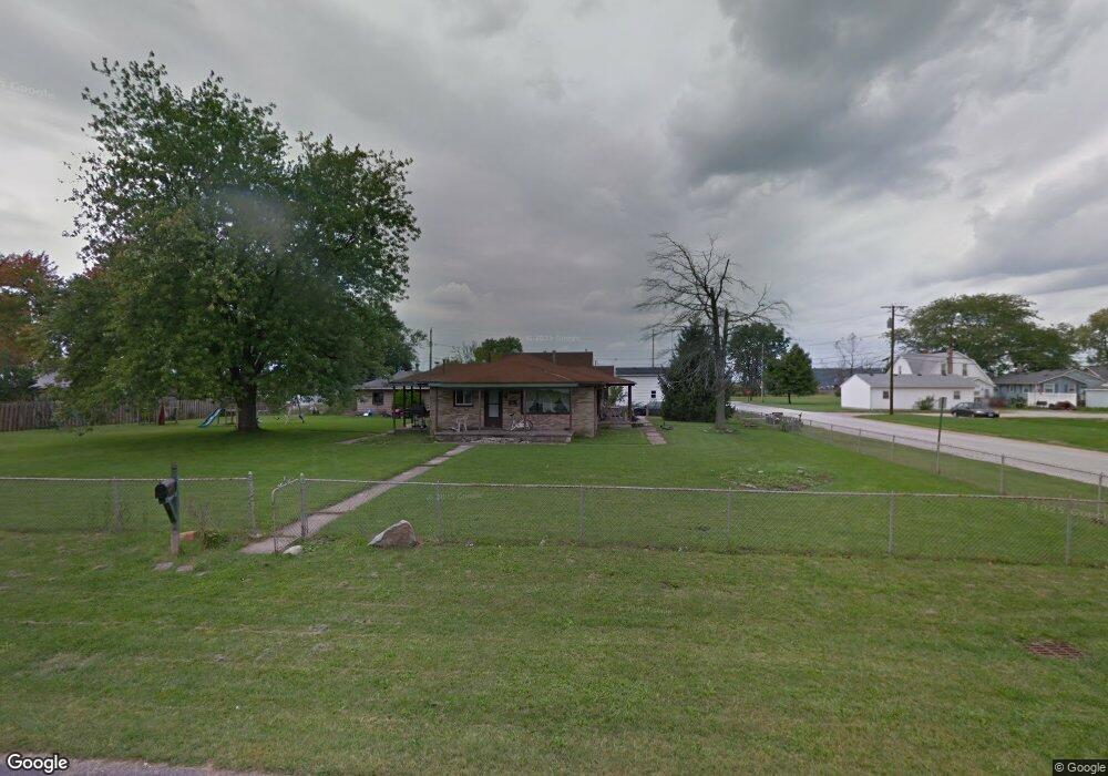
200 Percy St Walbridge, OH 43465
Estimated Value: $158,000 - $201,000
3
Beds
2
Baths
1,680
Sq Ft
$105/Sq Ft
Est. Value
About This Home
This home is located at 200 Percy St, Walbridge, OH 43465 and is currently estimated at $175,922, approximately $104 per square foot. 200 Percy St is a home located in Wood County with nearby schools including Lake Elementary School, Lake Middle School, and Lake High School.
Ownership History
Date
Name
Owned For
Owner Type
Purchase Details
Closed on
Apr 26, 2000
Sold by
Glass Maryah and Updegraff Maryah J
Bought by
Glass Kenneth R
Current Estimated Value
Home Financials for this Owner
Home Financials are based on the most recent Mortgage that was taken out on this home.
Original Mortgage
$114,750
Outstanding Balance
$46,586
Interest Rate
11.85%
Estimated Equity
$129,336
Purchase Details
Closed on
Apr 6, 1994
Sold by
Rose Robert L
Bought by
Glass Kenneth R and Updegraff Maryah
Purchase Details
Closed on
Aug 31, 1992
Bought by
Rose Robert L
Create a Home Valuation Report for This Property
The Home Valuation Report is an in-depth analysis detailing your home's value as well as a comparison with similar homes in the area
Home Values in the Area
Average Home Value in this Area
Purchase History
We collect this data history from publicly available records. To have your information removed, we recommend requesting removal directly through your county’s website.
| Date | Buyer | Sale Price | Title Company |
|---|---|---|---|
| Glass Kenneth R | -- | -- | |
| Glass Kenneth R | $82,000 | -- | |
| Rose Robert L | $70,000 | -- |
Source: Public Records
Mortgage History
We collect this data history from publicly available records. To have your information removed, we recommend requesting removal directly through your county’s website.
| Date | Status | Borrower | Loan Amount |
|---|---|---|---|
| Open | Glass Kenneth R | $114,750 |
Source: Public Records
Tax History
| Year | Tax Paid | Tax Assessment Tax Assessment Total Assessment is a certain percentage of the fair market value that is determined by local assessors to be the total taxable value of land and additions on the property. | Land | Improvement |
|---|---|---|---|---|
| 2025 | $1,864 | $40,985 | $8,050 | $32,935 |
| 2024 | $1,858 | $40,985 | $8,050 | $32,935 |
| 2023 | $1,858 | $40,990 | $8,050 | $32,940 |
| 2021 | $1,804 | $33,880 | $7,490 | $26,390 |
| 2020 | $1,734 | $33,880 | $7,490 | $26,390 |
| 2019 | $1,583 | $28,490 | $7,490 | $21,000 |
| 2018 | $1,581 | $28,490 | $7,490 | $21,000 |
| 2017 | $1,661 | $28,490 | $7,490 | $21,000 |
| 2016 | $1,695 | $31,360 | $7,490 | $23,870 |
| 2015 | $1,695 | $31,360 | $7,490 | $23,870 |
| 2014 | $1,790 | $31,360 | $7,490 | $23,870 |
| 2013 | $1,868 | $31,360 | $7,490 | $23,870 |
Source: Public Records
Map
Nearby Homes
- 211 E Perry St
- 407 N Grove St
- 209 Parkview Dr
- 403 Park Ln
- 236 S Bridge Rd
- 238 S Bridge Rd
- 232 S Bridge Rd
- 241 S Bridge Rd
- 30630 Drouillard Rd Unit 82
- 28574 Lemoyne Rd
- 3901 Plumey Rd
- 29658 Tracy Rd
- 0 Williston Rd
- 199 E Bridge Rd
- 4500 Woodville Rd
- 5882 Cherokee Ave
- 7210 W Lake Rd
- 5980 Arapaho Ave
- 204 Short St
- 115 W Bridge Rd
- 200 Percy St
- 103 Harrison Ave
- 206 Percy St
- 601 S Main St
- 607 S Main St
- 200 Harrison Ave
- 208 Percy St
- 331 S Main St
- 201 Harrison Ave
- 105 Cedar Ct
- 103 Cedar Ct
- 103 Cedar Ct Unit 4
- 103 Cedar Ct Unit 3
- 103 Cedar Ct Unit 2
- 103 Cedar Ct Unit 1
- 609 S Main St
- 609 S Main St
- 105 Percy St
- 329 S Main St
- 205 Percy St
Your Personal Tour Guide
Ask me questions while you tour the home.