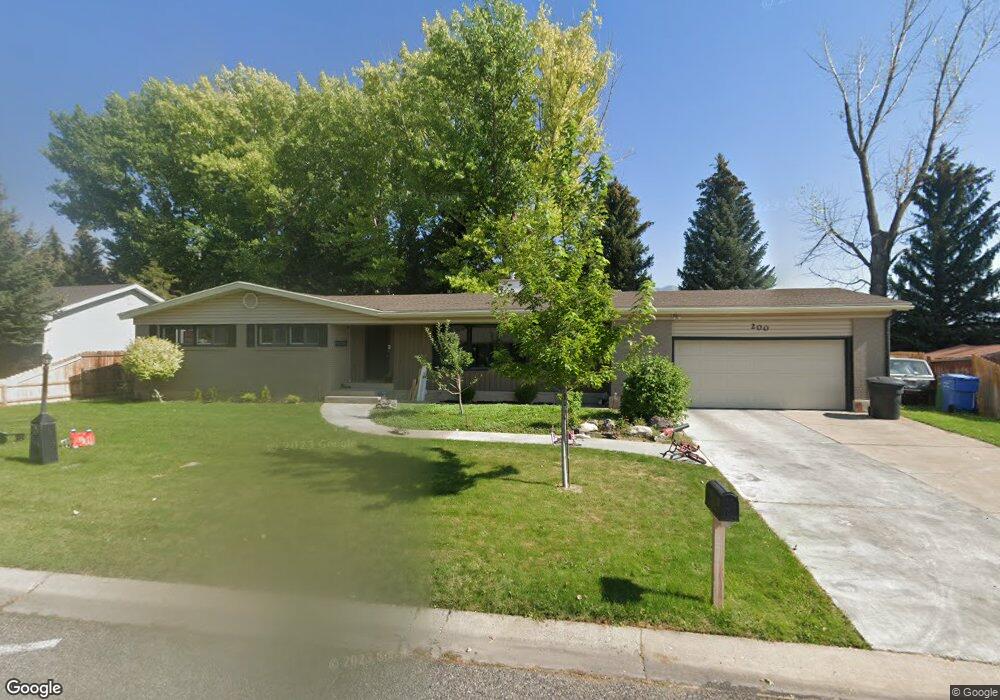
200 Summit Dr Smithfield, UT 84335
Estimated Value: $471,000 - $526,000
5
Beds
3
Baths
3,298
Sq Ft
$150/Sq Ft
Est. Value
About This Home
This home is located at 200 Summit Dr, Smithfield, UT 84335 and is currently estimated at $496,319, approximately $150 per square foot. 200 Summit Dr is a home located in Cache County with nearby schools including Sunrise School, North Cache Middle School, and White Pine Middle School.
Ownership History
Date
Name
Owned For
Owner Type
Purchase Details
Closed on
Mar 28, 2012
Sold by
Toone Connie M H and Toone Charles H
Bought by
Biggs Christopher M
Current Estimated Value
Home Financials for this Owner
Home Financials are based on the most recent Mortgage that was taken out on this home.
Original Mortgage
$188,979
Outstanding Balance
$129,284
Interest Rate
3.86%
Mortgage Type
New Conventional
Estimated Equity
$367,035
Create a Home Valuation Report for This Property
The Home Valuation Report is an in-depth analysis detailing your home's value as well as a comparison with similar homes in the area
Home Values in the Area
Average Home Value in this Area
Purchase History
| Date | Buyer | Sale Price | Title Company |
|---|---|---|---|
| Biggs Christopher M | -- | Cache Title Company |
Source: Public Records
Mortgage History
| Date | Status | Borrower | Loan Amount |
|---|---|---|---|
| Open | Biggs Christopher M | $188,979 |
Source: Public Records
Tax History
| Year | Tax Paid | Tax Assessment Tax Assessment Total Assessment is a certain percentage of the fair market value that is determined by local assessors to be the total taxable value of land and additions on the property. | Land | Improvement |
|---|---|---|---|---|
| 2025 | $2,055 | $275,095 | $0 | $0 |
| 2024 | $2,373 | $298,060 | $0 | $0 |
| 2023 | $2,493 | $296,100 | $0 | $0 |
| 2022 | $2,534 | $296,095 | $0 | $0 |
| 2021 | $2,372 | $423,520 | $95,400 | $328,120 |
| 2020 | $2,089 | $347,800 | $95,400 | $252,400 |
| 2019 | $1,989 | $315,800 | $63,400 | $252,400 |
| 2018 | $1,921 | $295,016 | $63,400 | $231,616 |
| 2017 | $1,772 | $148,610 | $0 | $0 |
| 2016 | $1,269 | $104,610 | $0 | $0 |
| 2015 | $1,274 | $104,610 | $0 | $0 |
| 2014 | $1,243 | $104,070 | $0 | $0 |
| 2013 | -- | $107,565 | $0 | $0 |
Source: Public Records
Map
Nearby Homes
Your Personal Tour Guide
Ask me questions while you tour the home.