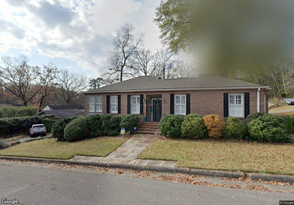
2000 20th St S Birmingham, AL 35209
Estimated Value: $472,000 - $608,000
4
Beds
2
Baths
1,721
Sq Ft
$299/Sq Ft
Est. Value
About This Home
This home is located at 2000 20th St S, Birmingham, AL 35209 and is currently estimated at $513,812, approximately $298 per square foot. 2000 20th St S is a home located in Jefferson County with nearby schools including Avondale Elementary School, W.E. Putnam Middle School Magnet, and Woodlawn High School-Magnet.
Ownership History
Date
Name
Owned For
Owner Type
Purchase Details
Closed on
Jun 8, 2016
Sold by
Firestone Flowers Llc
Bought by
Ff Llc
Current Estimated Value
Purchase Details
Closed on
Dec 29, 2014
Sold by
Baxley Marie Prat
Bought by
Firestone Flowers Llc
Purchase Details
Closed on
Mar 4, 2003
Sold by
Halligan Marilyn M and Madonia Thomas P
Bought by
Lewis Leesa J
Home Financials for this Owner
Home Financials are based on the most recent Mortgage that was taken out on this home.
Original Mortgage
$206,000
Interest Rate
5.88%
Create a Home Valuation Report for This Property
The Home Valuation Report is an in-depth analysis detailing your home's value as well as a comparison with similar homes in the area
Home Values in the Area
Average Home Value in this Area
Purchase History
| Date | Buyer | Sale Price | Title Company |
|---|---|---|---|
| Ff Llc | -- | -- | |
| Firestone Flowers Llc | $1,115,000 | -- | |
| Lewis Leesa J | $229,000 | -- |
Source: Public Records
Mortgage History
| Date | Status | Borrower | Loan Amount |
|---|---|---|---|
| Previous Owner | Lewis Leesa J | $206,000 |
Source: Public Records
Tax History
| Year | Tax Paid | Tax Assessment Tax Assessment Total Assessment is a certain percentage of the fair market value that is determined by local assessors to be the total taxable value of land and additions on the property. | Land | Improvement |
|---|---|---|---|---|
| 2025 | $3,128 | $44,140 | -- | -- |
| 2024 | $3,128 | $44,140 | -- | -- |
| 2022 | $2,740 | $38,780 | $20,730 | $18,050 |
| 2021 | $2,366 | $33,620 | $20,730 | $12,890 |
| 2020 | $2,370 | $33,670 | $17,420 | $16,250 |
| 2019 | $2,126 | $30,320 | $0 | $0 |
| 2018 | $2,521 | $35,760 | $0 | $0 |
| 2017 | $2,225 | $31,680 | $0 | $0 |
| 2016 | $2,121 | $30,240 | $0 | $0 |
| 2015 | $2,006 | $28,660 | $0 | $0 |
| 2014 | $1,753 | $27,320 | $0 | $0 |
| 2013 | $1,753 | $27,320 | $0 | $0 |
Source: Public Records
Map
Nearby Homes
- 1921 21st Ave S
- 2000 Warwick Ct
- 1780 Valley Ave Unit A
- 2534 19th St S
- 2052 23rd Ave S
- 1913 16th Ave S Unit A
- 2533 19th St S
- 1733 16th Ave S
- 1729 16th Ave S
- 1529 19th St S
- 1902 26th Ave S
- 1431 18th St S
- 1720 Valley Ave Unit C
- 1771 Valley Ave Unit A
- 1710 Valley Ave Unit E
- 1710 Valley Ave Unit H
- 1740 Valley Ave Unit A
- 2124 16th Ave S
- 1610 25th Terrace S
- 2212 Peacock Ln
- 2000 20th St S
- 1943 20th Ave S
- 2001 20th Ave S
- 2001 20th Ave S Unit 44044
- 1939 20th Ave S
- 1948 21st Ave S
- 1942 21st Ave S
- 2005 20th Ave S
- 1936 21st Ave S
- 1948 20th Ave S
- 1942 20th Ave S
- 1935 20th Ave S
- 2004 20th Ave S
- 1932 21st Ave S
- 2009 20th Ave S
- 1931 20th Ave S
- 1934 20th Ave S
- 1928 21st Ave S
- 2013 20th Ave S
- 2008 20th Ave S
Your Personal Tour Guide
Ask me questions while you tour the home.