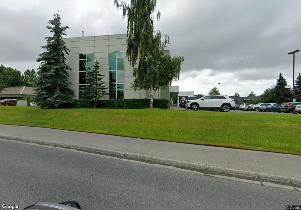
2000 Abbott Rd Unit A2 Anchorage, AK 99507
Abbott Loop NeighborhoodEstimated Value: $1,914,717
Studio
--
Bath
3,840
Sq Ft
$499/Sq Ft
Est. Value
About This Home
This home is located at 2000 Abbott Rd Unit A2, Anchorage, AK 99507 and is currently estimated at $1,914,717, approximately $498 per square foot. 2000 Abbott Rd Unit A2 is a home located in Anchorage Municipality with nearby schools including Trailside Elementary, Hanshew Middle School, and Service High School.
Ownership History
Date
Name
Owned For
Owner Type
Purchase Details
Closed on
Dec 8, 2023
Sold by
Imaging Associates Llc
Bought by
Abbott Holdings Llc
Current Estimated Value
Home Financials for this Owner
Home Financials are based on the most recent Mortgage that was taken out on this home.
Original Mortgage
$1,440,000
Outstanding Balance
$1,412,731
Interest Rate
7.79%
Mortgage Type
Construction
Estimated Equity
$501,986
Purchase Details
Closed on
Dec 17, 2008
Sold by
Providence Health & Services Washington
Bought by
Legacy Llc
Create a Home Valuation Report for This Property
The Home Valuation Report is an in-depth analysis detailing your home's value as well as a comparison with similar homes in the area
Home Values in the Area
Average Home Value in this Area
Purchase History
| Date | Buyer | Sale Price | Title Company |
|---|---|---|---|
| Abbott Holdings Llc | -- | None Listed On Document | |
| Legacy Llc | -- | None Available |
Source: Public Records
Mortgage History
| Date | Status | Borrower | Loan Amount |
|---|---|---|---|
| Open | Abbott Holdings Llc | $1,440,000 |
Source: Public Records
Tax History
| Year | Tax Paid | Tax Assessment Tax Assessment Total Assessment is a certain percentage of the fair market value that is determined by local assessors to be the total taxable value of land and additions on the property. | Land | Improvement |
|---|---|---|---|---|
| 2025 | $18,985 | $1,175,900 | -- | $1,175,900 |
| 2024 | $18,985 | $1,175,900 | $0 | $1,175,900 |
| 2023 | $20,026 | $1,175,900 | $0 | $1,175,900 |
| 2022 | $19,607 | $1,164,300 | $0 | $1,164,300 |
| 2021 | $20,981 | $1,164,300 | $0 | $1,164,300 |
| 2020 | $20,004 | $1,176,700 | $0 | $1,176,700 |
| 2019 | $18,595 | $1,136,600 | $0 | $1,136,600 |
| 2018 | $18,685 | $1,139,300 | $0 | $1,139,300 |
| 2017 | $17,841 | $1,139,300 | $0 | $1,139,300 |
| 2016 | $13,758 | $1,069,500 | $0 | $1,069,500 |
| 2015 | $13,758 | $1,000,900 | $0 | $1,000,900 |
| 2014 | $13,758 | $895,400 | $0 | $895,400 |
Source: Public Records
Map
Nearby Homes
- 2011 Courage Cir
- 2060 Courage Cir
- 9130 Golovin St
- 2340 Sentry Dr Unit H804
- 9710 Vanguard Dr Unit 88
- 9499 Brayton Dr Unit 39
- 9499 Brayton Dr Unit 21
- 9499 Brayton Dr Unit 152
- 9499 Brayton Dr Unit 245
- 9700 Reliance Dr
- 9612 Reliance Dr
- 1928 Colony Place Unit 44
- 1913 Sturbridge Ct Unit 57
- 9599 Brayton Dr Unit 422
- 8406 Lake Otis Pkwy Unit A04
- 1741 Cedrus Cir
- 10248 Jamestown Dr Unit H
- 10250 Jamestown Dr Unit B20
- 2361 Yorktown Cir
- 8521 Atkins Place
- 2000 Abbott Rd
- 2000 Abbott Rd
- 2000 Abbott Rd
- 2000 Abbott Rd
- 2000 Abbott Rd Unit B2
- 2000 Abbott Rd Unit A3
- 1951 Courage Dr
- 1961 Courage Dr
- 1941 Courage Dr
- 1971 Courage Dr
- 1931 Courage Dr
- 1981 Courage Dr
- 1921 Courage Dr
- L11B19 Courage Dr
- L7 B19 Courage Dr
- 2001 Courage Dr
- 2011 Abbott Rd Unit C
- 2011 Abbott Rd Unit 200
- 9201 Flintlock St
- 1911 Courage Dr
Your Personal Tour Guide
Ask me questions while you tour the home.