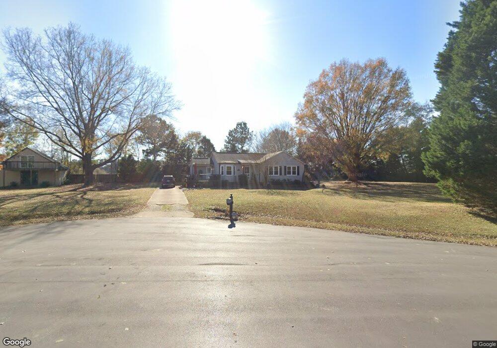
2000 Vine Hill Ct Clayton, NC 27520
Estimated Value: $290,000 - $309,000
3
Beds
2
Baths
1,245
Sq Ft
$242/Sq Ft
Est. Value
About This Home
This home is located at 2000 Vine Hill Ct, Clayton, NC 27520 and is currently estimated at $301,655, approximately $242 per square foot. 2000 Vine Hill Ct is a home located in Johnston County with nearby schools including West Clayton Elementary School, Clayton Middle School, and Clayton High.
Ownership History
Date
Name
Owned For
Owner Type
Purchase Details
Closed on
Oct 1, 2019
Sold by
Cline Jeffrey D and Cline Amy Marie
Bought by
Cline Amy Marie
Current Estimated Value
Purchase Details
Closed on
Sep 12, 2005
Sold by
Ruggles Amy Marie and Cline Amy Marie
Bought by
Cline Jerrrey D and Cline Amy Marie
Purchase Details
Closed on
Aug 7, 2002
Sold by
Ruggles Amy Marie
Bought by
Ruggles Bruce William
Purchase Details
Closed on
Sep 10, 2001
Sold by
Ruggles Bruce William
Bought by
Ruggles Bruce W
Create a Home Valuation Report for This Property
The Home Valuation Report is an in-depth analysis detailing your home's value as well as a comparison with similar homes in the area
Home Values in the Area
Average Home Value in this Area
Purchase History
| Date | Buyer | Sale Price | Title Company |
|---|---|---|---|
| Cline Amy Marie | -- | None Available | |
| Cline Jerrrey D | -- | None Available | |
| Ruggles Bruce William | $500 | -- | |
| Ruggles Bruce W | -- | -- |
Source: Public Records
Tax History
| Year | Tax Paid | Tax Assessment Tax Assessment Total Assessment is a certain percentage of the fair market value that is determined by local assessors to be the total taxable value of land and additions on the property. | Land | Improvement |
|---|---|---|---|---|
| 2025 | $1,824 | $287,300 | $80,000 | $207,300 |
| 2024 | $1,314 | $162,220 | $60,000 | $102,220 |
| 2023 | $1,363 | $162,220 | $60,000 | $102,220 |
| 2022 | $1,375 | $162,220 | $60,000 | $102,220 |
| 2021 | $1,375 | $162,220 | $60,000 | $102,220 |
| 2020 | $1,506 | $171,590 | $60,000 | $111,590 |
| 2019 | $1,506 | $171,590 | $60,000 | $111,590 |
| 2018 | $1,118 | $124,540 | $30,980 | $93,560 |
| 2017 | $1,118 | $124,540 | $30,980 | $93,560 |
| 2016 | $1,093 | $124,540 | $30,980 | $93,560 |
| 2015 | $1,093 | $124,540 | $30,980 | $93,560 |
| 2014 | $1,093 | $124,540 | $30,980 | $93,560 |
Source: Public Records
Map
Nearby Homes
- 83 Larson Ct
- 122 Enterprise Dr
- 1900 Cedar Ct
- 1912 Red Oak Ln
- 2200 Guy Rd
- 67 E Trafalgar Ct
- 1015 Mulberry Rd
- 103 Liam St
- 23 Tiger Eye Dr
- 29 Tiger Eye Dr
- 39 Tiger Eye Dr
- 8 Tiger Eye Dr
- 45 Tiger Eye Dr
- 20 Tiger Eye Dr
- 44 Tiger Eye Dr
- 62 Tiger Eye Dr
- 78 Tiger Eye Dr
- 37 Pink Iris Ct
- 24 Pink Iris Ct
- 49 W Fire Opal Ct
- 2008 Vine Hill Ct
- 2000 Englewood Dr
- 2009 Vine Hill Ct
- 2005 Vine Hill Ct
- 2007 Englewood Dr
- 2001 Englewood Dr
- 1748 Guy Rd
- 2101 Englewood Dr
- 121 Avery Farm Ln
- 2200 Huntsbridge Dr
- 2304 Huntsbridge Dr
- 1665 Guy Rd
- 2105 Englewood Dr
- 2104 Huntsbridge Dr
- 2108 Englewood Dr
- 2300 Huntsbridge Dr
- 2100 Huntsbridge Dr
- 2204 Huntsbridge Dr
- 2004 Huntsbridge Dr
- na Guy Rd
Your Personal Tour Guide
Ask me questions while you tour the home.