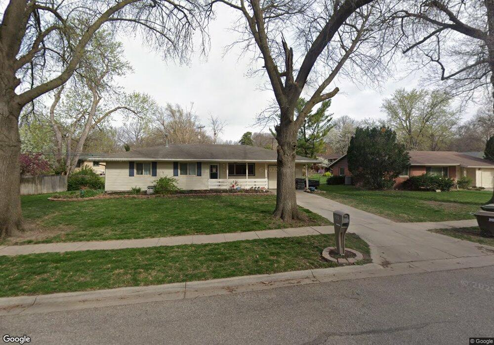
2001 Broadmoore Dr Lincoln, NE 68506
Central Lincoln NeighborhoodEstimated Value: $269,000 - $279,000
3
Beds
2
Baths
1,625
Sq Ft
$169/Sq Ft
Est. Value
About This Home
This home is located at 2001 Broadmoore Dr, Lincoln, NE 68506 and is currently estimated at $274,081, approximately $168 per square foot. 2001 Broadmoore Dr is a home located in Lancaster County with nearby schools including Morley Elementary School, Lux Middle School, and Lincoln East High School.
Ownership History
Date
Name
Owned For
Owner Type
Purchase Details
Closed on
Jun 13, 2006
Sold by
Wehrmeister Edward C and Wehrmeister Sue A
Bought by
Masek Dale J and Masek Denise R
Current Estimated Value
Home Financials for this Owner
Home Financials are based on the most recent Mortgage that was taken out on this home.
Original Mortgage
$126,700
Outstanding Balance
$74,132
Interest Rate
6.58%
Mortgage Type
Unknown
Estimated Equity
$199,949
Create a Home Valuation Report for This Property
The Home Valuation Report is an in-depth analysis detailing your home's value as well as a comparison with similar homes in the area
Home Values in the Area
Average Home Value in this Area
Purchase History
| Date | Buyer | Sale Price | Title Company |
|---|---|---|---|
| Masek Dale J | $127,000 | Ct |
Source: Public Records
Mortgage History
| Date | Status | Borrower | Loan Amount |
|---|---|---|---|
| Open | Masek Dale J | $126,700 |
Source: Public Records
Tax History
| Year | Tax Paid | Tax Assessment Tax Assessment Total Assessment is a certain percentage of the fair market value that is determined by local assessors to be the total taxable value of land and additions on the property. | Land | Improvement |
|---|---|---|---|---|
| 2025 | $3,366 | $263,300 | $60,000 | $203,300 |
| 2024 | $3,366 | $240,700 | $50,000 | $190,700 |
| 2023 | $3,784 | $225,800 | $50,000 | $175,800 |
| 2022 | $3,398 | $170,500 | $40,000 | $130,500 |
| 2021 | $3,215 | $170,500 | $40,000 | $130,500 |
| 2020 | $2,916 | $152,600 | $40,000 | $112,600 |
| 2019 | $2,916 | $152,600 | $40,000 | $112,600 |
| 2018 | $2,760 | $143,800 | $40,000 | $103,800 |
| 2017 | $2,786 | $143,800 | $40,000 | $103,800 |
| 2016 | $2,576 | $132,300 | $35,000 | $97,300 |
| 2015 | $2,558 | $132,300 | $35,000 | $97,300 |
| 2014 | $2,396 | $123,200 | $35,000 | $88,200 |
| 2013 | -- | $123,200 | $35,000 | $88,200 |
Source: Public Records
Map
Nearby Homes
- 6700 S Bermuda Dr
- 6501 Franklin St
- 1932 Monterey Dr
- 6707 Flint Ridge Rd
- 1955 S Knights Place
- 7101 South St Unit 1
- 2505 S 70th St
- 7010 Shamrock Rd
- 5625 South St
- 2801 Park Place Dr
- 1401 S 58th St
- 1205 Evergreen Dr
- 5601 Glade St
- 5501 Oldham St
- 5510 Sumner St
- 1116 Silver Ridge #17 Rd
- 5345 Franklin St
- 5434 Normal Blvd
- 1918 Yorkshire Ct
- 930 Evergreen Dr
- 1921 Broadmoore Dr
- 1934 Twin Ridge Rd
- 2000 Twin Ridge Rd
- 1924 Twin Ridge Rd
- 1911 Broadmoore Dr
- 2011 Broadmoore Dr
- 6631 S Bermuda Dr
- 1912 Twin Ridge Rd
- 2010 Broadmoore Dr
- 2020 Broadmoore Dr
- 6611 Franklin St
- 6621 Franklin St
- 6601 Franklin St
- 6640 S Bermuda Dr
- 6631 Franklin St
- 6610 South St
- 6641 S Bermuda Dr
- 1933 Twin Ridge Rd
- 2030 Broadmoore Dr
- 2001 Twin Ridge Rd
Your Personal Tour Guide
Ask me questions while you tour the home.