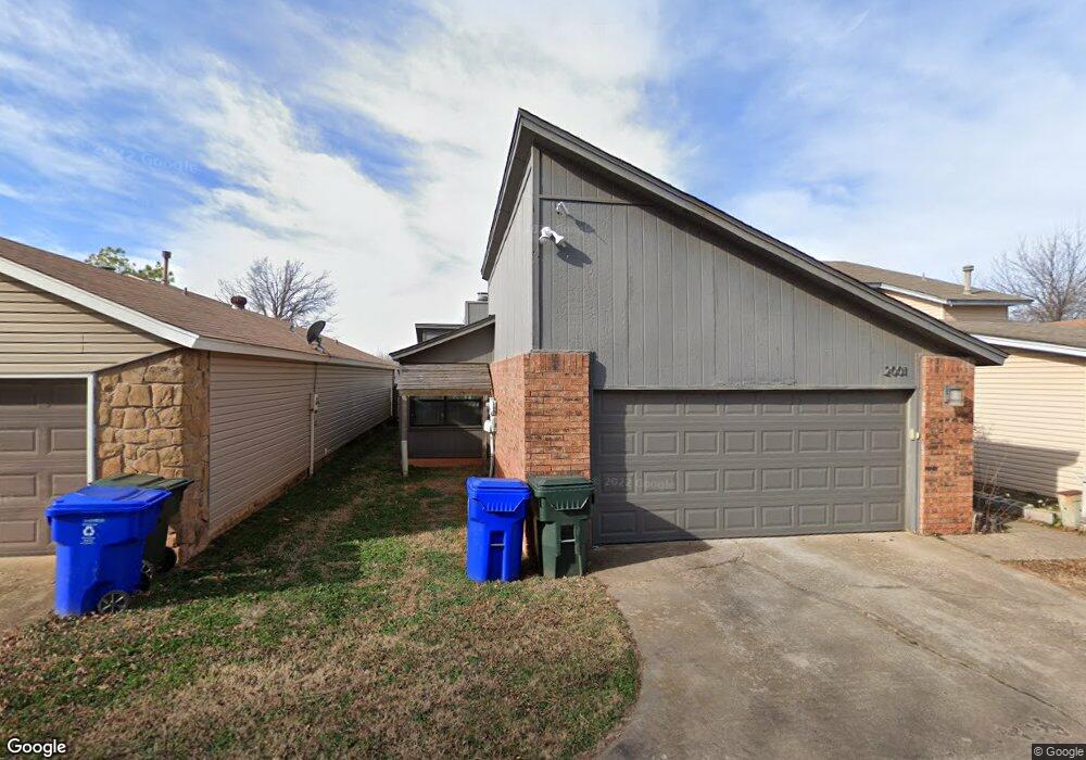
2001 Oakhurst Ave Norman, OK 73071
Southeast Norman NeighborhoodEstimated Value: $142,000 - $168,694
About This Home
This home is located at 2001 Oakhurst Ave, Norman, OK 73071 and is currently estimated at $159,174, approximately $142 per square foot. 2001 Oakhurst Ave is a home located in Cleveland County with nearby schools including Ronald Reagan Elementary School, Irving Middle School, and Norman High School.
Ownership History
We collect this data history from publicly available records. To have your information removed, we recommend requesting removal directly through your county’s website.
Purchase Details
Home Financials for this Owner
Home Financials are based on the most recent Mortgage that was taken out on this home.Purchase Details
Home Financials for this Owner
Home Financials are based on the most recent Mortgage that was taken out on this home.Purchase Details
Home Values in the Area
Average Home Value in this Area
Purchase History
We collect this data history from publicly available records. To have your information removed, we recommend requesting removal directly through your county’s website.
| Date | Buyer | Sale Price | Title Company |
|---|---|---|---|
| $120,000 | First American Title | ||
| $120,000 | First American Title | ||
| $96,000 | None Available | ||
| -- | None Available |
Mortgage History
We collect this data history from publicly available records. To have your information removed, we recommend requesting removal directly through your county’s website.
| Date | Status | Borrower | Loan Amount |
|---|---|---|---|
| Open | $114,000 | ||
| Closed | $114,000 | ||
| Previous Owner | $96,000 |
Tax History
We collect this data history from publicly available records. To have your information removed, we recommend requesting removal directly through your county’s website.
| Year | Tax Paid | Tax Assessment Tax Assessment Total Assessment is a certain percentage of the fair market value that is determined by local assessors to be the total taxable value of land and additions on the property. | Land | Improvement |
|---|---|---|---|---|
| 2025 | $1,451 | $12,088 | $2,691 | $9,397 |
| 2024 | $1,380 | $11,513 | $2,576 | $8,937 |
| 2023 | $1,316 | $10,964 | $2,553 | $8,411 |
| 2022 | $1,202 | $10,442 | $1,800 | $8,642 |
| 2021 | $1,268 | $10,442 | $1,800 | $8,642 |
| 2020 | $1,240 | $10,442 | $1,800 | $8,642 |
| 2019 | $1,262 | $10,442 | $1,800 | $8,642 |
| 2018 | $1,224 | $10,443 | $1,800 | $8,643 |
| 2017 | $1,237 | $10,443 | $0 | $0 |
| 2016 | $1,257 | $10,443 | $1,800 | $8,643 |
| 2015 | $1,103 | $10,443 | $1,800 | $8,643 |
| 2014 | $1,127 | $10,558 | $986 | $9,572 |
Map
- 2009 Oakcreek Dr
- 1012 Mount Irving Way
- 1901 Twin Tree Dr
- 1708 Parkridge Dr
- 2035 Delphine Dr
- 1933 Delphine Dr
- 2043 Delphine Dr
- 1921 Delphine Dr
- 2038 Delphine Dr
- 2004 Delphine Dr
- 2000 Delphine Dr
- 2034 Delphine Dr
- 2042 Delphine Dr
- 1515 Oakhurst Ave
- 1633 Creekside Ln
- 1816 Creekside Dr
- 3900 Black Mesa Rd
- 906 Mount Irving Way
- 1600 E Imhoff Rd
- 2701 Wheatland Dr
- 2006 Oakhurst Ave
- 2008 Oakhurst Ave
- 2002 Oakhurst Ave
- 2012 Oakhurst Ave
- 2000 Oakhurst Ave
- 2007 Twisted Oak Cir
- 2009 Twisted Oak Cir
- 2021 Twisted Oak Dr
- 2003 Twisted Oak Cir
- 2011 Twisted Oak Cir
- 2013 Twisted Oak Cir
- 2001 Twisted Oak Cir
- 1917 Oakhurst Ave
- 2005 Oakhurst Ave
- 1919 Oakhurst Ave
- 2003 Oakhurst Ave
- 1915 Oakhurst Ave
- 2009 Oakhurst Ave
- 1913 Oakhurst Ave
- 1911 Oakhurst Ave
Ask me questions while you tour the home.