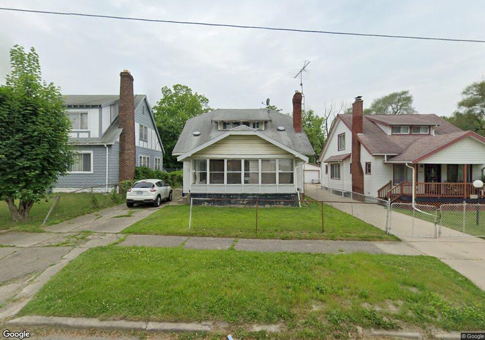
2001 Root St Flint, MI 48505
King Avenue Plus NeighborhoodEstimated Value: $32,000 - $74,000
4
Beds
1
Bath
1,537
Sq Ft
$34/Sq Ft
Est. Value
About This Home
This home is located at 2001 Root St, Flint, MI 48505 and is currently estimated at $52,825, approximately $34 per square foot. 2001 Root St is a home located in Genesee County with nearby schools including Brownell STEM Academy, Flint Cultural Center Academy, and WAY Academy of Flint.
Ownership History
Date
Name
Owned For
Owner Type
Purchase Details
Closed on
Sep 24, 2024
Sold by
Cherry Deborah L
Bought by
Epps Noelle Renee
Current Estimated Value
Purchase Details
Closed on
May 5, 2023
Sold by
Williams Ronnie L
Bought by
Tyler Melvin
Purchase Details
Closed on
Sep 19, 2022
Sold by
Crystal Bingham
Bought by
Williams Ronnie L
Purchase Details
Closed on
May 13, 2010
Sold by
Turnbow Charlotte
Bought by
Bingham Crystal
Purchase Details
Closed on
Jan 4, 2000
Sold by
Creel K M
Bought by
Turnbow Charlotte
Create a Home Valuation Report for This Property
The Home Valuation Report is an in-depth analysis detailing your home's value as well as a comparison with similar homes in the area
Home Values in the Area
Average Home Value in this Area
Purchase History
| Date | Buyer | Sale Price | Title Company |
|---|---|---|---|
| Epps Noelle Renee | $8,600 | None Listed On Document | |
| Epps Noelle Renee | $8,600 | None Listed On Document | |
| Tyler Melvin | -- | None Listed On Document | |
| Williams Ronnie L | -- | -- | |
| Bingham Crystal | -- | Cislo Title Company | |
| Turnbow Charlotte | -- | Cislo Title Company |
Source: Public Records
Tax History
| Year | Tax Paid | Tax Assessment Tax Assessment Total Assessment is a certain percentage of the fair market value that is determined by local assessors to be the total taxable value of land and additions on the property. | Land | Improvement |
|---|---|---|---|---|
| 2025 | $994 | $10,400 | $0 | $0 |
| 2024 | $924 | $10,200 | $0 | $0 |
| 2023 | $775 | $7,700 | $0 | $0 |
| 2022 | $0 | $5,700 | $0 | $0 |
| 2021 | $638 | $6,500 | $0 | $0 |
| 2020 | $598 | $6,400 | $0 | $0 |
| 2019 | $592 | $6,500 | $0 | $0 |
| 2018 | $558 | $5,800 | $0 | $0 |
| 2017 | $547 | $0 | $0 | $0 |
| 2016 | $544 | $0 | $0 | $0 |
| 2015 | -- | $0 | $0 | $0 |
| 2014 | -- | $0 | $0 | $0 |
| 2012 | -- | $6,300 | $0 | $0 |
Source: Public Records
Map
Nearby Homes
- 2217 Francis Ave
- 1710 Wilberforce Cir
- 1706 Wilberforce Cir
- 800 Martin Luther King Ave
- 1303 Root St
- 1606 Garland St
- 122 Welch Blvd
- 1214 Root St
- 630 E Dartmouth St
- 218 E Jackson Ave
- 1620 Mason St
- 2309 Mason St
- 310 White St
- 501 W Witherbee St
- 115 E Genesee St
- 1645 Seminole St
- 200 W Mcclellan St
- 1273 Broadway Blvd
- 132 W Jamieson St
- 432 W Dartmouth St
- 1917 Root St
- 2005 Root St
- 1913 Root St
- 2008 Avenue A
- 518 E Witherbee St
- 2008 Root St
- 514 E Witherbee St
- 1920 Root St
- 522 E Witherbee St
- 521 E Paterson St
- 510 E Witherbee St
- 1926 Root St
- 2002 Root St
- 506 E Witherbee St
- 1914 Root St
- 550 E Witherbee St
- 551 E Paterson St
- 2018 Avenue A
- 558 Delia St
- 554 E Witherbee St
Your Personal Tour Guide
Ask me questions while you tour the home.