2002 Rock Fish Rd Moncks Corner, SC 29461
Estimated Value: $444,000 - $669,000
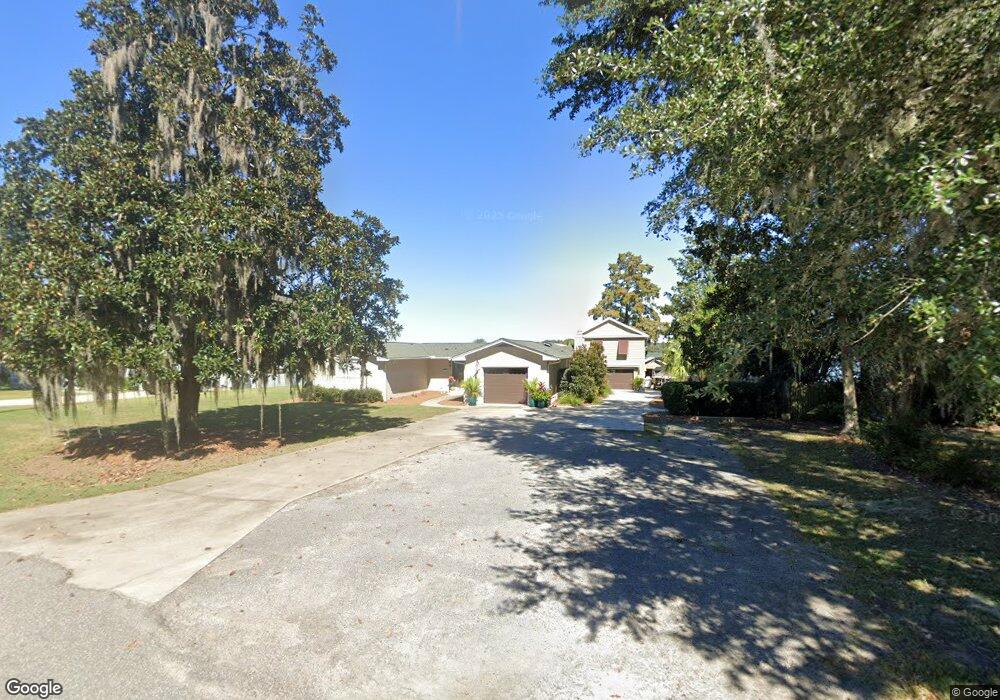
About This Home
This home is located at 2002 Rock Fish Rd, Moncks Corner, SC 29461 and is currently estimated at $582,007, approximately $341 per square foot. 2002 Rock Fish Rd is a home located in Berkeley County with nearby schools including Foxbank Elementary School, Berkeley Middle School, and Berkeley High School.
Ownership History
We collect this data history from publicly available records. To have your information removed, we recommend requesting removal directly through your county’s website.
Purchase Details
Purchase Details
Home Financials for this Owner
Home Financials are based on the most recent Mortgage that was taken out on this home.Purchase History
We collect this data history from publicly available records. To have your information removed, we recommend requesting removal directly through your county’s website.
| Date | Buyer | Sale Price | Title Company |
|---|---|---|---|
| -- | None Listed On Document | ||
| $400,000 | None Available |
Mortgage History
We collect this data history from publicly available records. To have your information removed, we recommend requesting removal directly through your county’s website.
| Date | Status | Borrower | Loan Amount |
|---|---|---|---|
| Previous Owner | $240,000 |
Tax History
We collect this data history from publicly available records. To have your information removed, we recommend requesting removal directly through your county’s website.
| Year | Tax Paid | Tax Assessment Tax Assessment Total Assessment is a certain percentage of the fair market value that is determined by local assessors to be the total taxable value of land and additions on the property. | Land | Improvement |
|---|---|---|---|---|
| 2025 | $2,091 | $20,185 | $8,325 | $11,860 |
| 2024 | $2,091 | $20,185 | $8,325 | $11,860 |
| 2023 | $1,992 | $20,185 | $8,325 | $11,860 |
| 2022 | $2,006 | $17,552 | $8,388 | $9,164 |
| 2021 | $2,062 | $15,350 | $8,388 | $6,964 |
| 2020 | $1,865 | $15,352 | $8,388 | $6,964 |
| 2019 | $1,851 | $15,352 | $8,388 | $6,964 |
| 2018 | $1,256 | $11,153 | $6,126 | $5,027 |
| 2017 | $1,196 | $11,153 | $6,126 | $5,027 |
| 2016 | $1,224 | $11,160 | $6,130 | $5,030 |
| 2015 | $1,131 | $11,160 | $6,130 | $5,030 |
| 2014 | $1,115 | $11,160 | $6,130 | $5,030 |
| 2013 | -- | $11,160 | $6,130 | $5,030 |
Map
- 2015 Albert Storm Ave
- 1807 Perch Rd
- 554 Point Comfort Rd
- 0 Point Comfort Rd Unit 24030382
- 0 Point Comfort Rd Unit 24030383
- 0 Point Comfort Rd Unit 24028043
- 1813 Fishing Island Rd
- 1719 Waterside Blvd
- 1805 Ringneck Rd
- 1701 Waterside Blvd
- 1705 Redwood Dr
- 1305 Old Rice Mill Rd
- 1703 Redwood Dr
- 1822 Mallard Cir
- 1613 Westminister Way
- 1645 Pimlico Blvd
- Lot 19 Magnolia Ln
- 1004 Magnolia Ln
- 1003 British Dr
- 214 Osprey Dr
- 2000 Rock Fish Rd
- 2004 Rock Fish Rd
- 2003 Rock Fish Rd
- 2001 Rock Fish Rd
- 2008 Rock Fish Rd
- 2005 Rock Fish Rd
- 1918 Rock Fish Rd
- 2009 Rock Fish Rd
- 1916 Rock Fish Rd
- 1803 Bass Rd
- 1917 Rock Fish Rd
- 2010 Rock Fish Rd
- 2011 Rock Fish Rd
- 1914 Rock Fish Rd
- 1801 Bass Rd
- 2013 Rock Fish Rd
- 2008 Albert Storm Ave
- 2012 Rock Fish Rd
- 1915 Rock Fish Rd
- 2010 Albert Storm Ave
Ask me questions while you tour the home.