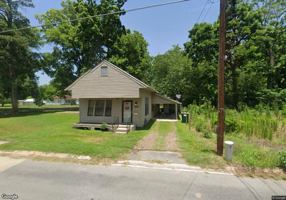
2003 Port Rd Pine Bluff, AR 71601
Estimated Value: $40,012 - $70,000
Studio
1
Bath
1,260
Sq Ft
$46/Sq Ft
Est. Value
About This Home
This home is located at 2003 Port Rd, Pine Bluff, AR 71601 and is currently estimated at $58,503, approximately $46 per square foot. 2003 Port Rd is a home located in Jefferson County with nearby schools including Matthews Elementary School, Dollarway High School, and Hope Academy.
Ownership History
Date
Name
Owned For
Owner Type
Purchase Details
Closed on
Dec 29, 1999
Bought by
Womack Darrell
Current Estimated Value
Purchase Details
Closed on
Dec 7, 1998
Bought by
Walker Thelma R and 2003 Port Rd
Purchase Details
Closed on
Apr 7, 1998
Bought by
Secretary Of Hud
Purchase Details
Closed on
Sep 2, 1997
Bought by
Chase Mortgage Services Inc
Purchase Details
Closed on
Aug 27, 1986
Bought by
Steward Gentle
Purchase Details
Closed on
Jan 1, 1910
Bought by
Dooms Frank
Create a Home Valuation Report for This Property
The Home Valuation Report is an in-depth analysis detailing your home's value as well as a comparison with similar homes in the area
Purchase History
| Date | Buyer | Sale Price | Title Company |
|---|---|---|---|
| Womack Darrell | $4,000 | -- | |
| Walker Thelma R | -- | -- | |
| Secretary Of Hud | -- | -- | |
| Chase Mortgage Services Inc | -- | -- | |
| Steward Gentle | $21,000 | -- | |
| Dooms Frank | -- | -- |
Source: Public Records
Tax History
| Year | Tax Paid | Tax Assessment Tax Assessment Total Assessment is a certain percentage of the fair market value that is determined by local assessors to be the total taxable value of land and additions on the property. | Land | Improvement |
|---|---|---|---|---|
| 2025 | $250 | $3,990 | $600 | $3,390 |
| 2024 | $183 | $3,140 | $600 | $2,540 |
| 2023 | $168 | $3,140 | $600 | $2,540 |
| 2022 | $140 | $2,200 | $340 | $1,860 |
| 2021 | $140 | $2,200 | $340 | $1,860 |
| 2020 | $140 | $2,200 | $340 | $1,860 |
| 2019 | $140 | $2,200 | $340 | $1,860 |
| 2018 | $135 | $2,200 | $340 | $1,860 |
| 2017 | $159 | $2,510 | $340 | $2,170 |
| 2016 | $159 | $2,510 | $340 | $2,170 |
| 2015 | $152 | $2,510 | $340 | $2,170 |
| 2014 | -- | $2,510 | $340 | $2,170 |
Source: Public Records
Map
Nearby Homes
- 3217 E 4th Ave
- 2221 E 6th Ave
- .18 Acre E 6th Ave
- 1909 Lucia Ln
- 812 S Nebraska St
- 919 S Nebraska St
- 1120 E 8th Ave
- 1401 Ashley Dr
- 1307 S Dakota St
- 1309 Bailey Dr
- 1302 Boston Dr
- 2707 Colonial Ave
- 1503 Collins Dr
- 1603 Belmoor Dr
- 2713 Claremont Ave
- 2810 Claremont Ave
- 000 S 65 Hwy
- 00
- 0 NE Corner Hwy 65 425-81
- 2710 S Belair Dr
Your Personal Tour Guide
Ask me questions while you tour the home.