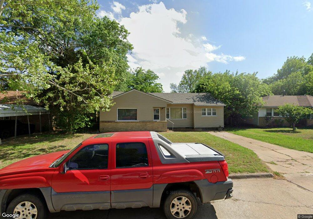
2004 W Oak Ave Duncan, OK 73533
Estimated Value: $86,845 - $114,000
3
Beds
1
Bath
1,324
Sq Ft
$75/Sq Ft
Est. Value
About This Home
This home is located at 2004 W Oak Ave, Duncan, OK 73533 and is currently estimated at $98,961, approximately $74 per square foot. 2004 W Oak Ave is a home located in Stephens County with nearby schools including Mark Twain Elementary School, Duncan Middle School, and Duncan High School.
Ownership History
Date
Name
Owned For
Owner Type
Purchase Details
Closed on
Mar 18, 2021
Sold by
North Place Properties Llc
Bought by
Prestige Property Group Llc
Current Estimated Value
Home Financials for this Owner
Home Financials are based on the most recent Mortgage that was taken out on this home.
Original Mortgage
$39,264
Outstanding Balance
$28,300
Interest Rate
2.7%
Mortgage Type
Stand Alone Second
Estimated Equity
$70,661
Purchase Details
Closed on
Mar 6, 2000
Sold by
Burke Paul C and Burke Angela F
Purchase Details
Closed on
Feb 16, 2000
Sold by
Burke Paul C and Burke Angela F
Create a Home Valuation Report for This Property
The Home Valuation Report is an in-depth analysis detailing your home's value as well as a comparison with similar homes in the area
Purchase History
We collect this data history from publicly available records. To have your information removed, we recommend requesting removal directly through your county’s website.
| Date | Buyer | Sale Price | Title Company |
|---|---|---|---|
| Prestige Property Group Llc | $71,000 | Stephens County Abstract Co | |
| -- | $15,600 | -- | |
| -- | $16,000 | -- |
Source: Public Records
Mortgage History
We collect this data history from publicly available records. To have your information removed, we recommend requesting removal directly through your county’s website.
| Date | Status | Borrower | Loan Amount |
|---|---|---|---|
| Open | Prestige Property Group Llc | $39,264 |
Source: Public Records
Tax History
| Year | Tax Paid | Tax Assessment Tax Assessment Total Assessment is a certain percentage of the fair market value that is determined by local assessors to be the total taxable value of land and additions on the property. | Land | Improvement |
|---|---|---|---|---|
| 2025 | $584 | $6,925 | $568 | $6,357 |
| 2024 | $535 | $6,281 | $568 | $5,713 |
| 2023 | $535 | $5,982 | $568 | $5,414 |
| 2022 | $526 | $6,184 | $568 | $5,616 |
| 2021 | $418 | $4,908 | $568 | $4,340 |
| 2020 | $384 | $4,452 | $568 | $3,884 |
| 2019 | $367 | $4,240 | $568 | $3,672 |
| 2018 | $360 | $4,240 | $568 | $3,672 |
| 2017 | $331 | $3,846 | $568 | $3,278 |
| 2016 | $440 | $5,173 | $568 | $4,605 |
| 2015 | $470 | $5,173 | $568 | $4,605 |
| 2014 | $470 | $5,214 | $550 | $4,664 |
Source: Public Records
Map
Nearby Homes
- 1902 W Ash Ave
- 1905 W Ash Ave
- 2116 W Walnut Ave
- 209 N 22nd St
- 1803 W Birch Ave
- 2110 W Main St
- 408 N 20th St
- 1803 W Main St
- 1801 W Main St
- 2305 W Main St
- 1809 W Willow Ave
- 1705 W Ash Ave
- 1802 W Willow Ave
- 123 N Highway 81
- 433 N 20th St
- 502 N Alice Dr
- 2018 W Cedar Ave
- 220 N 30th St
- 705 N Alice Dr
- 0 W Beech Ave
- 2006 2006 W Oak Ave
- 2008 W Oak Ave
- 2005 W Birch Ave
- 2003 W Birch Ave
- 2002 W Oak Ave
- 2007 W Birch Ave
- 2010 W Oak Ave
- 2009 W Birch Ave
- 2001 W Birch Ave
- 2009 W Birch Ave
- 2005 W Oak Ave
- 2007 W Oak Ave
- 2003 W Oak Ave
- 2012 W Oak Ave
- 2009 W Oak Ave
- 2011 W Birch Ave
- 1912 W Oak Ave
- 2011 2011 W Oak Ave
- 1911 W Birch Ave
- 2006 W Birch Ave
Your Personal Tour Guide
Ask me questions while you tour the home.