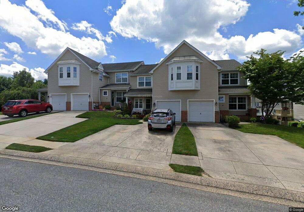
2005 Brandy Dr Forest Hill, MD 21050
Estimated Value: $355,000 - $423,000
Studio
4
Baths
1,792
Sq Ft
$218/Sq Ft
Est. Value
About This Home
This home is located at 2005 Brandy Dr, Forest Hill, MD 21050 and is currently estimated at $390,280, approximately $217 per square foot. 2005 Brandy Dr is a home located in Harford County with nearby schools including Forest Lakes Elementary School, Bel Air Middle School, and Bel Air High School.
Ownership History
Date
Name
Owned For
Owner Type
Purchase Details
Closed on
Oct 26, 2020
Sold by
Phillips Diana J
Bought by
Phillips Diana J and French Jason
Current Estimated Value
Home Financials for this Owner
Home Financials are based on the most recent Mortgage that was taken out on this home.
Original Mortgage
$189,500
Outstanding Balance
$153,215
Interest Rate
2.9%
Mortgage Type
New Conventional
Estimated Equity
$237,065
Purchase Details
Closed on
Nov 19, 2003
Sold by
Plieman Leo J
Bought by
Phillips Diana J
Purchase Details
Closed on
May 27, 1999
Sold by
Rosefields Inc
Bought by
Plieman Leo J and Taylor Linda S
Create a Home Valuation Report for This Property
The Home Valuation Report is an in-depth analysis detailing your home's value as well as a comparison with similar homes in the area
Home Values in the Area
Average Home Value in this Area
Purchase History
| Date | Buyer | Sale Price | Title Company |
|---|---|---|---|
| Phillips Diana J | -- | Swan Title Corp | |
| Phillips Diana J | $206,000 | -- | |
| Plieman Leo J | $156,735 | -- |
Source: Public Records
Mortgage History
| Date | Status | Borrower | Loan Amount |
|---|---|---|---|
| Open | Phillips Diana J | $189,500 | |
| Closed | Plieman Leo J | -- |
Source: Public Records
Tax History
| Year | Tax Paid | Tax Assessment Tax Assessment Total Assessment is a certain percentage of the fair market value that is determined by local assessors to be the total taxable value of land and additions on the property. | Land | Improvement |
|---|---|---|---|---|
| 2025 | $3,290 | $305,200 | $82,000 | $223,200 |
| 2024 | $3,290 | $301,867 | $0 | $0 |
| 2023 | $3,254 | $298,533 | $0 | $0 |
| 2022 | $3,217 | $295,200 | $82,000 | $213,200 |
| 2021 | $3,310 | $291,033 | $0 | $0 |
| 2020 | $3,310 | $286,867 | $0 | $0 |
| 2019 | $3,262 | $282,700 | $65,000 | $217,700 |
| 2018 | $3,124 | $273,200 | $0 | $0 |
| 2017 | $3,016 | $282,700 | $0 | $0 |
| 2016 | $140 | $254,200 | $0 | $0 |
| 2015 | $3,036 | $253,867 | $0 | $0 |
| 2014 | $3,036 | $253,533 | $0 | $0 |
Source: Public Records
Map
Nearby Homes
- 2027 Brandy Dr
- 217 Woodbine Ct
- 1923 Munsey Dr
- 933 Delray Dr
- 207 Cartland Way
- 142 Paden Ct
- 112 Gwen Dr Unit 1K
- 109 Sunshine Ct Unit A
- 105 Sunshine Ct Unit G
- 1809 Beth Bridge Cir
- 1707 Connor Place
- 16 Wagner Way
- 434 Dellcrest Dr
- 1717 Landmark Dr Unit 1J
- 1721 Chrisemmett Ct Unit 3A
- 1712 Landmark Dr Unit E
- 1710 Landmark Dr Unit 1L
- 1615 Samantha Dr
- 109 Spencer Cir
- 206 Kimary Ct Unit 2D
- 2003 Brandy Dr
- 2007 Brandy Dr
- 2001 Brandy Dr
- 2009 Brandy Dr
- 2011 Brandy Dr
- 2013 Brandy Dr
- 2004 Tiffany Terrace
- 2000 Tiffany Terrace
- 2006 Tiffany Terrace
- 2015 Brandy Dr
- 2008 Tiffany Terrace
- 2006 Brandy Dr
- 2004 Brandy Dr
- 2002 Brandy Dr
- 2010 Tiffany Terrace
- 2000 Brandy Dr
- 2017 Brandy Dr
- 2008 Brandy Dr
- 2012 Tiffany Terrace
- 2019 Brandy Dr
Your Personal Tour Guide
Ask me questions while you tour the home.