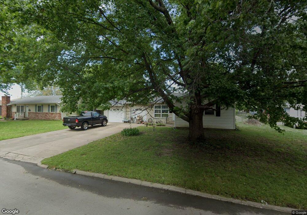
2005 Forest Dr Carthage, MO 64836
Estimated Value: $130,719 - $172,000
3
Beds
2
Baths
1,400
Sq Ft
$112/Sq Ft
Est. Value
About This Home
This home is located at 2005 Forest Dr, Carthage, MO 64836 and is currently estimated at $156,930, approximately $112 per square foot. 2005 Forest Dr is a home located in Jasper County with nearby schools including Carthage High School, St. Ann's Catholic School, and Victory Academy.
Ownership History
Date
Name
Owned For
Owner Type
Purchase Details
Closed on
Apr 12, 2011
Sold by
Thomas Investments Llc
Bought by
Renteria Kellie J
Current Estimated Value
Purchase Details
Closed on
Aug 19, 2010
Sold by
Graywolf Feathers and Graywolf Billy
Bought by
Homesales Inc and Homesales Inc Of Delaware
Purchase Details
Closed on
Jun 14, 2007
Sold by
Dickson Helen R
Bought by
Graywolf Feathers
Home Financials for this Owner
Home Financials are based on the most recent Mortgage that was taken out on this home.
Original Mortgage
$83,650
Interest Rate
6.19%
Mortgage Type
Purchase Money Mortgage
Create a Home Valuation Report for This Property
The Home Valuation Report is an in-depth analysis detailing your home's value as well as a comparison with similar homes in the area
Home Values in the Area
Average Home Value in this Area
Purchase History
We collect this data history from publicly available records. To have your information removed, we recommend requesting removal directly through your county’s website.
| Date | Buyer | Sale Price | Title Company |
|---|---|---|---|
| Renteria Kellie J | -- | Abbey | |
| Homesales Inc | $52,700 | None Available | |
| Graywolf Feathers | -- | Fatco |
Source: Public Records
Mortgage History
We collect this data history from publicly available records. To have your information removed, we recommend requesting removal directly through your county’s website.
| Date | Status | Borrower | Loan Amount |
|---|---|---|---|
| Previous Owner | Graywolf Feathers | $83,650 |
Source: Public Records
Tax History
| Year | Tax Paid | Tax Assessment Tax Assessment Total Assessment is a certain percentage of the fair market value that is determined by local assessors to be the total taxable value of land and additions on the property. | Land | Improvement |
|---|---|---|---|---|
| 2025 | $653 | $14,270 | $1,850 | $12,420 |
| 2024 | $653 | $12,690 | $1,850 | $10,840 |
| 2023 | $653 | $12,690 | $1,850 | $10,840 |
| 2022 | $638 | $12,430 | $1,850 | $10,580 |
| 2021 | $631 | $12,430 | $1,850 | $10,580 |
| 2020 | $608 | $11,490 | $1,850 | $9,640 |
| 2019 | $610 | $11,490 | $1,850 | $9,640 |
| 2018 | $572 | $10,810 | $0 | $0 |
| 2017 | $573 | $10,810 | $0 | $0 |
| 2016 | $572 | $10,810 | $0 | $0 |
| 2015 | $528 | $10,810 | $0 | $0 |
| 2014 | $528 | $10,810 | $0 | $0 |
Source: Public Records
Map
Nearby Homes
- TBD Hazel Ave
- 510 W Fairview Ave
- 1914 Hazel Ave
- 1902 Forest St
- 1800 Hazel Ave
- 1724 Hillcrest Dr
- 1830 S Maple St
- 2043 S Grand Ave
- 1615 Forest St
- 1719 Robertson Ave Unit 21
- 1614 S Maple St
- 1611 Cherry Blossom Ln
- 303 W Centennial Ave
- 1373 W Fairview Ave
- 629 Wood Ave
- 2206 Benjamin Dr
- Tbd W George E Phelps Blvd
- 000 Annie Baxter & George Phelps
- 912 Griswold Ave
- 517 Cooper St
- 2003 Forest Dr
- 2007 Forest Dr
- 2003 Forest Dr
- 614 W Fairview Ave
- 608 W Fairview Ave
- 2001 Forest Dr
- 2009 Forest Dr
- 2004 Forest Dr
- 2006 Forest Dr
- 628 W Fairview Ave
- 602 W Fairview Ave
- 2008 Forest Dr
- 2026 Hazel St
- Xxx Hazel Ave
- 2043 Forest Dr
- 2036 Forest Dr
- 2032 Hazel St
- 2011 Forest Dr
- 617 W Fairview Ave
- 2010 Forest Dr
Your Personal Tour Guide
Ask me questions while you tour the home.