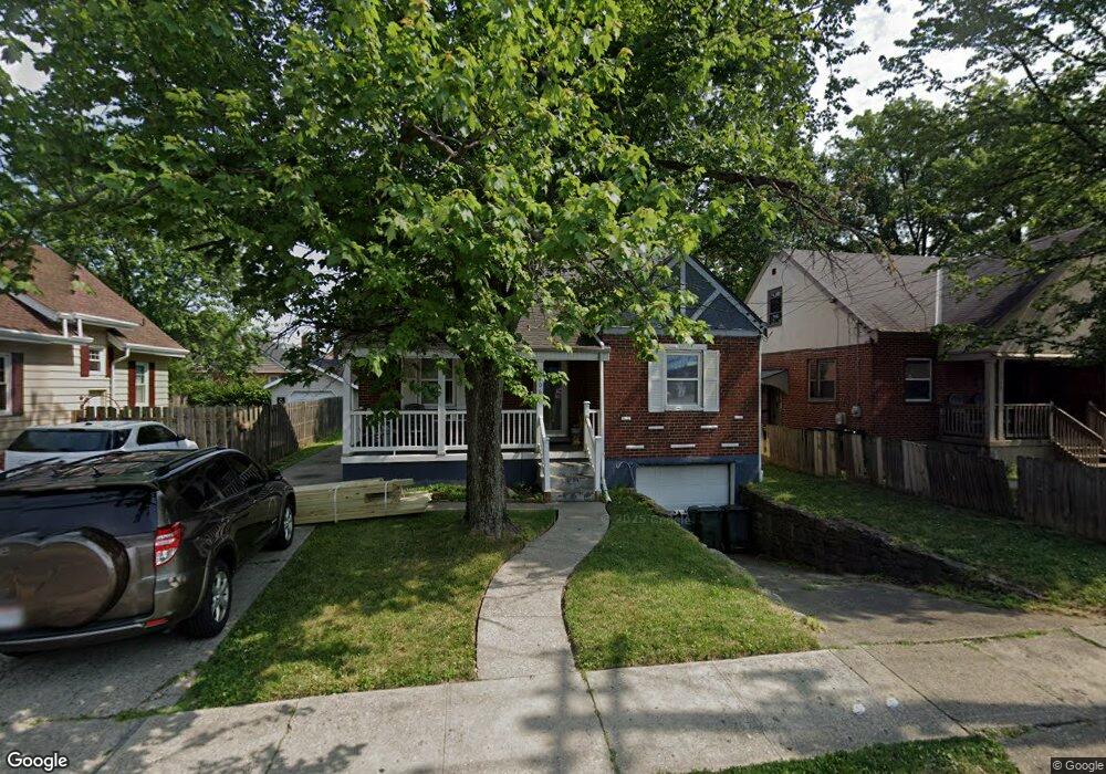
2006 W Galbraith Rd Cincinnati, OH 45239
North College Hill AreaEstimated Value: $177,000 - $196,655
About This Home
This home is located at 2006 W Galbraith Rd, Cincinnati, OH 45239 and is currently estimated at $188,914, approximately $138 per square foot. 2006 W Galbraith Rd is a home located in Hamilton County with nearby schools including North College Hill Elementary School, North College Hill Middle School, and North College Hill High School.
Ownership History
We collect this data history from publicly available records. To have your information removed, we recommend requesting removal directly through your county’s website.
Purchase Details
Home Values in the Area
Average Home Value in this Area
Purchase History
We collect this data history from publicly available records. To have your information removed, we recommend requesting removal directly through your county’s website.
| Date | Buyer | Sale Price | Title Company |
|---|---|---|---|
| -- | -- |
Tax History
We collect this data history from publicly available records. To have your information removed, we recommend requesting removal directly through your county’s website.
| Year | Tax Paid | Tax Assessment Tax Assessment Total Assessment is a certain percentage of the fair market value that is determined by local assessors to be the total taxable value of land and additions on the property. | Land | Improvement |
|---|---|---|---|---|
| 2025 | $2,417 | $46,600 | $5,835 | $40,765 |
| 2023 | $2,378 | $46,600 | $5,835 | $40,765 |
| 2022 | $1,887 | $26,387 | $4,778 | $21,609 |
| 2021 | $1,847 | $26,387 | $4,778 | $21,609 |
| 2020 | $1,620 | $26,387 | $4,778 | $21,609 |
| 2019 | $1,591 | $23,146 | $4,190 | $18,956 |
| 2018 | $1,592 | $23,146 | $4,190 | $18,956 |
| 2017 | $1,507 | $23,146 | $4,190 | $18,956 |
| 2016 | $1,618 | $26,464 | $6,048 | $20,416 |
| 2015 | $1,622 | $26,464 | $6,048 | $20,416 |
| 2014 | $1,620 | $26,464 | $6,048 | $20,416 |
| 2013 | $1,671 | $28,151 | $6,433 | $21,718 |
Map
- 6924 Gloria Dr
- 1933 Shollenberger Ave
- 6823 Betts Ave
- 7025 Mulberry St
- 6961 La Boiteaux Ave
- 6961 La Boiteaux Ave
- 6943 Rob Vern Dr
- 2026 Sundale Ave
- 1832 Dallas Ave
- 1814 Goodman Ave
- 1820 de Armand Ave
- 6915 Mearl Ave
- 1906 Acorn Dr
- 1938 Waltham Ave
- 6839 Greismer Ave
- 12126 Pin Oak Dr
- 1812 Sundale Ave
- 1826 Sterling Ave
- 1824 Sterling Ave
- 1725 Norcol Ln
- 6908 Lois Dr
- 6910 Lois Dr
- 6912 Lois Dr
- 2008 W Galbraith Rd
- 2010 W Galbraith Rd
- 2004 W Galbraith Rd
- 6914 Lois Dr
- 2000 W Galbraith Rd
- 2002 W Galbraith Rd
- 2012 W Galbraith Rd
- 6916 Lois Dr
- 6535 Lois Dr
- 6907 Lois Dr
- 2014 W Galbraith Rd
- 6918 Lois Dr
- 6911 Lois Dr
- 6913 Lois Dr
- 2016 W Galbraith Rd
- 6920 Lois Dr
- 2009 W Galbraith Rd
Ask me questions while you tour the home.