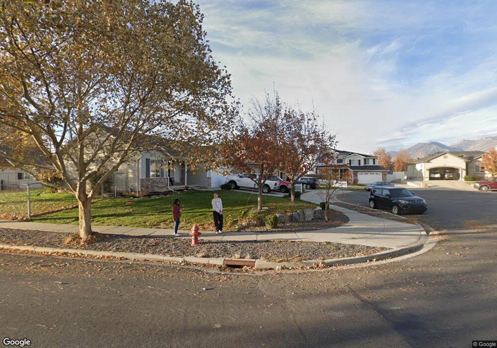
2007 E 1400 S Spanish Fork, UT 84660
Estimated Value: $525,209 - $562,000
5
Beds
3
Baths
2,498
Sq Ft
$219/Sq Ft
Est. Value
About This Home
This home is located at 2007 E 1400 S, Spanish Fork, UT 84660 and is currently estimated at $546,552, approximately $218 per square foot. 2007 E 1400 S is a home located in Utah County with nearby schools including East Meadows Elementary School, Spanish Fork Jr High School, and Spanish Fork High School.
Ownership History
Date
Name
Owned For
Owner Type
Purchase Details
Closed on
Nov 20, 2008
Sold by
Fussell Daniel L
Bought by
Fussell Daniel L and Fussell Amy Page
Current Estimated Value
Home Financials for this Owner
Home Financials are based on the most recent Mortgage that was taken out on this home.
Original Mortgage
$173,200
Outstanding Balance
$113,468
Interest Rate
6.04%
Mortgage Type
Purchase Money Mortgage
Estimated Equity
$433,084
Purchase Details
Closed on
Nov 14, 2008
Sold by
Bell James and Bell Joni C
Bought by
Winder Dee
Home Financials for this Owner
Home Financials are based on the most recent Mortgage that was taken out on this home.
Original Mortgage
$173,200
Outstanding Balance
$113,468
Interest Rate
6.04%
Mortgage Type
Purchase Money Mortgage
Estimated Equity
$433,084
Purchase Details
Closed on
Nov 22, 2004
Sold by
The James & Joni Bell Trust
Bought by
Bell James and Bell Joni C
Home Financials for this Owner
Home Financials are based on the most recent Mortgage that was taken out on this home.
Original Mortgage
$60,000
Interest Rate
5.64%
Mortgage Type
Credit Line Revolving
Purchase Details
Closed on
Jan 9, 2004
Sold by
Bell James J
Bought by
Bell James J and Bell Joni C
Home Financials for this Owner
Home Financials are based on the most recent Mortgage that was taken out on this home.
Original Mortgage
$157,600
Interest Rate
3.25%
Mortgage Type
New Conventional
Purchase Details
Closed on
Apr 24, 2003
Sold by
Bell James J and Bell Joni C
Bought by
Bell James J and Bell Joni C
Purchase Details
Closed on
Nov 20, 2002
Sold by
Bell James J and Bell Joni C
Bought by
Bell James J
Home Financials for this Owner
Home Financials are based on the most recent Mortgage that was taken out on this home.
Original Mortgage
$173,700
Interest Rate
6.12%
Purchase Details
Closed on
Apr 4, 2002
Sold by
Bell James J
Bought by
Bell James J and Bell Joni C
Purchase Details
Closed on
Oct 15, 2001
Sold by
Woodside Homes Corp
Bought by
Bell James J
Create a Home Valuation Report for This Property
The Home Valuation Report is an in-depth analysis detailing your home's value as well as a comparison with similar homes in the area
Home Values in the Area
Average Home Value in this Area
Purchase History
| Date | Buyer | Sale Price | Title Company |
|---|---|---|---|
| Fussell Daniel L | -- | Security Title Of Davis Cou | |
| Fussell Daniel L | -- | Meridian Title Company | |
| Winder Dee | -- | Meridian Title Company | |
| Bell James | -- | -- | |
| Bell James J | -- | Sundance Title Insurance Ag | |
| Bell James J | -- | Sundance Title Insurance Ag | |
| Bell James J | -- | -- | |
| Bell James J | -- | Horizon Title | |
| Bell James J | -- | Horizon Title Insurance Agen | |
| Bell James J | -- | Guardian Title Ins Agency |
Source: Public Records
Mortgage History
| Date | Status | Borrower | Loan Amount |
|---|---|---|---|
| Open | Fussell Daniel L | $173,200 | |
| Closed | Winder Dee | $168,480 | |
| Previous Owner | Bell James | $60,000 | |
| Previous Owner | Bell James J | $157,600 | |
| Previous Owner | Bell James J | $173,700 | |
| Closed | Bell James J | $19,700 |
Source: Public Records
Tax History
| Year | Tax Paid | Tax Assessment Tax Assessment Total Assessment is a certain percentage of the fair market value that is determined by local assessors to be the total taxable value of land and additions on the property. | Land | Improvement |
|---|---|---|---|---|
| 2025 | $2,371 | $257,345 | -- | -- |
| 2024 | $2,371 | $244,365 | $0 | $0 |
| 2023 | $2,470 | $254,925 | $0 | $0 |
| 2022 | $2,575 | $260,645 | $0 | $0 |
| 2021 | $2,204 | $356,900 | $115,800 | $241,100 |
| 2020 | $2,087 | $328,500 | $105,300 | $223,200 |
| 2019 | $1,829 | $302,900 | $87,700 | $215,200 |
| 2018 | $1,768 | $283,000 | $82,800 | $200,200 |
| 2017 | $1,586 | $136,455 | $0 | $0 |
| 2016 | -- | $125,675 | $0 | $0 |
| 2015 | $1,358 | $113,960 | $0 | $0 |
| 2014 | $1,327 | $111,705 | $0 | $0 |
Source: Public Records
Map
Nearby Homes
- 1282 S 2000 E
- 1166 S 1920 E
- 357 E 1460 S Unit 45
- 385 E 1460 S Unit 47
- 1878 E 1050 S
- 1061 S 2230 E
- 1147 S 1660 E
- 2397 E 1370 S
- 1692 E 1000 S
- 938 S 1740 E
- 2034 E 800 S
- 839 S 1760 E
- 1332 E 1670 S Unit 823
- 2342 E 830 S Unit 27
- 2342 E 830 S
- 2342 E 830 S Unit 26
- 2308 E 850 South St Unit 10
- 82 E 1900 S
- 2662 E 1600 S
- 1817 S 2510 E
- 2007 E 1400 S Unit 2
- 2013 E 1400 S
- 1999 E 1400 S
- 1973 E 1400 S
- 2021 E 1400 South Span
- 2021 E 1400 S
- 2021 E 1400 S Unit 4
- 2008 E 1330 S
- 1330 S 2000 E Unit 196
- 2002 E 1330 S
- 1959 E 1400 S
- 2029 E 1400 S
- 2016 E 1330 S
- 1326 S 2000 E
- 2041 E 1400 S
- 2026 E 1330 S Unit 218
- 1419 S 1960 E
- 2046 E 1330 S Unit 219
- 2046 E 1330 S
- 1312 S 2000 E
Your Personal Tour Guide
Ask me questions while you tour the home.