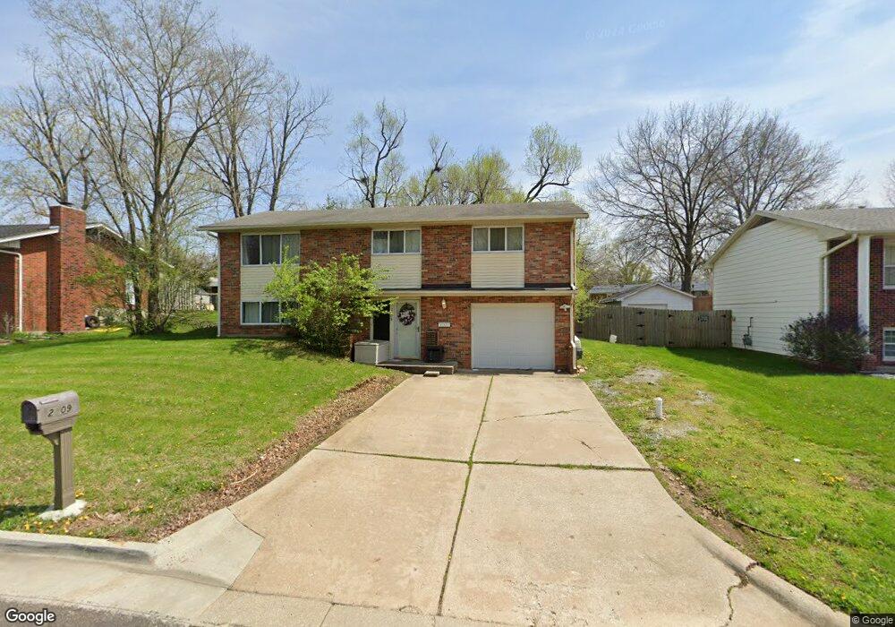
2009 Doris Dr Columbia, MO 65202
Parkade NeighborhoodEstimated Value: $247,299 - $256,000
About This Home
This home is located at 2009 Doris Dr, Columbia, MO 65202 and is currently estimated at $251,075, approximately $143 per square foot. 2009 Doris Dr is a home located in Boone County with nearby schools including Parkade Elementary School, West Middle School, and David H. Hickman High School.
Ownership History
We collect this data history from publicly available records. To have your information removed, we recommend requesting removal directly through your county’s website.
Purchase Details
Home Financials for this Owner
Home Financials are based on the most recent Mortgage that was taken out on this home.Purchase Details
Home Financials for this Owner
Home Financials are based on the most recent Mortgage that was taken out on this home.Home Values in the Area
Average Home Value in this Area
Purchase History
We collect this data history from publicly available records. To have your information removed, we recommend requesting removal directly through your county’s website.
| Date | Buyer | Sale Price | Title Company |
|---|---|---|---|
| -- | -- | ||
| -- | Boone Central Title Co |
Mortgage History
We collect this data history from publicly available records. To have your information removed, we recommend requesting removal directly through your county’s website.
| Date | Status | Borrower | Loan Amount |
|---|---|---|---|
| Open | $15,027 | ||
| Closed | $13,013 | ||
| Open | $164,000 | ||
| Previous Owner | $80,000 |
Tax History
We collect this data history from publicly available records. To have your information removed, we recommend requesting removal directly through your county’s website.
| Year | Tax Paid | Tax Assessment Tax Assessment Total Assessment is a certain percentage of the fair market value that is determined by local assessors to be the total taxable value of land and additions on the property. | Land | Improvement |
|---|---|---|---|---|
| 2025 | $1,767 | $26,980 | $3,154 | $23,826 |
| 2024 | $1,589 | $23,560 | $3,154 | $20,406 |
| 2023 | $1,576 | $23,560 | $3,154 | $20,406 |
| 2022 | $1,458 | $21,812 | $3,154 | $18,658 |
| 2021 | $1,461 | $21,812 | $3,154 | $18,658 |
| 2020 | $1,439 | $20,191 | $3,154 | $17,037 |
| 2019 | $1,439 | $20,191 | $3,154 | $17,037 |
| 2018 | $1,342 | $0 | $0 | $0 |
| 2017 | $1,325 | $18,696 | $3,154 | $15,542 |
| 2016 | $1,360 | $18,696 | $3,154 | $15,542 |
| 2015 | $1,255 | $18,696 | $3,154 | $15,542 |
| 2014 | $1,262 | $18,696 | $3,154 | $15,542 |
Map
- 2109 Speck Ct
- 1801 Parkade Blvd
- 2003 Bear Creek Dr
- 607 Bear Valley Ct
- 707 Independence St
- 710 Hirth Ave
- 2 E Craig St
- 1909 Newton Dr
- 106 W Forest Ave
- 504 Hunt Ave
- 600 Clinkscales Rd
- 1404 W Worley St
- 903 N Garth Ave
- 400 Auburn Ln
- 308 West Blvd N
- 107 E Forest Ave
- LOT 27 Caribou Dr
- 107 4th Ave
- 216 Ridgeway Ave
- 3302 Alligator Ln
- 2005 Doris Dr
- 2013 Doris Dr
- 1809 Parklawn Dr
- 909 Sondra Ave
- 2001 Doris Dr
- 905 Sondra Ave
- 2101 Doris Dr
- 911 Sondra Ave
- 1807 Parklawn Dr
- 2008 Doris Dr
- 2004 Doris Dr
- 2100 Doris Dr
- 915 Sondra Ave
- 2105 Doris Dr
- 1801 Parklawn Dr
- 1930 Doris Dr
- 1925 Doris Dr
- 917 Sondra Ave
- 1808 Parklawn Dr
- 2108 Doris Dr Unit 2110
Ask me questions while you tour the home.