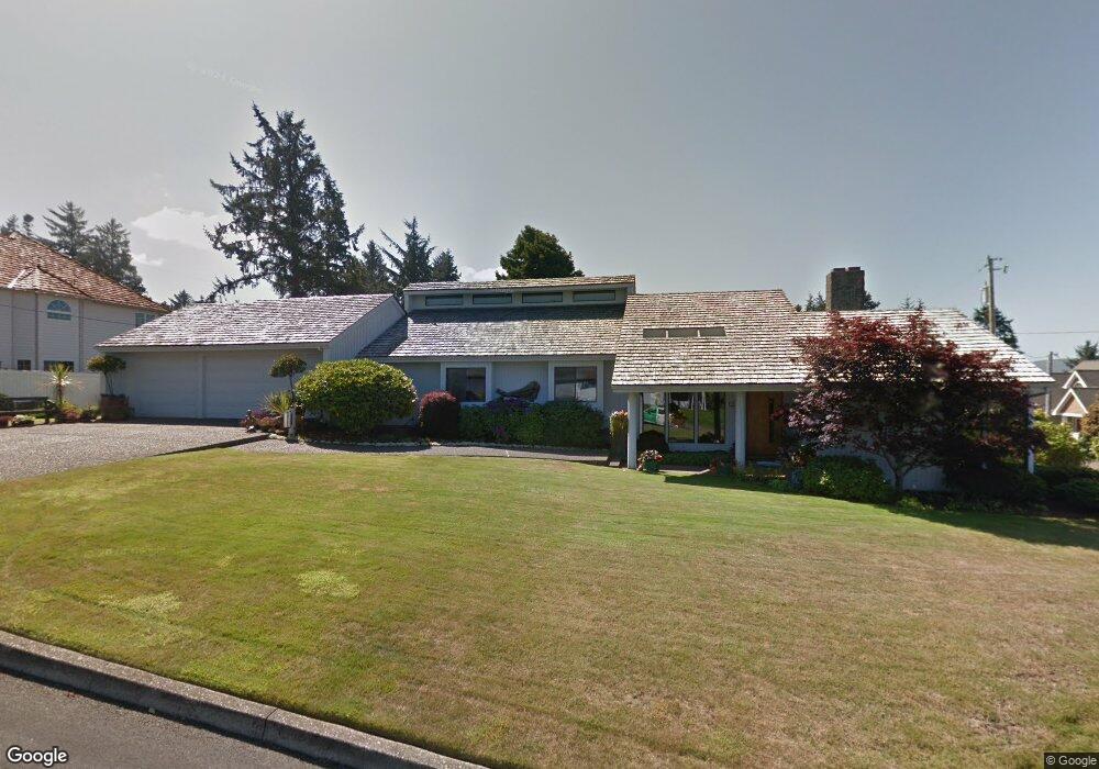
2009 Maple St Seaside, OR 97138
Estimated Value: $658,000 - $741,000
About This Home
This home is located at 2009 Maple St, Seaside, OR 97138 and is currently estimated at $690,082, approximately $297 per square foot. 2009 Maple St is a home located in Clatsop County with nearby schools including Seaside High School.
Ownership History
We collect this data history from publicly available records. To have your information removed, we recommend requesting removal directly through your county’s website.
Purchase Details
Purchase Details
Purchase Details
Purchase History
We collect this data history from publicly available records. To have your information removed, we recommend requesting removal directly through your county’s website.
| Date | Buyer | Sale Price | Title Company |
|---|---|---|---|
| -- | None Available | ||
| -- | Pacific Title Company | ||
| $5,000 | Accommodation |
Tax History
We collect this data history from publicly available records. To have your information removed, we recommend requesting removal directly through your county’s website.
| Year | Tax Paid | Tax Assessment Tax Assessment Total Assessment is a certain percentage of the fair market value that is determined by local assessors to be the total taxable value of land and additions on the property. | Land | Improvement |
|---|---|---|---|---|
| 2025 | $7,079 | $492,639 | -- | -- |
| 2024 | $6,871 | $478,291 | -- | -- |
| 2023 | $6,668 | $464,361 | $0 | $0 |
| 2022 | $6,486 | $450,837 | $0 | $0 |
| 2021 | $6,348 | $437,707 | $0 | $0 |
| 2020 | $6,159 | $424,959 | $0 | $0 |
| 2019 | $6,006 | $412,582 | $0 | $0 |
| 2018 | $5,787 | $400,566 | $0 | $0 |
| 2017 | $5,367 | $388,900 | $0 | $0 |
| 2016 | $4,677 | $377,574 | $97,985 | $279,589 |
| 2015 | $4,524 | $366,578 | $95,132 | $271,446 |
| 2014 | $4,681 | $355,902 | $0 | $0 |
| 2013 | -- | $345,537 | $0 | $0 |
Map
- 361 Hilltop Dr
- 360 Hilltop Dr
- 1805 Broadway St
- 0 Vl Whispering Pines Dr
- 1975 Forest Dr
- 1265 Avenue
- 2270 Skyline Dr
- VL Spruce Dr
- 2165 Skyline Dr
- 0 Spruce Dr Unit 533082968
- 1601 Spruce Dr
- 495 N Wahanna Rd
- 1103 Avenue F
- 0 Vl Whispering Pines (Tl 13345) Dr
- 805 S King St
- 1010 2nd Ave
- 1000 S King St
- 1021 4th Ave
- 0 Way
- 850 1st Ave
- 2025 Maple St
- 2002 Maple St
- 340 Hilltop Dr
- 320 Hilltop Dr
- 2020 Maple St
- 1979 Broadway St
- 261 Hilltop Dr
- 2045 Maple St
- 2026 Fernwood St
- 2044 Maple St
- 1643 Whispering Pines Dr
- 2046 Fernwood St
- 1646 Whispering Pines Dr
- 380 Hilltop Dr
- 2007 Fernwood St
- 2065 Maple St
- 2003 Cedar St
- 1639 Whispering Pines Dr
- 2027 Fernwood St
- 2066 Fernwood St
Ask me questions while you tour the home.