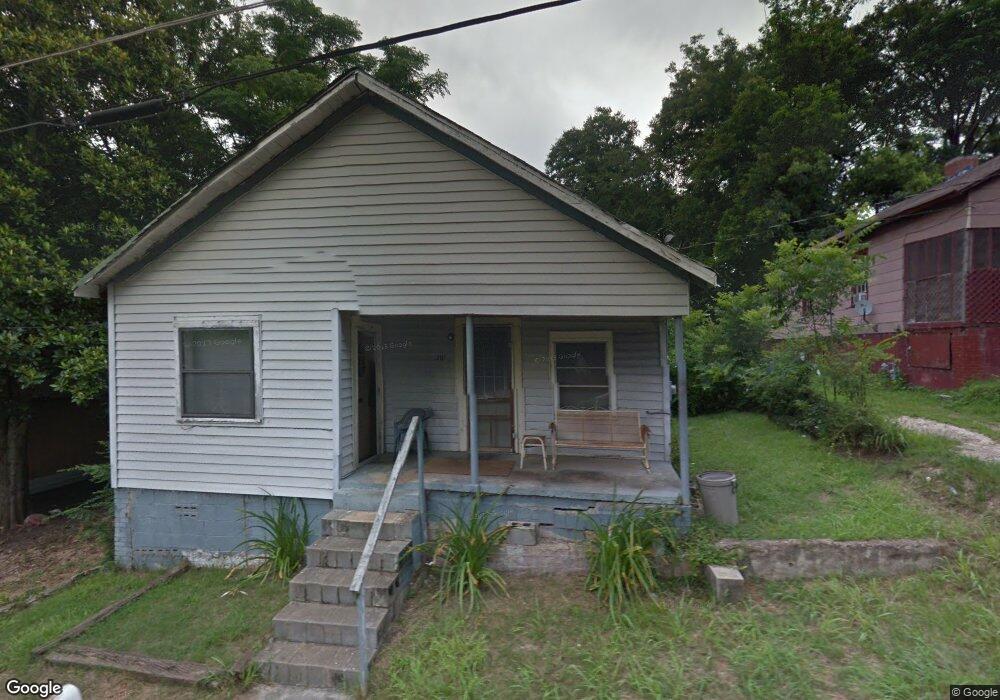
201 Dix St Lagrange, GA 30241
Estimated Value: $36,000 - $56,000
2
Beds
1
Bath
1,008
Sq Ft
$48/Sq Ft
Est. Value
About This Home
This home is located at 201 Dix St, Lagrange, GA 30241 and is currently estimated at $47,925, approximately $47 per square foot. 201 Dix St is a home located in Troup County with nearby schools including Hollis Hand Elementary School, Franklin Forest Elementary School, and Ethel W. Kight Elementary School.
Ownership History
Date
Name
Owned For
Owner Type
Purchase Details
Closed on
May 20, 2022
Sold by
Smith Rodney
Bought by
Urrea Maynor Alexander Mayor
Current Estimated Value
Purchase Details
Closed on
Dec 11, 2017
Sold by
Barton Dorothy J
Bought by
Smith Rodney
Purchase Details
Closed on
Apr 28, 1993
Sold by
Charlie Ford
Bought by
Barton Dorothy J
Purchase Details
Closed on
Mar 12, 1993
Sold by
Trust Co Bank Of Columbus
Bought by
Charlie Ford
Purchase Details
Closed on
Feb 5, 1980
Sold by
Byrd Cornelius
Bought by
Trust Co Bank Of Columbus
Purchase Details
Closed on
Nov 1, 1946
Sold by
Hoye William
Bought by
Byrd Cornelius
Create a Home Valuation Report for This Property
The Home Valuation Report is an in-depth analysis detailing your home's value as well as a comparison with similar homes in the area
Purchase History
| Date | Buyer | Sale Price | Title Company |
|---|---|---|---|
| Urrea Maynor Alexander Mayor | $33,000 | -- | |
| Smith Rodney | $10,000 | -- | |
| Barton Dorothy J | -- | -- | |
| Charlie Ford | -- | -- | |
| Trust Co Bank Of Columbus | $4,100 | -- | |
| Byrd Cornelius | -- | -- |
Source: Public Records
Tax History
| Year | Tax Paid | Tax Assessment Tax Assessment Total Assessment is a certain percentage of the fair market value that is determined by local assessors to be the total taxable value of land and additions on the property. | Land | Improvement |
|---|---|---|---|---|
| 2025 | $351 | $15,240 | $2,160 | $13,080 |
| 2024 | $331 | $14,120 | $2,160 | $11,960 |
| 2023 | $359 | $13,160 | $2,160 | $11,000 |
| 2022 | $346 | $12,400 | $2,160 | $10,240 |
| 2021 | $298 | $9,880 | $1,600 | $8,280 |
| 2020 | $298 | $9,880 | $1,600 | $8,280 |
| 2019 | $269 | $8,912 | $1,632 | $7,280 |
| 2018 | $121 | $8,912 | $1,632 | $7,280 |
| 2017 | $269 | $8,912 | $1,632 | $7,280 |
| 2016 | $267 | $8,869 | $1,632 | $7,237 |
| 2015 | $268 | $8,869 | $1,632 | $7,237 |
| 2014 | $257 | $8,488 | $1,632 | $6,856 |
| 2013 | -- | $11,240 | $1,632 | $9,608 |
Source: Public Records
Map
Nearby Homes
Your Personal Tour Guide
Ask me questions while you tour the home.