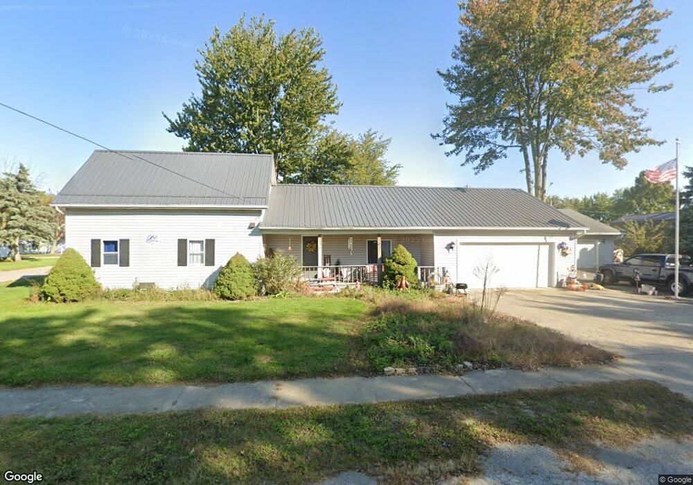
201 E Mulberry St Waynesfield, OH 45896
Estimated Value: $153,820 - $200,000
3
Beds
1
Bath
1,680
Sq Ft
$110/Sq Ft
Est. Value
About This Home
This home is located at 201 E Mulberry St, Waynesfield, OH 45896 and is currently estimated at $184,455, approximately $109 per square foot. 201 E Mulberry St is a home located in Auglaize County with nearby schools including Waynesfield-Goshen Local Elementary School and Waynesfield-Goshen Local High School.
Ownership History
Date
Name
Owned For
Owner Type
Purchase Details
Closed on
Mar 27, 2019
Sold by
Edgington Raymond N and Edgington Lavera F
Bought by
Edgington Raymond N and Edgington Lavera F
Current Estimated Value
Purchase Details
Closed on
Jun 20, 1996
Sold by
Spillman Robert W and Spillman Colene M
Bought by
Edgington Lavera F
Purchase Details
Closed on
May 19, 1992
Sold by
Spillman Robert W
Bought by
Spillman Robert W
Create a Home Valuation Report for This Property
The Home Valuation Report is an in-depth analysis detailing your home's value as well as a comparison with similar homes in the area
Purchase History
| Date | Buyer | Sale Price | Title Company |
|---|---|---|---|
| Edgington Raymond N | -- | None Available | |
| Edgington Lavera F | $27,500 | -- | |
| Spillman Robert W | -- | -- |
Source: Public Records
Tax History
| Year | Tax Paid | Tax Assessment Tax Assessment Total Assessment is a certain percentage of the fair market value that is determined by local assessors to be the total taxable value of land and additions on the property. | Land | Improvement |
|---|---|---|---|---|
| 2025 | $2,400 | $37,090 | $3,010 | $34,080 |
| 2024 | $2,400 | $37,090 | $3,010 | $34,080 |
| 2023 | $1,366 | $37,090 | $3,010 | $34,080 |
| 2022 | $1,272 | $29,220 | $2,800 | $26,420 |
| 2021 | $1,256 | $29,220 | $2,800 | $26,420 |
| 2020 | $629 | $29,218 | $2,800 | $26,418 |
| 2019 | $1,010 | $24,350 | $2,335 | $22,015 |
| 2018 | $985 | $24,350 | $2,335 | $22,015 |
| 2017 | $981 | $24,350 | $2,335 | $22,015 |
| 2016 | $933 | $23,885 | $2,223 | $21,662 |
| 2015 | $933 | $23,885 | $2,223 | $21,662 |
| 2014 | $934 | $23,885 | $2,223 | $21,662 |
| 2013 | $1,032 | $23,885 | $2,223 | $21,662 |
Source: Public Records
Map
Nearby Homes
- 404 N Westminster St
- 105 Guthrie St
- 204 S Westminster St
- 533 N Westminster St
- 101 Sunrise Dr
- 25702 Ohio 67
- 16120 Waynesfield Rd
- 24702 Buckland Holden Rd
- 25353 Buckland Holden Rd
- 8150 Amherst Rd
- 4850 Bowdle Rd
- 14888 State Route 117
- 9310 Faulkner Rd
- 0 Ohio 67
- 13412 County Road 88
- 7165 Faulkner Rd
- 0 Center St
- 0 Spring St
- 11352 N Township Road 88
- 4500 McPheron Rd
Your Personal Tour Guide
Ask me questions while you tour the home.