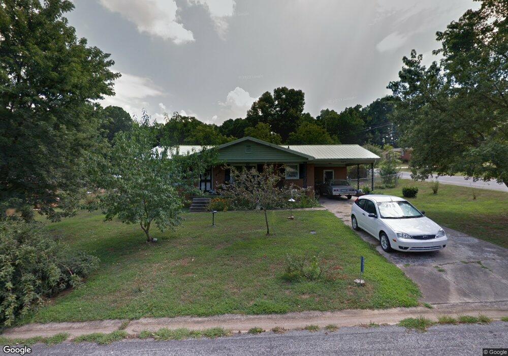
2011 Townview Dr Kannapolis, NC 28081
Estimated Value: $266,000 - $302,000
About This Home
This home is located at 2011 Townview Dr, Kannapolis, NC 28081 and is currently estimated at $280,848, approximately $240 per square foot. 2011 Townview Dr is a home located in Rowan County with nearby schools including Landis Elementary School, Corriher Lipe Middle School, and South Rowan High School.
Ownership History
We collect this data history from publicly available records. To have your information removed, we recommend requesting removal directly through your county’s website.
Purchase Details
Home Financials for this Owner
Home Financials are based on the most recent Mortgage that was taken out on this home.Home Values in the Area
Average Home Value in this Area
Purchase History
We collect this data history from publicly available records. To have your information removed, we recommend requesting removal directly through your county’s website.
| Date | Buyer | Sale Price | Title Company |
|---|---|---|---|
| $230,000 | Costner Law Office Pllc |
Mortgage History
We collect this data history from publicly available records. To have your information removed, we recommend requesting removal directly through your county’s website.
| Date | Status | Borrower | Loan Amount |
|---|---|---|---|
| Open | $235,290 |
Tax History
We collect this data history from publicly available records. To have your information removed, we recommend requesting removal directly through your county’s website.
| Year | Tax Paid | Tax Assessment Tax Assessment Total Assessment is a certain percentage of the fair market value that is determined by local assessors to be the total taxable value of land and additions on the property. | Land | Improvement |
|---|---|---|---|---|
| 2025 | $1,341 | $203,191 | $32,825 | $170,366 |
| 2024 | $1,341 | $203,191 | $32,825 | $170,366 |
| 2023 | $1,341 | $203,191 | $32,825 | $170,366 |
| 2022 | $687 | $93,213 | $16,160 | $77,053 |
| 2021 | $687 | $93,213 | $16,160 | $77,053 |
| 2020 | $687 | $93,213 | $16,160 | $77,053 |
| 2019 | $687 | $93,213 | $16,160 | $77,053 |
| 2018 | $606 | $81,583 | $16,160 | $65,423 |
| 2017 | $602 | $81,583 | $16,160 | $65,423 |
| 2016 | $594 | $81,583 | $16,160 | $65,423 |
| 2015 | $603 | $81,583 | $16,160 | $65,423 |
| 2014 | $615 | $84,672 | $16,160 | $68,512 |
Map
- 120 Homestead Ave
- 4646 Rainbow Dr
- 0000 Buffalo St
- 113 Hilton Ave
- 116 Newell Ave
- 1530 Buffalo St
- 4608 Rainbow Dr
- 4268 Vincent St
- 4648 Nob Hill Dr
- 0 Tanglewood Dr Unit CAR4382660
- 1225 W C St
- 4224 Pine St
- 4218 Pine St
- 1408 Westwinds Ct
- 5953 Yale Ave
- Lot 7 Solitude Ct Unit 7
- 464 Sand Dunes Dr Unit 78
- 5921 Princeton Ave
- 5760 Turner Dr
- 1015 S Walnut St
- 1739 Shadowbrook Dr
- 1737 Shadowbrook Dr
- 00 White Ave
- 0 White Ave
- 0 White Ave Unit CAR4120259
- 0 White Ave Unit 60 CAR4080438
- 2013 Townview Dr
- 1717 Shadowbrook Dr
- 2015 Townview Dr
- 2011 Townview Dr Unit 18
- 13-14 Townview Dr Unit 13-14
- 2017 Townview Dr
- 4746 Rainbow Dr
- 2009 Townview Dr
- 1733 Shadowbrook Dr
- 2014 Townview Dr
- 2012 Townview Dr
- 2019 Townview Dr
- 2010 Townview Dr
- 2007 Townview Dr
Ask me questions while you tour the home.