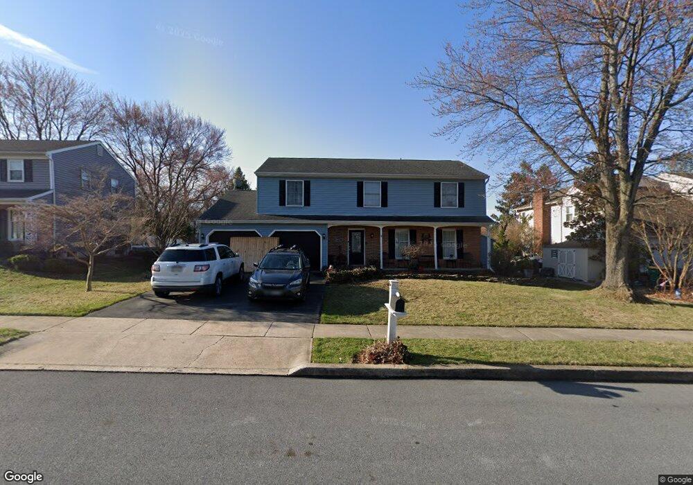
2012 Buckman Ave Reading, PA 19610
Whitfield NeighborhoodEstimated Value: $424,395 - $460,000
4
Beds
3
Baths
2,225
Sq Ft
$198/Sq Ft
Est. Value
About This Home
This home is located at 2012 Buckman Ave, Reading, PA 19610 and is currently estimated at $439,849, approximately $197 per square foot. 2012 Buckman Ave is a home located in Berks County with nearby schools including Spring Ridge Elementary School, Wilson West Middle School, and Wilson High School.
Ownership History
Date
Name
Owned For
Owner Type
Purchase Details
Closed on
Jul 18, 2003
Sold by
Boylan John C and Boylan Jennifer C
Bought by
Harris John R and Harris Brooke A
Current Estimated Value
Home Financials for this Owner
Home Financials are based on the most recent Mortgage that was taken out on this home.
Original Mortgage
$160,000
Outstanding Balance
$68,126
Interest Rate
5.28%
Mortgage Type
Purchase Money Mortgage
Estimated Equity
$371,723
Create a Home Valuation Report for This Property
The Home Valuation Report is an in-depth analysis detailing your home's value as well as a comparison with similar homes in the area
Home Values in the Area
Average Home Value in this Area
Purchase History
We collect this data history from publicly available records. To have your information removed, we recommend requesting removal directly through your county’s website.
| Date | Buyer | Sale Price | Title Company |
|---|---|---|---|
| Harris John R | $200,000 | -- |
Source: Public Records
Mortgage History
We collect this data history from publicly available records. To have your information removed, we recommend requesting removal directly through your county’s website.
| Date | Status | Borrower | Loan Amount |
|---|---|---|---|
| Open | Harris John R | $160,000 |
Source: Public Records
Tax History
| Year | Tax Paid | Tax Assessment Tax Assessment Total Assessment is a certain percentage of the fair market value that is determined by local assessors to be the total taxable value of land and additions on the property. | Land | Improvement |
|---|---|---|---|---|
| 2025 | $2,526 | $140,800 | $23,700 | $117,100 |
| 2024 | $6,024 | $140,800 | $23,700 | $117,100 |
| 2023 | $5,740 | $140,800 | $23,700 | $117,100 |
| 2022 | $5,599 | $140,800 | $23,700 | $117,100 |
| 2021 | $5,402 | $140,800 | $23,700 | $117,100 |
| 2020 | $5,402 | $140,800 | $23,700 | $117,100 |
| 2019 | $5,249 | $140,800 | $23,700 | $117,100 |
| 2018 | $5,204 | $140,800 | $23,700 | $117,100 |
| 2017 | $5,116 | $140,800 | $23,700 | $117,100 |
| 2016 | $1,766 | $140,800 | $23,700 | $117,100 |
| 2015 | $1,766 | $140,800 | $23,700 | $117,100 |
| 2014 | $1,766 | $140,800 | $23,700 | $117,100 |
Source: Public Records
Map
Nearby Homes
- 802 Broadcasting Rd
- 28 Cheltenham Dr
- 811 Carman Dr
- 37 Dorchester Dr
- 101 Robert Rd
- 162 Hawthorne Ct
- 112 Grandview Blvd
- 118 Laurel Ct Unit 118B
- 2402 Bell Dr
- 517 Berks Place
- 2111 Fairview St
- 65 Wyomissing Hills Blvd
- 100 Deborah Dr
- 2023 Spring St
- 1747 Colony Dr
- 2116 Noble St
- 2406 Noble St
- 318 N Dwight St
- 119 Norman St
- 20 Valley Rd
- 2014 Buckman Ave
- 2010 Buckman Ave
- 2013 Buckman Ave
- 2016 Buckman Ave
- 2011 Buckman Ave
- 820 Apple Dr
- 816 Apple Dr
- 2015 Buckman Ave
- 2009 Buckman Ave
- 814 Apple Dr
- 2017 Buckman Ave
- 2018 Buckman Ave
- 2012 Cypress Ln
- 2010 Cypress Ln
- 2014 Cypress Ln
- 2007 Buckman Ave
- 812 Apple Dr
- 2008 Cypress Ln
- 2016 Cypress Ln
- 2019 Buckman Ave
Your Personal Tour Guide
Ask me questions while you tour the home.