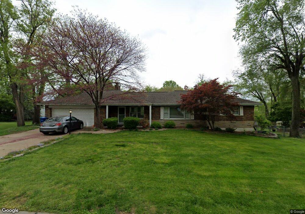
2012 Dolph Ln Saint Louis, MO 63125
Mehlville NeighborhoodEstimated Value: $280,445 - $320,000
2
Beds
2
Baths
1,540
Sq Ft
$195/Sq Ft
Est. Value
About This Home
This home is located at 2012 Dolph Ln, Saint Louis, MO 63125 and is currently estimated at $300,111, approximately $194 per square foot. 2012 Dolph Ln is a home located in St. Louis County with nearby schools including Bierbaum Elementary School, Margaret Buerkle Middle School, and Mehlville High School.
Ownership History
Date
Name
Owned For
Owner Type
Purchase Details
Closed on
Nov 2, 2021
Sold by
Wallis Joe and Wallis Lori
Bought by
Wallis Lori
Current Estimated Value
Purchase Details
Closed on
Jun 23, 2004
Sold by
Clements Maria Louise and Clements Matthew
Bought by
Wallis Joe and Wallis Lori
Home Financials for this Owner
Home Financials are based on the most recent Mortgage that was taken out on this home.
Original Mortgage
$135,000
Interest Rate
6.3%
Mortgage Type
Purchase Money Mortgage
Purchase Details
Closed on
Jan 2, 2004
Sold by
Clements Maria Louise and Clements Matthew
Bought by
Clements Matthew and Clements Maria Louise
Home Financials for this Owner
Home Financials are based on the most recent Mortgage that was taken out on this home.
Original Mortgage
$200,000
Interest Rate
5.97%
Mortgage Type
Stand Alone Refi Refinance Of Original Loan
Purchase Details
Closed on
Dec 30, 2000
Sold by
Rhomberg Hazel M & Trustee and Gerald A
Bought by
Rhomberg Maria Louise
Create a Home Valuation Report for This Property
The Home Valuation Report is an in-depth analysis detailing your home's value as well as a comparison with similar homes in the area
Home Values in the Area
Average Home Value in this Area
Purchase History
| Date | Buyer | Sale Price | Title Company |
|---|---|---|---|
| Wallis Lori | -- | None Listed On Document | |
| Wallis Joe | $220,000 | -- | |
| Clements Matthew | -- | -- | |
| Rhomberg Maria Louise | -- | -- |
Source: Public Records
Mortgage History
| Date | Status | Borrower | Loan Amount |
|---|---|---|---|
| Previous Owner | Wallis Joe | $135,000 | |
| Previous Owner | Clements Matthew | $200,000 |
Source: Public Records
Tax History
| Year | Tax Paid | Tax Assessment Tax Assessment Total Assessment is a certain percentage of the fair market value that is determined by local assessors to be the total taxable value of land and additions on the property. | Land | Improvement |
|---|---|---|---|---|
| 2025 | $3,103 | $52,380 | $19,000 | $33,380 |
| 2024 | $3,103 | $45,740 | $11,820 | $33,920 |
| 2023 | $3,103 | $45,740 | $11,820 | $33,920 |
| 2022 | $3,041 | $42,160 | $12,650 | $29,510 |
| 2021 | $2,698 | $42,160 | $12,650 | $29,510 |
| 2020 | $2,520 | $37,430 | $14,000 | $23,430 |
| 2019 | $2,513 | $37,430 | $14,000 | $23,430 |
| 2018 | $2,175 | $29,210 | $7,470 | $21,740 |
| 2017 | $2,172 | $29,210 | $7,470 | $21,740 |
| 2016 | $2,055 | $26,490 | $5,910 | $20,580 |
| 2015 | $1,927 | $26,490 | $5,910 | $20,580 |
| 2014 | $2,215 | $30,210 | $4,370 | $25,840 |
Source: Public Records
Map
Nearby Homes
- 4005 Reavis Barracks Rd
- 1928 Simba Cir
- 1841 Mansard Dr
- 4001 Redland Dr
- 4262 Eiffel Dr Unit 4262
- 3755 Park Crest Dr
- 9924 Bunker Hill Dr Unit G
- 9924 Bunker Hill Dr Unit A
- 3736 Park Crest Dr
- 9965 Bunker Hill Dr Unit C
- 9038 Villaridge Ct Unit 49
- 9070 Villaridge Ct Unit 38
- 10031 Echoridge Ln Unit A
- 9925 Bunker Hill Dr Unit F
- 9117 Villaridge Ct Unit D
- 9047 Villaridge Ct Unit A
- 10069 N Bunker Hill Dr Unit A
- 3841 Via Miralesta Dr
- 1275 Gardens Circle Dr Unit H
- 2 Ashford at Grove at Grant’s Trail Manors
- 2020 Dolph Ln
- 4014 Reavis Barracks Rd
- 2010 Dolph Ln
- 4010 Reavis Barracks Rd
- 2015 Happy Ln
- 2015 Dolph Ln
- 2033 Happy Ln
- 4040 Reavis Barracks Rd
- 2030 Dolph Ln
- 2027 Dolph Ln
- 2059 Happy Ln
- 4000 Reavis Barracks Rd
- 4017 Reavis Barracks Rd
- 4025 Reavis Barracks Rd
- 2034 Dolph Ln
- 4100 Reavis Barracks Rd
- 2041 Dolph Ln
- 4013 Reavis Barracks Rd
- 4009 Reavis Barracks Rd
- 4001 Reavis Barracks Rd
Your Personal Tour Guide
Ask me questions while you tour the home.