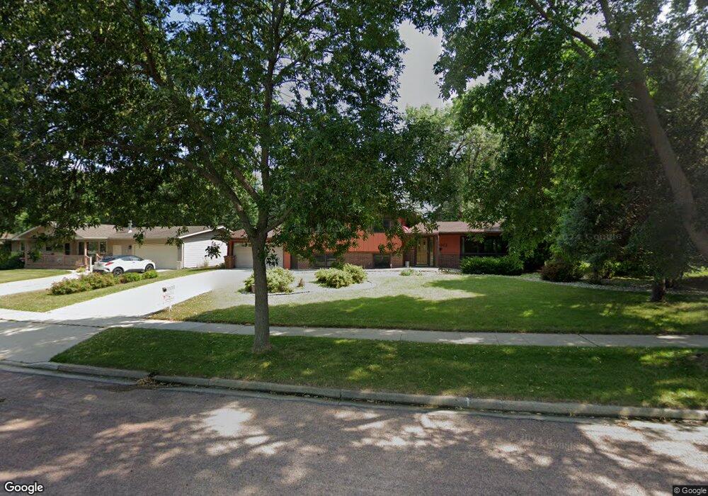
2012 Kansas Dr Brookings, SD 57006
Estimated Value: $301,232 - $365,000
3
Beds
2
Baths
2,184
Sq Ft
$151/Sq Ft
Est. Value
About This Home
This home is located at 2012 Kansas Dr, Brookings, SD 57006 and is currently estimated at $330,808, approximately $151 per square foot. 2012 Kansas Dr is a home located in Brookings County with nearby schools including Brookings High School and St Thomas More Catholic School.
Ownership History
Date
Name
Owned For
Owner Type
Purchase Details
Closed on
Sep 15, 2013
Sold by
Bretsch Carey L and Bretsch Lisa L
Bought by
Strombom Carl V and Bretsch Lisa L
Current Estimated Value
Home Financials for this Owner
Home Financials are based on the most recent Mortgage that was taken out on this home.
Original Mortgage
$173,920
Outstanding Balance
$126,936
Interest Rate
4.39%
Estimated Equity
$203,872
Create a Home Valuation Report for This Property
The Home Valuation Report is an in-depth analysis detailing your home's value as well as a comparison with similar homes in the area
Home Values in the Area
Average Home Value in this Area
Purchase History
We collect this data history from publicly available records. To have your information removed, we recommend requesting removal directly through your county’s website.
| Date | Buyer | Sale Price | Title Company |
|---|---|---|---|
| Strombom Carl V | -- | -- |
Source: Public Records
Mortgage History
We collect this data history from publicly available records. To have your information removed, we recommend requesting removal directly through your county’s website.
| Date | Status | Borrower | Loan Amount |
|---|---|---|---|
| Open | Strombom Carl V | $173,920 |
Source: Public Records
Tax History
| Year | Tax Paid | Tax Assessment Tax Assessment Total Assessment is a certain percentage of the fair market value that is determined by local assessors to be the total taxable value of land and additions on the property. | Land | Improvement |
|---|---|---|---|---|
| 2026 | $4,084 | $318,400 | $39,800 | $278,600 |
| 2025 | $3,603 | $296,400 | $32,600 | $263,800 |
| 2024 | $3,660 | $247,800 | $32,600 | $215,200 |
| 2023 | $3,546 | $236,700 | $32,600 | $204,100 |
| 2022 | $3,241 | $223,700 | $32,600 | $191,100 |
| 2021 | $3,160 | $216,300 | $32,600 | $183,700 |
| 2020 | $2,896 | $193,700 | $32,600 | $161,100 |
| 2019 | $2,815 | $190,200 | $32,600 | $157,600 |
| 2018 | $2,795 | $181,600 | $32,600 | $149,000 |
| 2017 | $2,851 | $181,600 | $32,600 | $149,000 |
| 2016 | $2,778 | $181,600 | $32,600 | $149,000 |
| 2010 | -- | $172,300 | $0 | $0 |
Source: Public Records
Map
Nearby Homes
- 323 Dakota Ave
- 2055 1st St
- 2110 Derdall Dr
- 1726 Orchard Dr
- L1, B2 Wilbert Square Addition Unit L1, B2 Wilbert Squar
- L4, B2 Wilbert Square Addition Unit L4, B2 Wilbert Squar
- L5, B2 Wilbert Square Addition Unit L5, B2 Wilbert Squar
- L7, B2 Wilbert Square Addiiton Unit L7, B2 Wilbert Squar
- L2, B1 Wilbert Square Addition Unit L2, B1 Wilbert Squar
- L6, B1 Wilbert Square Addition Unit L6, B1 Wilbert Squar
- L4, B1 Wilbert Square Addition Unit L4, B1 Wilbert Squar
- L3, B1 Wilbert Square Addition Unit L3, B1 Wilbert Squar
- L9, B1 Wilbert Square Addition Unit L9, B1 Wilbert Squar
- L2, B2 Wilbert Square Addition Unit L2, B2 Wilbert Squar
- L6, B2 Wilbert Square Addition Unit L6, B2 Wilbert Squar
- L5, B1 Wilbert Square Addition Unit L5, B1 Wilbert Squar
- L3, B2 Wilbert Square Addition Unit L3, B2 Wilbert Squar
- 201 Gilley Ave S
- L1, B1 Wilbert Square Addition Unit L1, B1 Wilbert Squar
- 1103 3rd St
Your Personal Tour Guide
Ask me questions while you tour the home.