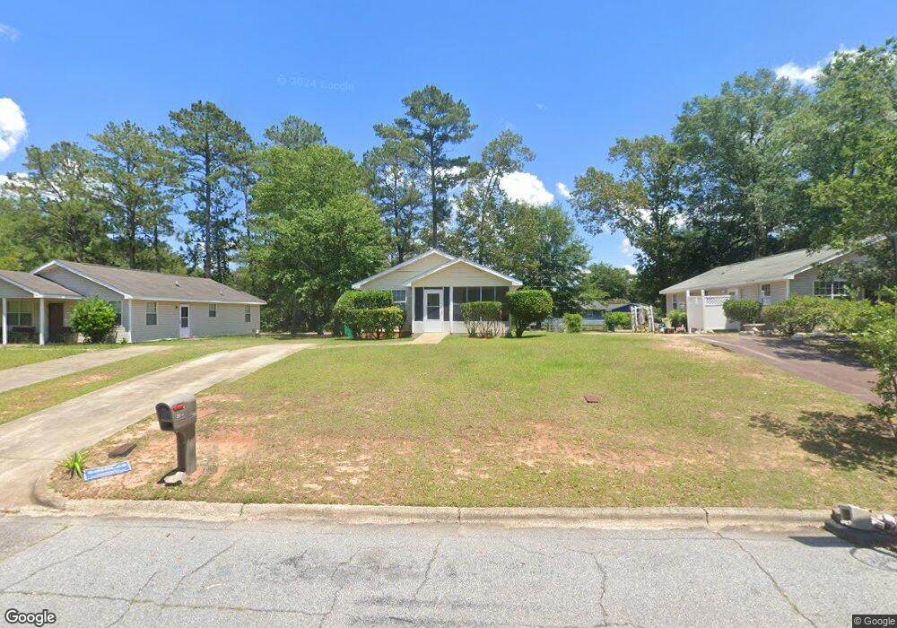
2014 Beachview Dr Albany, GA 31705
Estimated Value: $61,000 - $95,000
3
Beds
1
Bath
1,040
Sq Ft
$74/Sq Ft
Est. Value
About This Home
This home is located at 2014 Beachview Dr, Albany, GA 31705 and is currently estimated at $76,662, approximately $73 per square foot. 2014 Beachview Dr is a home located in Dougherty County with nearby schools including Robert H. Harvey Elementary School, Albany Middle School, and Dougherty Comprehensive High School.
Ownership History
Date
Name
Owned For
Owner Type
Purchase Details
Closed on
Feb 3, 2017
Bought by
Whtie Mary L and Peters Antonio J
Current Estimated Value
Purchase Details
Closed on
Dec 8, 2008
Sold by
Flint River Habitat For Humanity
Bought by
Davis Nellie B
Purchase Details
Closed on
Apr 23, 1998
Sold by
Flint River Habitat For Humanity Inc
Bought by
Davis Nellie B and White Mattie P
Purchase Details
Closed on
Jan 16, 1998
Sold by
Gowan Robert D
Bought by
Flint River Habitat For Humanity Inc
Purchase Details
Closed on
May 7, 1996
Sold by
Walls Cleveland
Bought by
Gowan Robert D
Purchase Details
Closed on
Jan 24, 1992
Sold by
Gowan Robert D
Bought by
Walls Cleveland Jr
Purchase Details
Closed on
Aug 30, 1985
Sold by
Gowan R D
Bought by
Gowan R D
Create a Home Valuation Report for This Property
The Home Valuation Report is an in-depth analysis detailing your home's value as well as a comparison with similar homes in the area
Purchase History
| Date | Buyer | Sale Price | Title Company |
|---|---|---|---|
| Whtie Mary L | $12,384 | -- | |
| Davis Nellie B | -- | -- | |
| Davis Nellie B | $35,000 | -- | |
| Flint River Habitat For Humanity Inc | $21,000 | -- | |
| Gowan Robert D | -- | -- | |
| Walls Cleveland Jr | $19,500 | -- | |
| Gowan R D | -- | -- |
Source: Public Records
Tax History
| Year | Tax Paid | Tax Assessment Tax Assessment Total Assessment is a certain percentage of the fair market value that is determined by local assessors to be the total taxable value of land and additions on the property. | Land | Improvement |
|---|---|---|---|---|
| 2025 | $1,150 | $24,720 | $2,000 | $22,720 |
| 2024 | $1,150 | $24,720 | $2,000 | $22,720 |
| 2023 | $220 | $24,720 | $2,000 | $22,720 |
| 2022 | $1,062 | $24,720 | $2,000 | $22,720 |
| 2021 | $1,072 | $24,720 | $2,000 | $22,720 |
| 2020 | $1,074 | $24,720 | $2,000 | $22,720 |
| 2019 | $1,078 | $24,720 | $2,000 | $22,720 |
| 2018 | $1,083 | $24,720 | $2,000 | $22,720 |
| 2017 | $1,009 | $24,720 | $2,000 | $22,720 |
| 2016 | $1,009 | $24,720 | $2,000 | $22,720 |
| 2015 | $737 | $24,720 | $2,000 | $22,720 |
| 2014 | $717 | $24,520 | $1,800 | $22,720 |
Source: Public Records
Map
Nearby Homes
- 1412 Westcliff Ct
- 1407 Cromartie Beach Dr
- 2430 Beachview Dr
- 1616 Cromartie Beach Dr
- 1523 Malone Ave
- 1500 Evelyn Ave
- 1710 River Pointe Dr
- 1408 River Pointe Dr
- 1901 River Pointe Dr
- 1502 River Pointe Dr
- 1510 River Pointe Dr
- 1811 River Pointe Dr
- 1508 River Pointe Dr
- 1514 River Pointe Dr
- 1600 River Pointe Dr
- 1312 River Pointe Dr
- 1610 River Pointe Dr
- 1706 River Pointe Dr
- 1511 River Pointe Dr
- 1513 River Pointe Dr
- 2016 Beachview Dr
- 2012 Beachview Dr
- 2018 Beachview Dr
- 2010 Beachview Dr
- 2003 Coves Ct
- 2005 Coves Ct
- 2020 Beachview Dr
- 2007 Coves Ct
- 2008 Beachview Dr
- 2015 Beachview Dr
- 2017 Beachview Dr
- 2013 Beachview Dr
- 2009 Coves Ct
- 2001 Coves Ct
- 2019 Beachview Dr
- 2011 Beachview Dr
- 2022 Beachview Dr
- 2006 Beachview Dr
- 2011 Coves Ct
- 2021 Beachview Dr
Your Personal Tour Guide
Ask me questions while you tour the home.