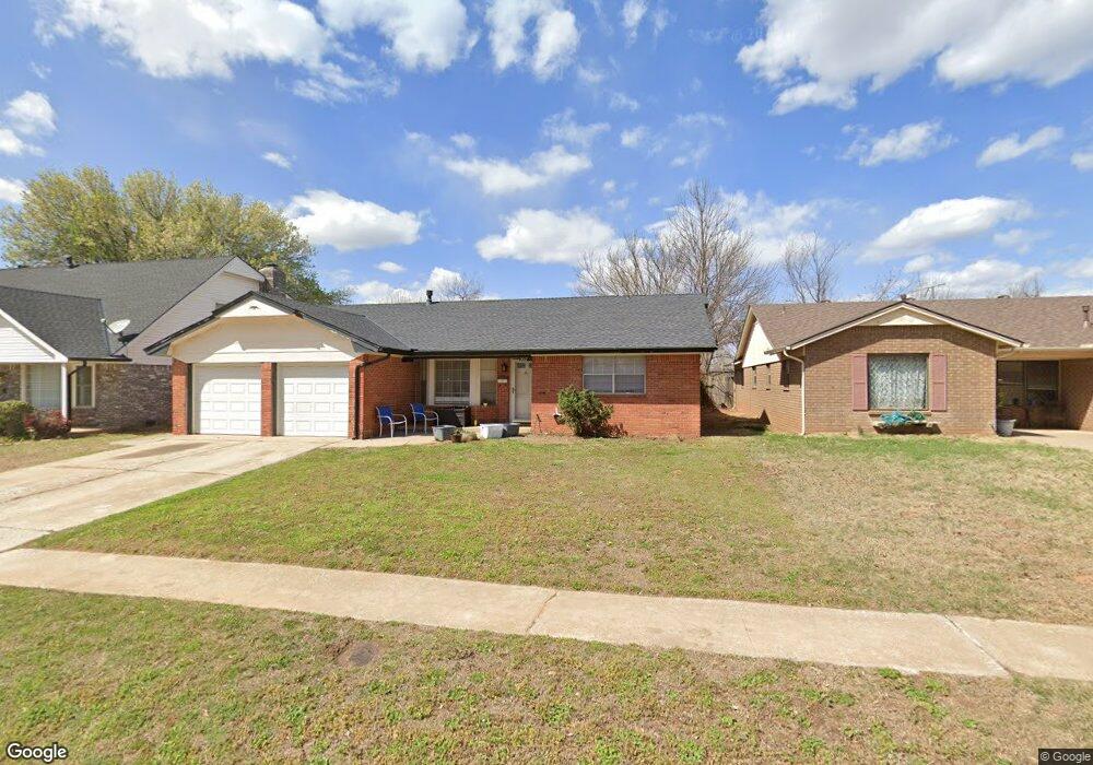
2017 La Dean Dr Norman, OK 73069
Southwest Norman NeighborhoodEstimated Value: $227,000 - $258,000
3
Beds
2
Baths
1,523
Sq Ft
$160/Sq Ft
Est. Value
About This Home
This home is located at 2017 La Dean Dr, Norman, OK 73069 and is currently estimated at $243,697, approximately $160 per square foot. 2017 La Dean Dr is a home located in Cleveland County with nearby schools including Jackson Elementary School, Alcott Middle School, and Norman High School.
Ownership History
Date
Name
Owned For
Owner Type
Purchase Details
Closed on
Feb 28, 2012
Sold by
Federal Home Loan Mortgage Corporation
Bought by
Lindstrom Judy L
Current Estimated Value
Home Financials for this Owner
Home Financials are based on the most recent Mortgage that was taken out on this home.
Original Mortgage
$94,905
Outstanding Balance
$64,196
Interest Rate
3.93%
Mortgage Type
New Conventional
Estimated Equity
$179,501
Purchase Details
Closed on
Oct 11, 2011
Sold by
Demun Darin W and Demun Donna F
Bought by
Federal Home Loan Mortgage Corporation
Create a Home Valuation Report for This Property
The Home Valuation Report is an in-depth analysis detailing your home's value as well as a comparison with similar homes in the area
Home Values in the Area
Average Home Value in this Area
Purchase History
| Date | Buyer | Sale Price | Title Company |
|---|---|---|---|
| Lindstrom Judy L | $100,000 | The Oklahoma City Abstract & | |
| Federal Home Loan Mortgage Corporation | $94,870 | None Available |
Source: Public Records
Mortgage History
| Date | Status | Borrower | Loan Amount |
|---|---|---|---|
| Open | Lindstrom Judy L | $94,905 |
Source: Public Records
Tax History
| Year | Tax Paid | Tax Assessment Tax Assessment Total Assessment is a certain percentage of the fair market value that is determined by local assessors to be the total taxable value of land and additions on the property. | Land | Improvement |
|---|---|---|---|---|
| 2025 | $1,780 | $15,832 | $4,374 | $11,458 |
| 2024 | $1,722 | $15,371 | $3,487 | $11,884 |
| 2023 | $1,671 | $14,923 | $3,052 | $11,871 |
| 2022 | $1,553 | $14,488 | $3,000 | $11,488 |
| 2021 | $1,637 | $14,488 | $3,000 | $11,488 |
| 2020 | $1,602 | $14,488 | $3,000 | $11,488 |
| 2019 | $1,629 | $14,488 | $3,000 | $11,488 |
| 2018 | $1,580 | $14,489 | $3,000 | $11,489 |
| 2017 | $1,598 | $14,489 | $0 | $0 |
| 2016 | $1,625 | $14,489 | $3,000 | $11,489 |
| 2015 | -- | $14,107 | $1,413 | $12,694 |
| 2014 | -- | $14,107 | $1,413 | $12,694 |
Source: Public Records
Map
Nearby Homes
- 812 Annie Ct
- 824 Annie Ct
- 2010 W Brooks St
- 837 Carriage Ln
- 1810 Windsor Way
- 1617 Avondale Dr
- 1614 Cruce St
- 1606 Cruce St
- 337 George L Cross Dr
- 337 Garrison Dr
- 2516 Briggs St
- 2416 Osborne Dr
- 2501 Brentwood Dr
- 1229 Westlawn Dr
- 1510 Melrose Dr
- 1301 24th Ave SW Unit 1305
- 3626 Cassidy Dr
- 1222 Camden Way
- 1410 Huntington Way
- 1523 Vine St
- 2021 La Dean Dr
- 2013 La Dean Dr
- 2103 La Dean Dr
- 803 Annie Ct
- 2005 La Dean Dr
- 2104 La Dean Dr
- 2109 La Dean Dr
- 804 Annie Ct
- 2001 La Dean Dr
- 736 Nancy Lynn Terrace
- 2117 La Dean Dr
- 723 Jona Kay Terrace
- 809 Annie Ct
- 728 Nancy Lynn Terrace
- 802 Nancy Lynn Terrace
- 732 Nancy Lynn Terrace
- 806 Nancy Lynn Terrace
- 801 Jona Kay Terrace
- 719 Jona Kay Terrace
- 805 Jona Kay Terrace
Your Personal Tour Guide
Ask me questions while you tour the home.