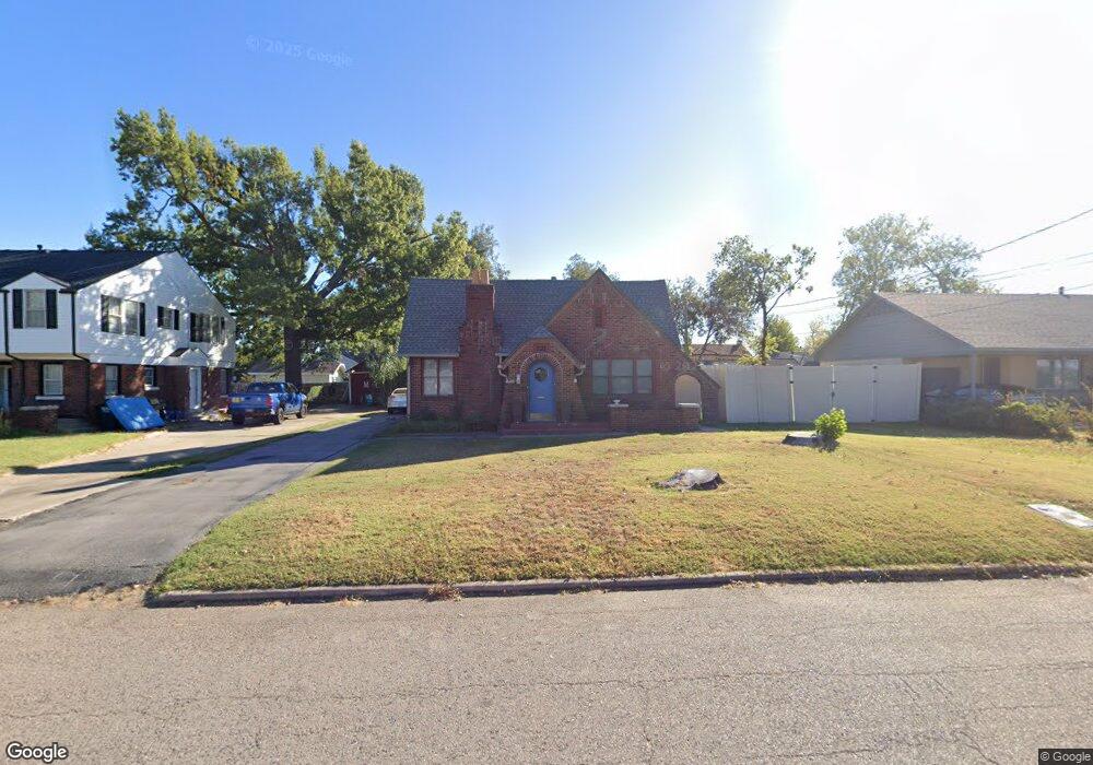
2017 N Beard St Shawnee, OK 74804
Estimated Value: $181,000 - $208,000
3
Beds
2
Baths
2,083
Sq Ft
$93/Sq Ft
Est. Value
About This Home
This home is located at 2017 N Beard St, Shawnee, OK 74804 and is currently estimated at $194,658, approximately $93 per square foot. 2017 N Beard St is a home located in Pottawatomie County with nearby schools including Will Rogers Elementary School, Shawnee Middle School, and Shawnee High School.
Ownership History
Date
Name
Owned For
Owner Type
Purchase Details
Closed on
Dec 20, 2017
Sold by
Brooks Christpher and Brooks Chriatopher Channing
Bought by
Mcmahan James Craign
Current Estimated Value
Purchase Details
Closed on
Mar 28, 2007
Sold by
Thoms William H and Thoms Marilyn L
Bought by
Brooks Christopher and Brooks Jennifer
Home Financials for this Owner
Home Financials are based on the most recent Mortgage that was taken out on this home.
Original Mortgage
$143,346
Interest Rate
6.3%
Mortgage Type
VA
Create a Home Valuation Report for This Property
The Home Valuation Report is an in-depth analysis detailing your home's value as well as a comparison with similar homes in the area
Purchase History
| Date | Buyer | Sale Price | Title Company |
|---|---|---|---|
| Mcmahan James Craign | $129,000 | First American Title | |
| Brooks Christopher | $139,000 | None Available |
Source: Public Records
Mortgage History
| Date | Status | Borrower | Loan Amount |
|---|---|---|---|
| Previous Owner | Brooks Christopher | $143,346 |
Source: Public Records
Tax History
| Year | Tax Paid | Tax Assessment Tax Assessment Total Assessment is a certain percentage of the fair market value that is determined by local assessors to be the total taxable value of land and additions on the property. | Land | Improvement |
|---|---|---|---|---|
| 2025 | $1,521 | $16,237 | $1,620 | $14,617 |
| 2024 | $1,494 | $15,764 | $1,620 | $14,144 |
| 2023 | $1,494 | $15,305 | $1,620 | $13,685 |
| 2022 | $1,468 | $15,305 | $1,620 | $13,685 |
| 2021 | $1,441 | $15,305 | $1,620 | $13,685 |
| 2020 | $1,476 | $15,609 | $1,620 | $13,989 |
| 2019 | $1,525 | $15,609 | $1,620 | $13,989 |
| 2018 | $1,584 | $15,480 | $1,620 | $13,860 |
| 2017 | $1,771 | $18,547 | $4,512 | $14,035 |
| 2016 | $1,735 | $18,006 | $4,290 | $13,716 |
| 2015 | $1,649 | $17,482 | $3,872 | $13,610 |
| 2014 | $1,598 | $16,973 | $3,787 | $13,186 |
Source: Public Records
Map
Nearby Homes
- 2021 N Broadway Ave
- 1926 N Market Ave
- 1908 N Bdwy Ave
- 1928 N Broadway Ave
- 1921 N Bell Ave
- 1951 N Louisa Ave
- 1901 N Bell Ave
- 0 N Beard Ave
- 216 W Georgia St
- 1815 N Bell Ave
- 2106 N Aydelotte Ave
- 1822 N Philadelphia Ave
- 210 E Cammack
- 1805 N Philadelphia Ave
- 1617 N Beard St
- 1607 N Beard Ave
- 202 E Chicago St
- 1824 N Minnesota Ave
- 801 W Franklin St
- 815 W Franklin St
- 2017 N Beard Ave
- 2009 N Beard St
- 2009 N Beard Ave
- 2025 N Beard St
- 21 W Rosa St
- 22 W Federal St
- 2026 N Beard St
- 2026 N Beard Ave
- 2022 N Bdwy
- 24 W Rosa St
- 2000 N Broadway Ave
- 1940 N Beard St
- 1940 N Beard Ave
- 2105 N Beard St
- 102 W Federal St
- 2001 N Beard Ave
- 1935 N Beard St
- 114 W Federal St
- 2126 N Beard Ave
- 119 W Rosa St
Your Personal Tour Guide
Ask me questions while you tour the home.