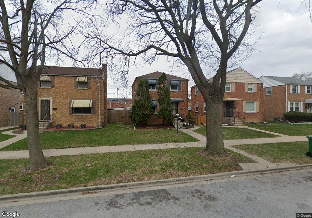
2018 S 24th Ave Broadview, IL 60155
South Maywood NeighborhoodEstimated Value: $259,819 - $273,000
3
Beds
1
Bath
1,029
Sq Ft
$261/Sq Ft
Est. Value
About This Home
This home is located at 2018 S 24th Ave, Broadview, IL 60155 and is currently estimated at $268,705, approximately $261 per square foot. 2018 S 24th Ave is a home located in Cook County with nearby schools including Thurgood Marshall Elementary School, Roosevelt Middle School, and Proviso West High School.
Ownership History
Date
Name
Owned For
Owner Type
Purchase Details
Closed on
May 10, 2023
Sold by
Cole Johnny B and Cole Janice
Bought by
Harris Cole Janice Marie
Current Estimated Value
Purchase Details
Closed on
Sep 14, 2000
Sold by
Cole Johnny B
Bought by
Harris Janice M
Purchase Details
Closed on
Aug 28, 1997
Sold by
Caldwell Michael and Grier Caldwell Kathy J
Bought by
Harris Cole Johnny B and Harris Cole Janice M
Home Financials for this Owner
Home Financials are based on the most recent Mortgage that was taken out on this home.
Original Mortgage
$102,600
Interest Rate
7.65%
Create a Home Valuation Report for This Property
The Home Valuation Report is an in-depth analysis detailing your home's value as well as a comparison with similar homes in the area
Home Values in the Area
Average Home Value in this Area
Purchase History
| Date | Buyer | Sale Price | Title Company |
|---|---|---|---|
| Harris Cole Janice Marie | -- | None Listed On Document | |
| Harris Janice M | -- | None Available | |
| Harris Cole Johnny B | $72,000 | Attorneys Natl Title Network |
Source: Public Records
Mortgage History
| Date | Status | Borrower | Loan Amount |
|---|---|---|---|
| Previous Owner | Harris Cole Johnny B | $102,600 |
Source: Public Records
Tax History
| Year | Tax Paid | Tax Assessment Tax Assessment Total Assessment is a certain percentage of the fair market value that is determined by local assessors to be the total taxable value of land and additions on the property. | Land | Improvement |
|---|---|---|---|---|
| 2025 | $5,847 | $21,000 | $2,646 | $18,354 |
| 2024 | $5,847 | $21,000 | $2,646 | $18,354 |
| 2023 | $4,847 | $21,000 | $2,646 | $18,354 |
| 2022 | $4,847 | $15,935 | $2,095 | $13,840 |
| 2021 | $4,686 | $15,933 | $2,094 | $13,839 |
| 2020 | $4,621 | $15,933 | $2,094 | $13,839 |
| 2019 | $3,337 | $11,951 | $1,874 | $10,077 |
| 2018 | $3,220 | $11,951 | $1,874 | $10,077 |
| 2017 | $3,148 | $11,951 | $1,874 | $10,077 |
| 2016 | $2,800 | $9,806 | $1,653 | $8,153 |
| 2015 | $2,684 | $9,806 | $1,653 | $8,153 |
| 2014 | $2,660 | $9,806 | $1,653 | $8,153 |
| 2013 | $3,024 | $11,581 | $1,653 | $9,928 |
Source: Public Records
Map
Nearby Homes
- 2007 S 25th Ave
- 2111 S 24th Ave
- 1926 S 24th Ave
- 1908 S 23rd Ave
- 1910 S 22nd Ave
- 1925 S 22nd Ave
- 2116 S 21st Ave
- 1839 S 22nd Ave
- 1909 S 20th Ave
- 2247 S 21st Ave
- 2341 S 24th Ave
- 1908 S 18th Ave
- 745 Manchester Ave
- 1924 S 17th Ave
- 1037 24th Ave
- 1815 Harrison St
- 814 Norfolk Ave
- 1433 S 21st Ave
- 1427 S 21st Ave
- 1420 S 21st Ave
Your Personal Tour Guide
Ask me questions while you tour the home.