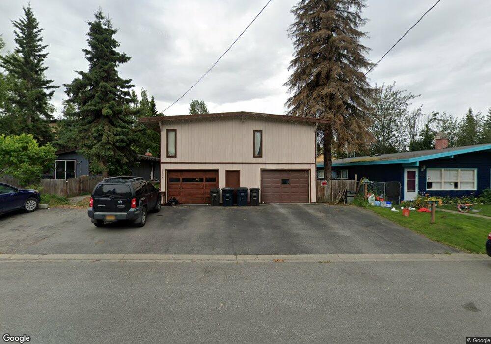
2024 Borealis Dr Anchorage, AK 99503
North Star NeighborhoodEstimated Value: $321,000 - $502,000
5
Beds
3
Baths
2,648
Sq Ft
$161/Sq Ft
Est. Value
About This Home
This home is located at 2024 Borealis Dr, Anchorage, AK 99503 and is currently estimated at $426,276, approximately $160 per square foot. 2024 Borealis Dr is a home located in Anchorage Municipality with nearby schools including North Star Elementary School, Central Middle School of Science, and West High School.
Ownership History
Date
Name
Owned For
Owner Type
Purchase Details
Closed on
May 24, 2007
Sold by
Shaw Ronald James
Bought by
Shaw Evelyn C
Current Estimated Value
Purchase Details
Closed on
Sep 29, 2004
Sold by
Shaw Evelyn C and Nelms Evelyn C
Bought by
Shaw Ronald J
Home Financials for this Owner
Home Financials are based on the most recent Mortgage that was taken out on this home.
Original Mortgage
$159,000
Interest Rate
5.76%
Mortgage Type
New Conventional
Create a Home Valuation Report for This Property
The Home Valuation Report is an in-depth analysis detailing your home's value as well as a comparison with similar homes in the area
Home Values in the Area
Average Home Value in this Area
Purchase History
| Date | Buyer | Sale Price | Title Company |
|---|---|---|---|
| Shaw Evelyn C | -- | None Available | |
| Shaw Ronald J | -- | -- |
Source: Public Records
Mortgage History
| Date | Status | Borrower | Loan Amount |
|---|---|---|---|
| Previous Owner | Shaw Ronald J | $159,000 |
Source: Public Records
Tax History
| Year | Tax Paid | Tax Assessment Tax Assessment Total Assessment is a certain percentage of the fair market value that is determined by local assessors to be the total taxable value of land and additions on the property. | Land | Improvement |
|---|---|---|---|---|
| 2025 | $3,021 | $434,200 | $112,100 | $322,100 |
| 2024 | $3,021 | $412,100 | $112,100 | $300,000 |
| 2023 | $6,592 | $387,100 | $112,100 | $275,000 |
| 2022 | $3,109 | $384,600 | $112,000 | $272,600 |
| 2021 | $6,662 | $369,700 | $112,000 | $257,700 |
| 2020 | $6,367 | $374,500 | $112,000 | $262,500 |
| 2019 | $6,212 | $379,700 | $112,000 | $267,700 |
| 2018 | $6,160 | $375,600 | $116,800 | $258,800 |
| 2017 | $6,125 | $391,100 | $110,900 | $280,200 |
| 2016 | $5,112 | $400,700 | $110,900 | $289,800 |
| 2015 | $5,112 | $368,400 | $101,200 | $267,200 |
| 2014 | $5,112 | $360,200 | $99,500 | $260,700 |
Source: Public Records
Map
Nearby Homes
- 800 W 21st Ave
- 827 W 20th Ave
- 816 W 23rd Ave Unit 6
- 1001 W Fireweed Ln
- 2205 Barrow St
- 2400 Barrow St Unit 202
- 545 W 15th Ave Unit 3
- 1431 F St Unit 4
- 629 W 15th Ave
- NHN Dorbrandt St
- 000 Dawson St
- 1113 W Fireweed Ln Unit 503
- 100 W 15th Ave Unit A
- 907 W 27th Ave
- 1430 Bridgeway St Unit 7
- 1430 Bridgeway St Unit 9
- 930 W 27th Ave
- 400 E 24th Ave Unit 4
- 913 W 14th Ave
- 342 Eyak Dr
- 2032 Borealis Dr
- 2018 Borealis Dr
- 2038 Borealis Dr
- 504 W 20th Ave
- 501 W 21st Ave Unit 3
- L8 Borealis Dr
- 2015 Blueberry St
- 2027 Blueberry St
- 2029 Blueberry St
- 2029 Blueberry St
- 2001 Borealis Dr
- 2029 Borealis Dr
- 2015 Borealis Dr
- 2015 Borealis Dr
- 550 W 21st Ave
- 2041 Borealis Dr
- 2051 Borealis Dr
- L13 B3 Blueberry St
- 2108 Dawson St
- 560 W 21st Ave
Your Personal Tour Guide
Ask me questions while you tour the home.