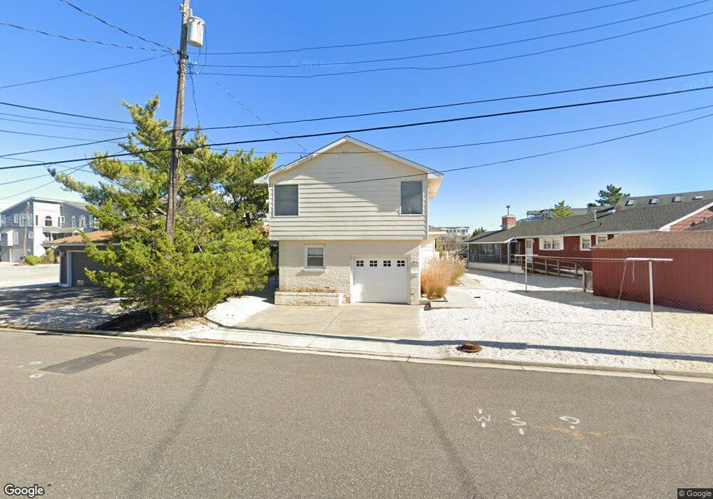
2029 6th Ave Avalon, NJ 08202
Estimated Value: $2,685,000 - $3,226,000
Studio
--
Bath
1,962
Sq Ft
$1,480/Sq Ft
Est. Value
About This Home
This home is located at 2029 6th Ave, Avalon, NJ 08202 and is currently estimated at $2,902,864, approximately $1,479 per square foot. 2029 6th Ave is a home located in Cape May County with nearby schools including Avalon Elementary School.
Ownership History
Date
Name
Owned For
Owner Type
Purchase Details
Closed on
Sep 30, 2014
Sold by
Pfleger Mary Elizabeth
Bought by
Pfleger Mary Elizabeth
Current Estimated Value
Home Financials for this Owner
Home Financials are based on the most recent Mortgage that was taken out on this home.
Original Mortgage
$672,500
Outstanding Balance
$515,759
Interest Rate
4.11%
Mortgage Type
New Conventional
Estimated Equity
$2,387,105
Purchase Details
Closed on
Feb 20, 1999
Sold by
Melso Vincent
Bought by
Pfleger Gregory
Home Financials for this Owner
Home Financials are based on the most recent Mortgage that was taken out on this home.
Original Mortgage
$300,000
Interest Rate
6.76%
Create a Home Valuation Report for This Property
The Home Valuation Report is an in-depth analysis detailing your home's value as well as a comparison with similar homes in the area
Home Values in the Area
Average Home Value in this Area
Purchase History
| Date | Buyer | Sale Price | Title Company |
|---|---|---|---|
| Pfleger Mary Elizabeth | -- | North American Title Agency | |
| Pfleger Gregory | $375,000 | -- |
Source: Public Records
Mortgage History
| Date | Status | Borrower | Loan Amount |
|---|---|---|---|
| Open | Pfleger Mary Elizabeth | $672,500 | |
| Closed | Pfleger Gregory | $300,000 |
Source: Public Records
Tax History
| Year | Tax Paid | Tax Assessment Tax Assessment Total Assessment is a certain percentage of the fair market value that is determined by local assessors to be the total taxable value of land and additions on the property. | Land | Improvement |
|---|---|---|---|---|
| 2025 | $10,507 | $1,711,300 | $1,571,000 | $140,300 |
| 2024 | $10,422 | $1,711,300 | $1,571,000 | $140,300 |
| 2023 | $10,422 | $1,711,300 | $1,571,000 | $140,300 |
| 2022 | $9,720 | $1,711,300 | $1,571,000 | $140,300 |
| 2021 | $9,361 | $1,711,300 | $1,571,000 | $140,300 |
| 2020 | $9,001 | $1,711,300 | $1,571,000 | $140,300 |
| 2019 | $8,728 | $1,711,300 | $1,571,000 | $140,300 |
| 2018 | $8,351 | $1,711,300 | $1,571,000 | $140,300 |
| 2017 | $7,736 | $1,391,400 | $1,252,000 | $139,400 |
| 2016 | $7,653 | $1,391,400 | $1,252,000 | $139,400 |
| 2015 | $7,527 | $1,391,400 | $1,252,000 | $139,400 |
| 2014 | $7,426 | $1,388,100 | $1,252,000 | $136,100 |
Source: Public Records
Map
Nearby Homes
- 647 Barry Rd
- 890 21st St
- 447 24th St
- 408 22nd St
- 389 22nd St
- 420 24th St Unit East
- 386 24th St
- 386 24th St Unit Upper
- 2290 Ocean Dr Unit C
- 2425 Harbor Ave Unit 2425
- 1719 Ocean Dr Unit 2
- 16 4th Ave
- 211 23rd St
- 1838 Dune Dr
- 178 19th St
- 2023 Dune Dr Unit R6
- 174 17th St
- 174 23rd St
- 2928 Ocean Dr Unit C-N
- 2934 Ocean Dr Unit North
- 599 Sunrise Dr
- 2049 6th Ave
- 597 Sunrise Dr
- 599 21st St
- 581 21st St
- 589 21st St
- 593 Sunrise Dr
- 573 21st St
- 600 Sunrise Dr Unit EAST
- 2026 6th Ave Unit South
- 2026 6th Ave
- 2026 6th Ave
- 2026 6th Ave Unit South Unit
- 2066 6th Ave Unit 2066
- 589 Sunrise Dr
- 2036 6th Ave
- 2036 6th Ave
- 602 Sunrise Dr
- 591 Sunrise Dr
- 563 21st St
Your Personal Tour Guide
Ask me questions while you tour the home.