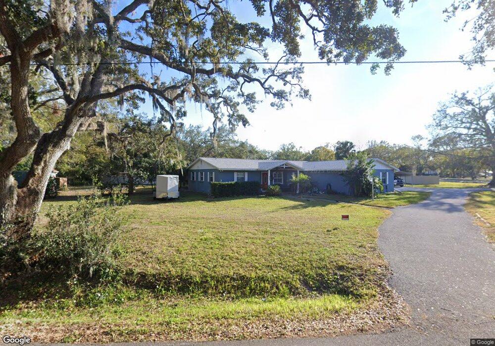
203 5th Ave SE Ruskin, FL 33570
Estimated Value: $187,000 - $420,000
3
Beds
2
Baths
2,813
Sq Ft
$118/Sq Ft
Est. Value
About This Home
This home is located at 203 5th Ave SE, Ruskin, FL 33570 and is currently estimated at $331,548, approximately $117 per square foot. 203 5th Ave SE is a home located in Hillsborough County with nearby schools including Ruskin Elementary School, Shields Middle School, and Lennard High School.
Ownership History
Date
Name
Owned For
Owner Type
Purchase Details
Closed on
May 14, 2014
Sold by
Bennett Mary R and Taphorn Mary B
Bought by
Byler Billi J and Byler Daniel
Current Estimated Value
Home Financials for this Owner
Home Financials are based on the most recent Mortgage that was taken out on this home.
Original Mortgage
$157,509
Outstanding Balance
$118,819
Interest Rate
4.37%
Mortgage Type
FHA
Estimated Equity
$212,729
Purchase Details
Closed on
Mar 20, 2000
Sold by
Millis Harold D and Millis Tina
Bought by
Bennett Malcolm L and Bennett Mary R
Home Financials for this Owner
Home Financials are based on the most recent Mortgage that was taken out on this home.
Original Mortgage
$81,000
Interest Rate
8.29%
Mortgage Type
New Conventional
Purchase Details
Closed on
Aug 8, 1995
Sold by
Hughes Edward K
Bought by
Millis Harold D and Millis Tina
Create a Home Valuation Report for This Property
The Home Valuation Report is an in-depth analysis detailing your home's value as well as a comparison with similar homes in the area
Home Values in the Area
Average Home Value in this Area
Purchase History
| Date | Buyer | Sale Price | Title Company |
|---|---|---|---|
| Byler Billi J | $170,000 | -- | |
| Bennett Malcolm L | $90,000 | -- | |
| Millis Harold D | $65,000 | -- |
Source: Public Records
Mortgage History
| Date | Status | Borrower | Loan Amount |
|---|---|---|---|
| Open | Byler Billi J | $157,509 | |
| Previous Owner | Millis Harold D | $77,000 | |
| Previous Owner | Millis Harold D | $81,000 |
Source: Public Records
Tax History
| Year | Tax Paid | Tax Assessment Tax Assessment Total Assessment is a certain percentage of the fair market value that is determined by local assessors to be the total taxable value of land and additions on the property. | Land | Improvement |
|---|---|---|---|---|
| 2025 | $1,953 | $125,869 | -- | -- |
| 2024 | $1,953 | $122,322 | -- | -- |
| 2023 | $1,855 | $118,759 | $0 | $0 |
| 2022 | $1,715 | $115,300 | $0 | $0 |
| 2021 | $1,684 | $111,942 | $0 | $0 |
| 2020 | $1,605 | $110,396 | $0 | $0 |
| 2019 | $1,519 | $107,914 | $0 | $0 |
| 2018 | $1,467 | $105,902 | $0 | $0 |
| 2017 | $1,437 | $142,201 | $0 | $0 |
| 2016 | $1,410 | $101,591 | $0 | $0 |
| 2015 | $1,424 | $100,885 | $0 | $0 |
| 2014 | $2,015 | $90,830 | $0 | $0 |
| 2013 | -- | $86,102 | $0 | $0 |
Source: Public Records
Map
Nearby Homes
- 0 Us Highway 41 S Unit U8081156
- 205 2nd Ave SE
- 502 3rd Ave SE
- 409 E College Ave
- 506 3rd Ave SE
- 307 Campus Dr
- 77 E Shell Point Rd
- 0 1st St NE
- 0 W Shell Point Rd
- 204 E Shell Point Rd
- 314 Dickman Dr SW
- 1 W Shell Point
- 601 8th Ct SE
- 1110 Lauren Manor Loop
- 118 2nd St NW
- 220 6th Ave SW
- 1142 12th St SE
- 0 12th St SE
- 404 Dickman Dr SW
- 404 Inlet Rd
- 208 6th Ave SE
- 204 6th Ave SE
- 202 5th Ave SE
- 301 5th Ave SE
- 302 5th Ave SE
- 302 6th Ave SE
- 203 6th Ave SE
- 207 6th Ave SE
- 602 2nd St SE
- 201 4th Ave SE
- 308 6th Ave SE
- 106 5th Ave SE
- 307 5th Ave SE
- 307 5th Ave SE Unit A & B
- 304 5th Ave SE
- 301 6th Ave SE
- 107 6th Ave SE
- 303 4th Ave SE
- 312 6th Ave SE
- 308 5th Ave SE
Your Personal Tour Guide
Ask me questions while you tour the home.