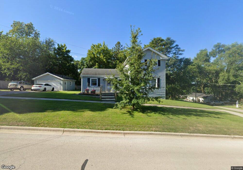
203 E 7th St Lockport, IL 60441
Lockport AreaEstimated Value: $237,000 - $309,000
About This Home
This home is located at 203 E 7th St, Lockport, IL 60441 and is currently estimated at $274,346, approximately $201 per square foot. 203 E 7th St is a home located in Will County with nearby schools including Milne Grove Elementary School, Kelvin Grove Jr High School, and Lockport Township High School East.
Ownership History
We collect this data history from publicly available records. To have your information removed, we recommend requesting removal directly through your county’s website.
Purchase Details
Purchase Details
Home Values in the Area
Average Home Value in this Area
Purchase History
We collect this data history from publicly available records. To have your information removed, we recommend requesting removal directly through your county’s website.
| Date | Buyer | Sale Price | Title Company |
|---|---|---|---|
| -- | None Listed On Document | ||
| -- | -- |
Tax History
We collect this data history from publicly available records. To have your information removed, we recommend requesting removal directly through your county’s website.
| Year | Tax Paid | Tax Assessment Tax Assessment Total Assessment is a certain percentage of the fair market value that is determined by local assessors to be the total taxable value of land and additions on the property. | Land | Improvement |
|---|---|---|---|---|
| 2024 | $5,196 | $73,050 | $20,958 | $52,092 |
| 2023 | $4,898 | $65,580 | $18,815 | $46,765 |
| 2022 | $4,619 | $61,173 | $17,550 | $43,623 |
| 2021 | $4,333 | $57,488 | $16,493 | $40,995 |
| 2020 | $4,198 | $55,598 | $15,951 | $39,647 |
| 2019 | $3,949 | $52,699 | $15,119 | $37,580 |
| 2018 | $3,659 | $48,717 | $13,976 | $34,741 |
| 2017 | $3,301 | $44,222 | $12,687 | $31,535 |
| 2016 | $3,037 | $40,793 | $11,703 | $29,090 |
| 2015 | $2,776 | $37,536 | $10,407 | $27,129 |
| 2014 | $2,776 | $36,093 | $10,007 | $26,086 |
| 2013 | $2,776 | $36,829 | $10,211 | $26,618 |
Map
- 623 S State St
- 507 S Hamilton St
- 1016 S State St
- 1200 S State St
- 120 N State St
- 118 N State St
- 1236 S Washington St
- 707 E 9th St Unit 1
- 510 E 13th St
- 924 Grandview Ave
- 613 E 3rd St Unit 3
- 533 E Division St
- 629 Thornton St
- 1640 Daviess Ave
- 1709 S State St
- 817 Summit Dr Unit 5A
- 1011 Ashley Ct S Unit 2D
- 1613 Mary Ann Ln
- 136 W 18th St
- 1352 Lacoma Ct
- 128 E 7th St
- 623 S Hamilton St
- 110 E 7th St
- 613 S Hamilton St
- 129 E 7th St
- 121 E 7th St
- 628 S Hamilton St
- 628 S State St
- 111 E 7th St
- 620 S State St Unit 2ND
- 620 S State St
- 620 S State St Unit 1ST
- 105 E 7th St
- 107 E 7th St
- 700 S State St
- 603 S Hamilton St
- 119 E 6th St
- 711 S Hamilton St
- 624 S Hamilton St
- 111 E 6th St
Ask me questions while you tour the home.